Assessment of Current Ice Conditions Relevant to Distribution and Access of Walrus
Near St. Lawrence Island
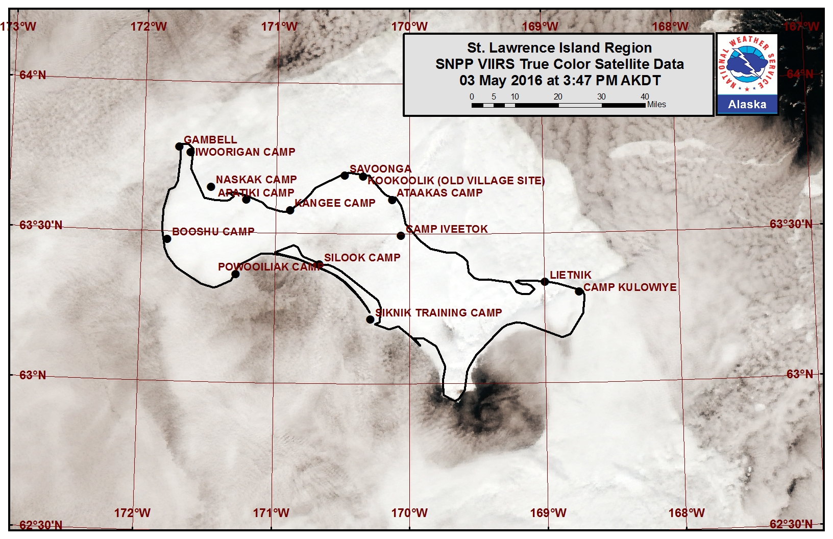
Shorefast ice remains secure along the northern coastline of St. Lawrence Island with consolidated first year sea ice stretching approximately 20 to 35 nm to the north of the coastline from Gambell to Savoonga. Beyond this ice area lies mainly new and young sea ice with isolated first year ice floes continuing to drift to the south through the Bering Strait. Along the west coast of the island, first year sea ice floes are drifting to the southwest past the coastline. Off the east coast of the island lies a larger belt of first year pack ice also drifting to the southwest down past the coastline. Along the southern coast of the island is a very large area of open water with ice-free conditions at this time.
Wales to Shishmaref
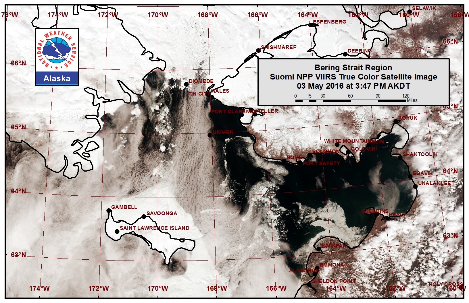
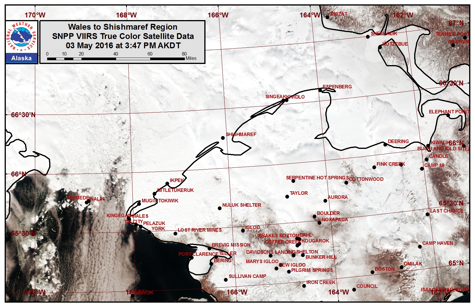
Shorefast ice along the coast from Wales to Shishmaref remains in place at this time, with very close first-year pack ice beyond the shorefast boundary through much of the southern Chukchi Sea. Near the Bering Strait the main ice pack is beginning to collapse and shift to the south as it breaks apart near the Diomede Islands continuing south into the northern Bering Sea. Sea ice near the Bering Strait region consists of first year ice floes in very open pack ice to open pack ice conditions. Open water conditions with the occasional first year ice floe drifting through may be found near the coastline from just south of Wales to the coast near Port Clarence.
Forecast Discussion
Ice Forecast
For St. Lawrence Island we expect the consolidated ice to remain along the northern coastline through next week. First year ice floes will continue to be pulled to the southwest past the coastline near Gambell and past the eastern coastline of the island. We do not expect any first year ice floes off the southern coastline of the island, with ice-free conditions persisting in that area through the coming week.
For the Wales to Shishmaref region we expect the very close pack ice to continue to slowly destabilize and collapse just north of the Diomede Islands through the coming week. The shorefast ice is expected to remain in place from Wales to Shishmaref, but beyond the shorefast ice near Wales first year ice floes will likely continue to drift to the south through the Bering Strait.
Weather System/Wind Synopsis
Low pressure south of Dutch Harbor will bring generally northerly flow of 10-20 mph (5-10 knots) over the Bering Strait and St. Lawrence Island through May 7th. There will be a brief transition of easterly winds as low pressure develops in the Bering Sea. As the low pressure meanders eastward toward the Pribilof Islands the winds will shift generally from the south and increase to 15 to 25 mph (10-20 knots) with periodic higher gusts likely after May 9th.
Temperature Trend
Above normal temperatures will generally persist through May 18th. Daytime temperatures will initially be around 25 to 35 degrees, and then increase to 30 to 40 degrees after May 10th. Overnight temperatures at 20 to 30 degrees will increase to 25 to 35 degrees after May 10th.
Daily Weather, Wind, and Temperature Updates
The National Weather Service provides twice-daily, text only updates on the weather, wind, and temperature conditions in specific geographical zones:
For Shishmaref: http://pafc.arh.noaa.gov/fpopcap/lfpfcst.html?z=AKZ207
For Wales, Gambell, and Savoonga: http://pafc.arh.noaa.gov/fpopcap/lfpfcst.html?z=AKZ213
An interactive map for access to other Alaskan zones: http://pafc.arh.noaa.gov/fpopcap/?leaf=1.
Marine forecast for the West Coast and Arctic Coast

Remote Sensing Images


Observations and Comments
Observations of Sea Ice Development
Observations from Shishmaref
6 May 2016 - Curtis Nayokpuk
No new observations with fog and snow flurries all week. Forecast for the next 4-5 days is morning fog with chance of rain and snow, and light winds from E and SE.
Two weeks ago a seal hunting trip out to the NE found rough, jagged ice up to 8 feet thick. There were no large ridges to anchor the ice, and they found a few flat, 12-inch thick ice sections covered with up to 2 feet of snow. Travel was limited to 3 miles from the shoreline, though one hunter reported finding a path to 7 miles out from Shishmaref and seeing flat sections to continue past that. With open leads 15-20 miles north (see satellite picture, above) the forecast for rain and warming temps could melt snow cover and limit travel over the rough ice.
