Assessment of Current Ice Conditions Relevant to Distribution and Access of Walrus
State of the Ice at Season’s Start
Contributed by Matthew Druckenmiller, National Snow and Ice Data Center (NSIDC) and SEARCH Sea Ice Action Team
Conditions in the Bering Sea region this year are generally consistent with much of the Arctic. The National Snow and Ice Data Center reported the 2016 maximum winter extent of Arctic sea ice to be the lowest in the satellite record (1979-present), noting that unusually warm conditions have undoubtedly played an important role. This was due to a combination of factors, including unusually high winter air temperatures and well above normal water temperatures in the northeast Pacific (see January AOOS post), which was in part due to a strong El Niño. With reduced winter ice extent this year, the open ocean is able to take up more heat from the sun during spring, which may then also cause more rapid and extensive ice retreat in the northern Bering and southern Chukchi Seas later in the season.
By March 1st, the shorefast ice off Wales was reported thinner than normal, owing to mild winter conditions. Based on observations from Winton Weyapuk, Jr. (see the SIZONet observation database), the pack ice was rarely seen off the village throughout March due to both poor visibility from fog and vast amounts of open water in the Strait and toward the southwest.
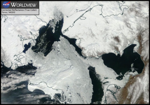
The northeast Bering Sea near Nome and Norton sound experienced an unusually low presence of pack ice throughout most of winter and spring. At Nome, Local Environmental Observer Network (LEO) member Anahma Shannon described the unusual conditions of 2016:
“I think that this is the first year we've only had shorefast ice. Generally the larger ice pans in the ocean push up against the shorefast ice and sometimes ebb and flow but this is the first time it's been absent more than present. This presented a safety problem for travelers snowmachining between villages or out to their crabbing pots on the ice.” [See the full observation post from 18 April 2016 here.]
The southern coast of the Seward Peninsula also experienced relatively narrow and absent shorefast ice in certain areas, for example, along the coast between Nome, Port Clarence, and Cape Mountain near Wales.
Additionally, the southeast Bering Sea experienced a very late onset of ice formation, with some locations not having seen ice until mid-March. For example at Toksook Bay, LEO Observer Anna John noted that:
“It's February! Middle of the winter. Our bay isn't frozen yet. People usually start jigging for tomcods by this time of the year on the bay. It hasn't been cold enough to freeze the bay….Incredibly, we are fortunate to have more snow this year. Some men are able to go hunting and fishing, to surrounding villages by snowmachines, and there were some people that were able to go to timberline to get wood for maqi (Yupik steam house)...” [See the full observation post from 1 March 2016 here.]
In recent years, 2013 and 2014, the ice in Toksook Bay was 2-3 feet thick by early March, according to observations from ice expert Simeon John (see observations here under 'Tooksok Bay').
Near St. Lawrence Island
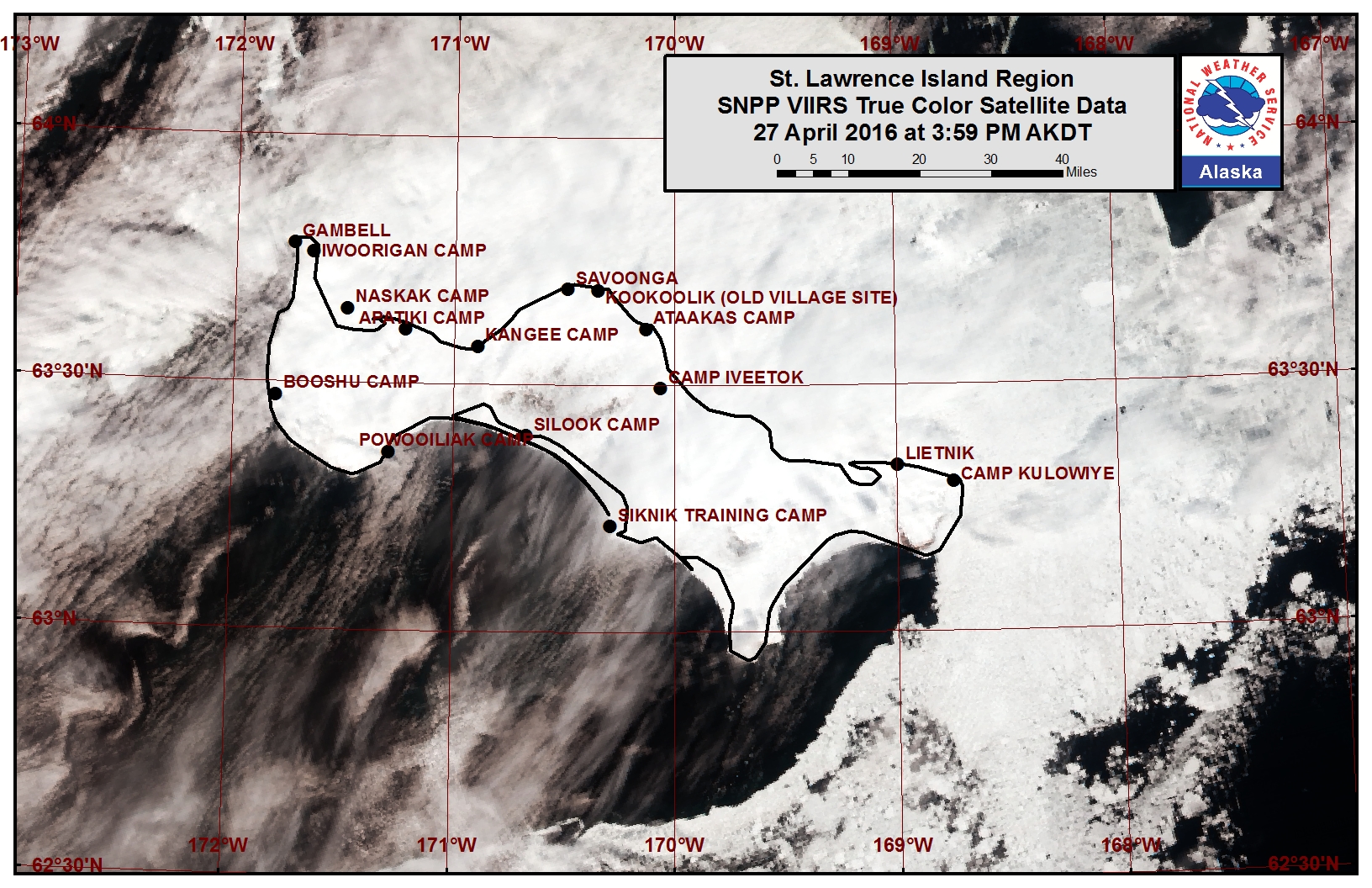
Shorefast ice remains secure along the northern coastline of St. Lawrence Island with consolidated first year sea ice stretching approximately 20 to 40 nautical miles to the north of the coastline from Gambell to Savoonga. Beyond this ice area lies mainly new and young sea ice with isolated first year ice floes drifting to the south through the Bering Strait. Along the west coast of the island first year sea ice floes are drifting to the southwest past the coastline. Off the east coast of the island lies a larger belt of close to very close first year pack ice also drifting to the southwest down past the coastline. Along the southern coast of the island is a very large area of open water to ice-free conditions at this time.
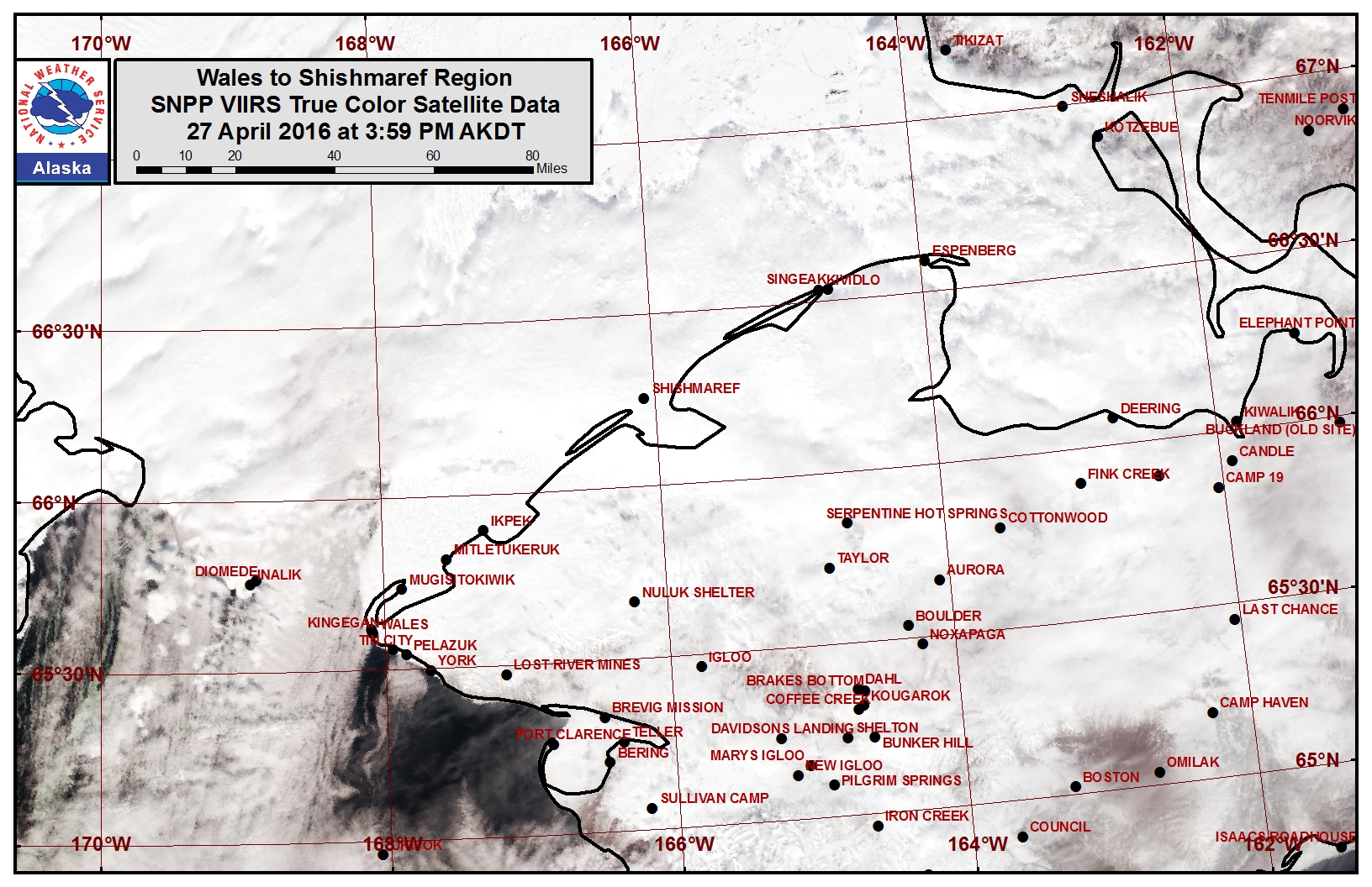
Wales to Shishmaref
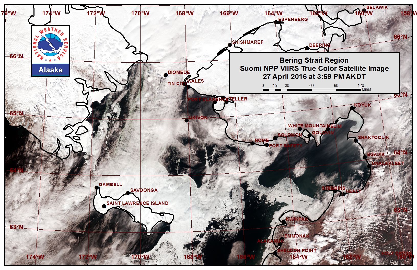
Shorefast ice along the coast from Wales to Shishmaref remains in place at this time with very close first year pack ice beyond the shorefast boundary through much of the southern Chukchi Sea at this time. Near the Bering Strait the main ice pack is beginning to collapse and shift to the south as it breaks apart near the Diomede Islands continuing south into the northern Bering Sea. Sea ice near the Bering Strait region consists of first year ice floes in very open pack ice. Open water conditions with the occasional first year ice floe drifting through may be found near the coastline from just south of Wales to the coast near Port Clarence.
Forecast Discussion
Ice Forecast
For the St. Lawrence Island region, we expect the consolidated ice to remain along the northern coastline of the island through the coming week. First year ice floes will likely continue to be pulled to the southwest past the coastline near Gambell and past the eastern coastline of the island. We do not expect any first year ice floes off the southern coastline of the island, with ice-free to open water conditions persisting in that area through the coming week.
For the Wales to Shishmaref region, we expect the very close pack ice to continue to slowly destabilize and collapse just north of the Diomede Islands in the southern Chukchi Sea through the coming week. The shorefast ice is expected to remain in place from Wales to Shishmaref, but beyond the shorefast ice near Wales first year ice floes will likely continue to drift to the south through the Bering Strait.
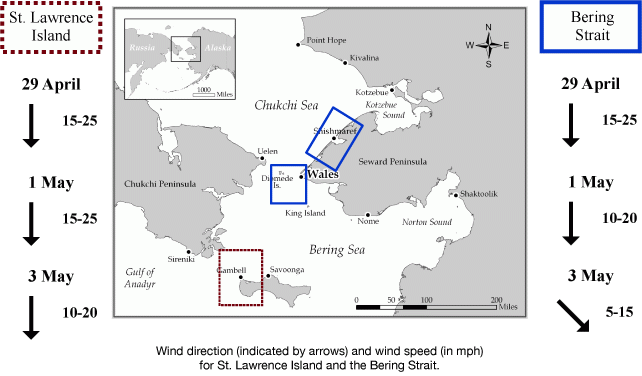
Weather System/Wind Synopsis
High pressure over Chukotka will persist through May 4th. Low pressure will move into the western Alaskan Interior on May 2nd and then weaken. These features will bring north winds 10 to 20 kt (15 to 25 mph), from Ikpek to Wales and across the St. Lawrence Island region. South of the Bering Strait higher gusts are likely at times through May 2nd. From Ikpek to Shishmaref, winds will be north 10 to 20 kt (5 to 15 mph) through May 2nd then turn more northwest at similar or slightly lower speeds on May 3rd and 4th.
Temperature Trend
Generally above normal temperatures will persist through May 10. Daytime temperatures around 25 to 35 °F. Overnight temperatures of 20 to 30 °F are anticipated. After May 5th daytime temperatures will generally be near or above freezing.
Daily Weather, Wind, and Temperature Updates
The National Weather Service provides twice-daily, text only updates on the weather, wind, and temperature conditions in specific geographical zones:
For Shishmaref: http://pafc.arh.noaa.gov/fpopcap/lfpfcst.html?z=AKZ207
For Wales, Gambell, and Savoonga: http://pafc.arh.noaa.gov/fpopcap/lfpfcst.html?z=AKZ213
An interactive map for access to other Alaskan zones: http://pafc.arh.noaa.gov/fpopcap/?leaf=1.
Marine forecast for the West Coast and Arctic Coast
Remote Sensing Images
Observations and Comments
Observations of Sea Ice Development
Observations from Nome
26 April 2016 - Boogles Johnson
The ice has been hanging around Nome. Over the weekend it was like a big lake in front of Nome with open water east of Cape Nome. There's minor shorefast ice and the ice that is in front of town is getting rotten quickly. There's a lot of slush and small pieces of ice but still good ice for walrus to haul out on. Two hunters have reported to me that they have seen a few walrus approximately 20/25 miles out.
Observations from Shishmaref
26 April 2016 - Curtis Nayokpuk
With constant northerly winds, yesterday's map of the shorefast ice shows solid ice. According to crabbers, the ice is 2 to 3 ft. thick along the North coast of Seward Peninsula and has been frozen in place for over two months. Looks like an early season for hunting if ice is thin and breaking up in Norton Sound.
