Assessment of Current Ice Conditions Relevant to Distribution and Access of Walrus
Near St. Lawrence Island
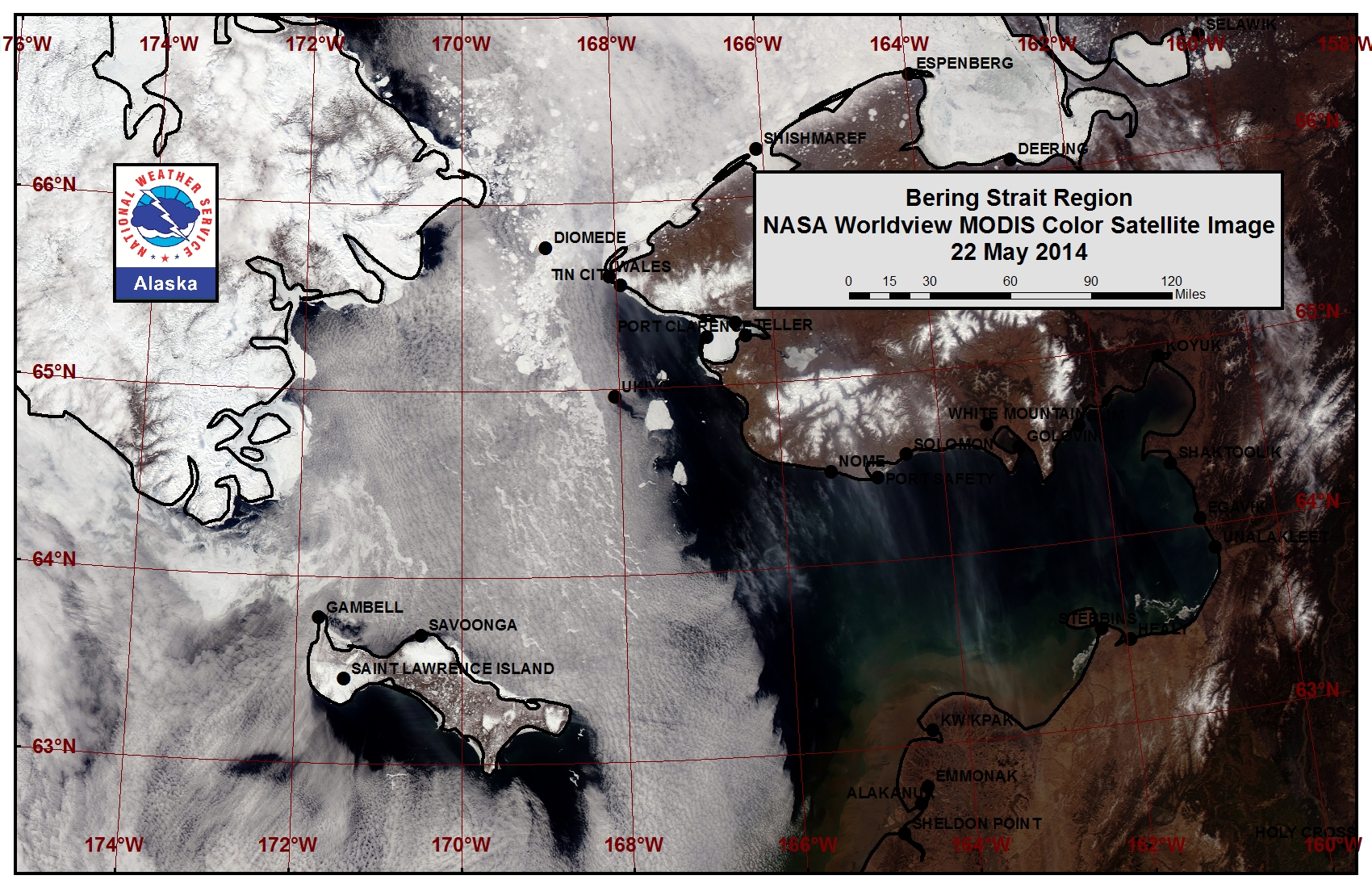
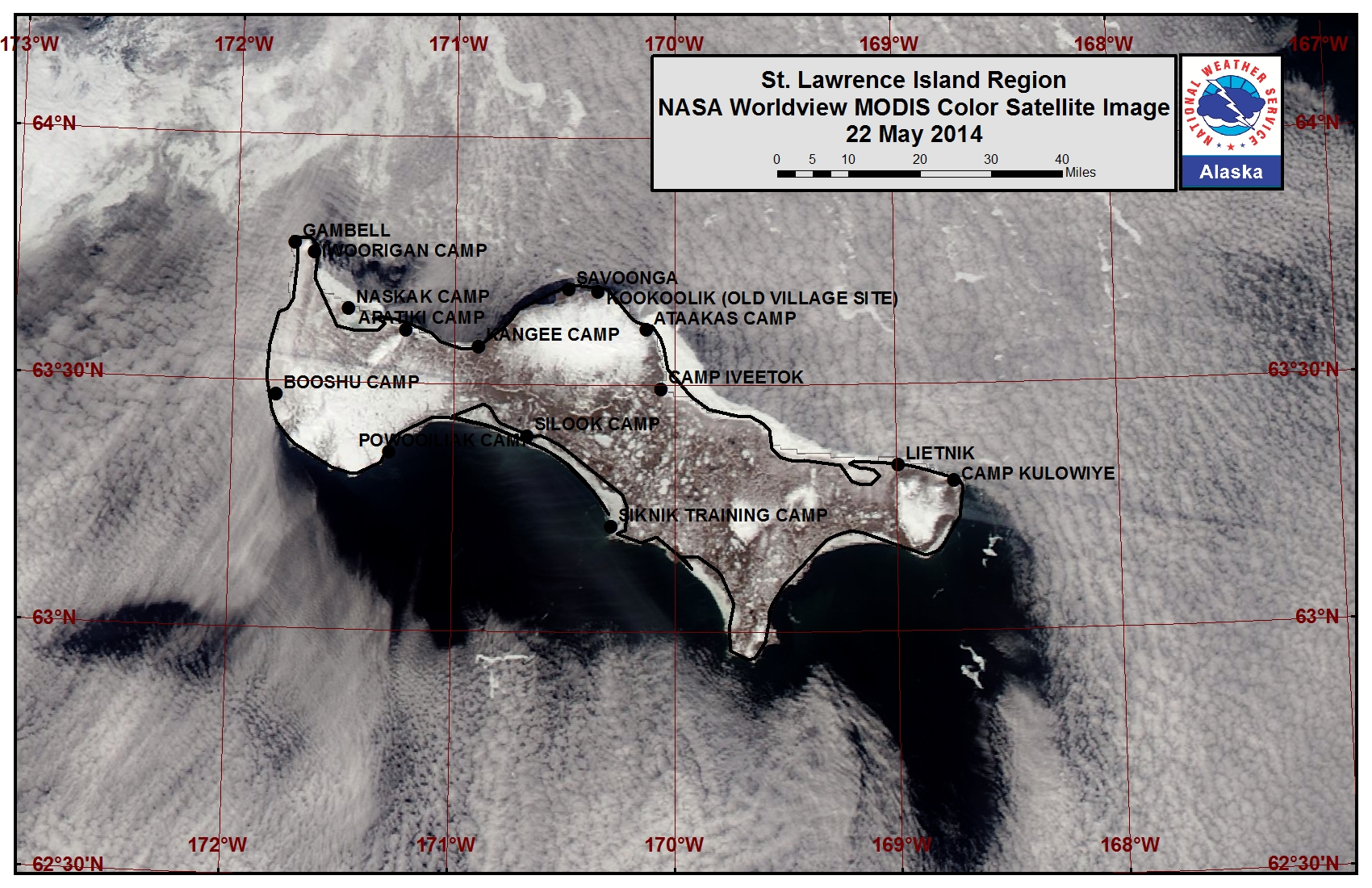
The remaining sea ice in the northern Bering Sea melted quite dramatically this past week. Ice that was previously shorefast around St. Lawrence Island is flooding and forming melt ponds. This ice is expected to continue to melt in place from the shoreline and to break off in the coming week. Isolated areas of very open pack ice to open water lie near Koozata Lagoon on the southern coastline and Kiloknak Lagoon on the eastern coastline. The island is surrounded by primarily sea-ice-free to open-water areas with the nearest close pack ice located 4 miles offshore from Gambell and the nearest open pack ice roughly 15 miles offshore from Savoonga.
Wales to Shishmaref
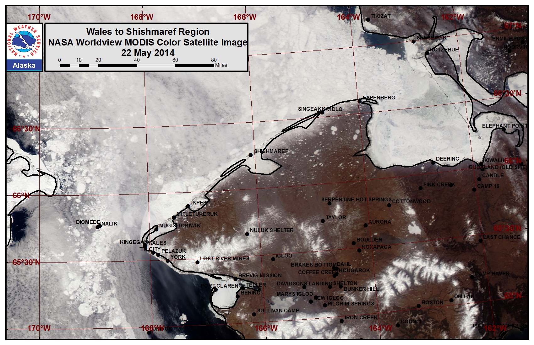
The outer extent of the shorefast ice from Ikpek up to Shismaref destabilized this past week and is continuing to do so. Melt ponds are continuing to form and sea ice within lagoons is beginning to melt out from the shoreline. The shorefast ice along the coast now varies from 2 miles off Shishmaref to 6 miles off Ikpek to 7 miles off Mugisitokiwik. This shorefast ice will continue to destabilize this week. Open water lies beyond the shorefast ice from Wales to the south and very open to open pack ice lies beyond the shorefast ice from Wales up to Shishmaref. Close pack ice is currently shifting through the Bering Strait near the Diomede Islands and consists of brash ice to vast floes.
5 to 10 Day Forecast
Weather System/Wind Synopsis
High pressure is established over the Bering Sea bringing west to northwest winds of 15 to 20 mph (10 to 15 kt) on Friday, 23 May. The winds will pick up from the west and southwest (15 to 25 mph, 10 to 20 kt) over the weekend as a low-pressure system moves through the Chukchi Sea. During this time, high pressure over the Bering Sea is replaced by low pressure. Low pressure moves into the Arctic of the Western Hemisphere as well, with high pressure over Eastern Russia. Winds will switch to the northwest on Monday and Tuesday (26-27 May) at 15 to 25 mph (10 to 20 kt). By Wednesday, 28 May, low pressure develops in the Arctic north of Eastern Russia and remains through Friday, 30 May. The winds will again switch to the southwest and remain around 15 to 25 mph (10 to 20 kt) Wednesday through Friday. High pressure will build back into Eastern Russia on Saturday and remain through Monday, 2 June. Northwest winds of 15 to 20 mph (10 to 15 kt) will be the result of the high-pressure position.
Temperature Trend & Ice Forecast
Temperatures during the period will be near normal with overnight temperatures ranging from near 30 over the Bering Sea to the upper 30s along the west coast of Alaska. The daytime temperatures will range from the mid 30s over the Bering Sea to the mid to upper 40s along the west coast of Alaska. Due to seasonal temperatures increasing, ice melt-out will continue throughout the northern Bering Sea. Shorefast ice will become more unstable and continue to break off. Due to the switching wind directions and generally westerly direction, ice floes will move toward the Alaska coast and slosh around the Bering Strait to St. Lawrence Island areas during the week.
Arrows show wind direction and wind speed in knots


Remote Sensing Images
Observations and Comments
Observations of Sea Ice Development
Observations from Savoonga
23 May 2014 - George Nongwook
There's quite a bit of ice about 20 miles out in the northwest through the northeast. The ice looks pretty sturdy and clean and may be thick multi-year ice. The winds keep picking up which is a problem. Yesterday winds picked up from the west, 15-20 mph. There are a lot of marine mammals out including walrus, bearded seals, and even killer whales.
Observations from Wales
23 May 2014 - Winton Weyapuk
Most of the pack ice has drifted past to the north. Any pack ice that comes near our side of the strait is blown further out in the northeasterly winds the past few days. Last week people were seeing walrus hauled out or heard them barking as they swam past or were hauled out on pack ice. We see some small floes drifting past along the shorefast ice now and then which are most likely pieces broken off the shorefast ice fairly nearby to the SE. Where the shorefast ice is grounded and anchored by ridging along its edge seems to determine its width. More ridging or extensions may be added to that during the winter. The shorefast ice is still quite solid although melting may be occurring on its bottom from warmer ocean water.
20 May 2014 - Amos Oxereok
Image 1 looks west across the Bering Strait. Fairway rock is visible at the horizon line on the left side of the frame. Little Diomede Island can be seen near the center of the frame. A few large melt ponds remain on the shorefast ice and are light blue in color. More snow-free areas in the land fast ice are now exposed and show up in the image as grey in color. More ablation of the shorfast ice can also be seen at the mouth of Village Creek, where meltwater has drained and flowed seaward.
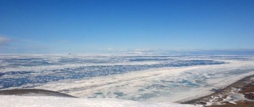
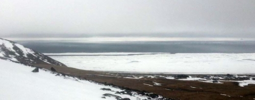
Image 2 shows a chunk of the seaward landfast ice edge breaking off near the south end of the Wales.
Observations from Nome
23 May 2014 - Fred Tocktoo
Nome's shore ice, Southern Norton Sound, has been gone for over a week now but you can see some ice floes if you go towards Teller road around King Island.
