Assessment of Current Ice Conditions Relevant to Distribution and Access of Walrus
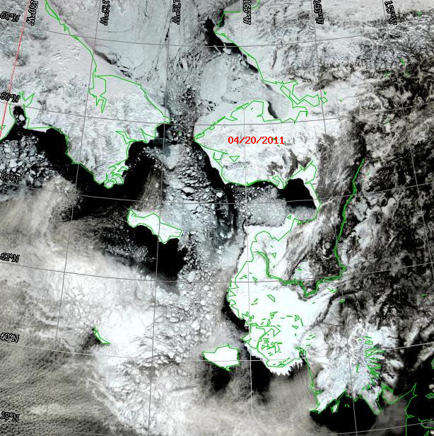
Sea ice conditions continue to reflect the effects of the large storm that moved through the area about 12 days ago. There are lots of small broken-up floes in the north central and northwestern Bering Sea, extending northward into the Bering Strait.
St. Lawrence Island
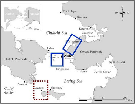
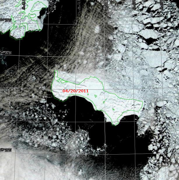
Sea ice continues to be made up of numerous small floes with extensive new/young ice in between, especially south of St. Lawrence Island. Shorefast ice is still present along the south shore. However, there is now open water along the edge of that shorefast ice. Numerous small floes of first-year thin ice are embedded in new/young that ice extends many miles west and north of Gambell. East of Gambell and north of Savoonga, the sea ice becomes much more concentrated with increased amounts of many sized first-year thick floes. The thickest and most concentrated sea ice now occupies the northeastern Bering Sea. Extensive shorefast ice still extends along the north coast of St. Lawrence. See the satellite images below.
Wales to Shishmaref
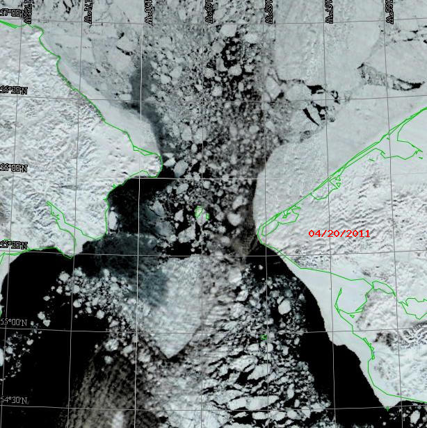
The major change in sea ice conditions has occurred in the Bering Strait where the continuous ice has now broken up in the Strait. See the satellite image below. The Strait is now made up of numerous small floes embedded in new/young ice with some large first year floes. Bowhead whales have been spotted off Wales, moving north. There is still extensive shorefast ice off of Wales and Shishmaref. Like last year, the edge of the shorefast ice west of Shishmaref is anchored in place by a line of grounded ice.
5 to 10 Day Forecast
An arctic cold front is moving south from the Bering Strait into the southern Bering with a strong low south of Sand Point moving eastward into the Gulf of Alaska. This will bring cold temperatures and north winds 25-30 kt through the weekend. A weak low will develop in the Central Bering Sea on Monday, April 25 and deepen as it moves southeast into the Gulf of Alaska. A weak pressure gradient will form over the northern Bering and Bering Strait with north winds 15 kt occurring from Monday, April 25 through Wednesday, April 27. A high pressure ridge will develop over the Bering Sea on Thursday with light northerly winds of 15 kt continuing into the weekend. A strong low will move into the central Being Sea on Sunday, May 1 and winds will increase to 30 kt by Monday, May 2.
Arrows show wind direction and wind speed in knots


Remote Sensing Images


Observations and Comments
Observations of Sea Ice Development
22 April 2011 - Winton Weyapuk, Jr. - Summary of Ice Development in Wales
From April 15th to the 22nd we've had mainly northeasterly winds. There were three days when the winds were calm and one day (the 18th) when the wind was from the south-southwest. A lead along the edge of the shore fast ice was open about half this time and the rest of the time it was closed. It looks like there could be more open water forming towards the south and the lead along the shore fast ice becoming wider.
