Assessment of Current Ice Conditions Relevant to Distribution and Access of Walrus
Near St. Lawrence Island
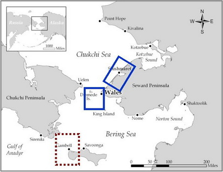
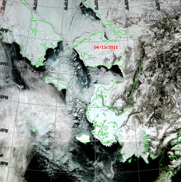
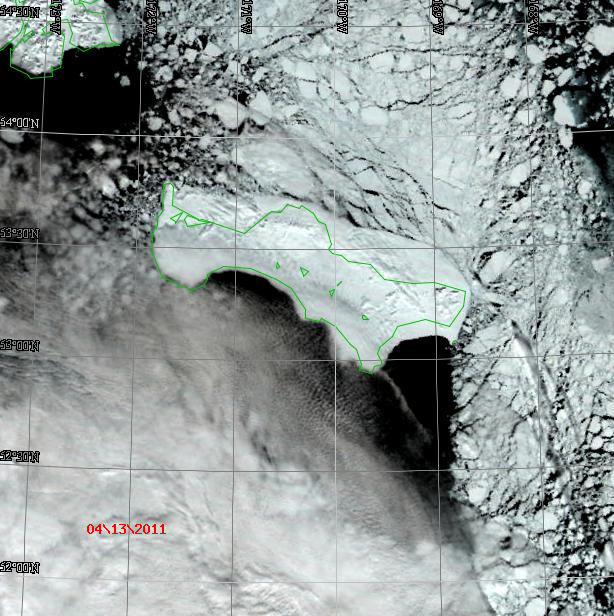
The big storm last week affected the concentration and extent of the sea ice in the Bering and southern Chukchi Seas - breaking and fracturing the ice, especially the shorefast ice that had exposure to storm winds (see the satellite images below). The lead edge of shorefast ice on the south side of St. Lawrence Island is fractured and broken up. It is probably very difficult to launch a boat from the edge because of the jumbled ice. Offshore of the shorefast edge, a large area of new/young and first-year thin ice extends at least 20 miles south. The pack ice west and northwest of Gambell is very loose with lots of new/young/first-year thin ice in between the heavier floes. The pack ice is pushing down onto the shorefast ice along the north coast of St. Lawrence. However, there is a lead at the shorefast edge that extends a few miles offshore. A comparison of the satellite image of sea ice last week compared to this week shows the great shifts in ice concentration and extent, especially west and northwest of the Island.
Wales to Shishmaref
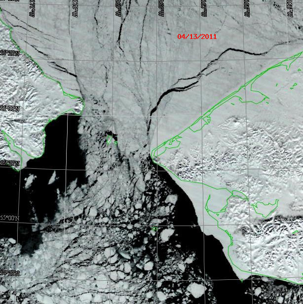
The shorefast ice edge near Wales also was broken up. New/young ice with open water and embedded floes extends well offshore into the Bering Strait from the shorefast edge. The shorefast ice off Shishmaref is still much in place but fractured with a wide lead between the edge of the shorefast ice and the pack ice. This lead has new/young ice with some open water. This lead can easily be seen in the below satellite image. The pack ice north in outer Kotzebue Sound is compacting due to the northerly winds.
5 to 10 Day Forecast
A high pressure system will persist over the northern Bering and Bering Strait through Thursday, 24 April, resulting in light northerly winds and minimal clouds. A weakening low pressure system will move from the Gulf of Alaska northward along the Bring Sea east coast Friday, April 22, stalling near Nunivak Island on Saturday, April 23. This will tighten the surface pressure gradient and winds will slowly increase to NE 20-25 kt by Monday, April 25.
Arrows show wind direction and wind speed in knots


Remote Sensing Images


Observations and Comments
Observations of Sea Ice Development
18 April 2011 - Fred O. Tocktoo - Subsistence Ranger, Western Arctic National Parklands
The storm that hit Nome area April 7, 2011 closed Nome's local roads and businesses and came in strong from the northeasterly winds gusting up to 50 mph plus. Nome's landfast ice held, at least out in front of Nome, which is about half a mile out. It was feared that the shore ice would float and break but it held during the storm. If we had southerly winds it would have been different and possibly bring in some shore ice to pile up along the southern shores of Seward Peninsula. We got lucky the winds were coming from northeasterly as the winds were coming in from inland. The storm dropped record amounts of snow.
15 April 2011 - Winton Weyapuk, Jr. - Summary of Ice Development in Wales
Winds on the 7th were from the NE at 30, gusting to 35 with heavy snow and blowing snow with visibility 1/4 mile. Since the 8th winds have been relatively light varying from NE to NNW between 10 and 20. The shore fast ice remains rough although blowing snow filled in some of the rough areas. The northeasterly winds also broke off a good part of the rough shelf ice extensions that had formed prior to the 7th, making the possibility of cutting trails to the edge of the shore fast ice much more feasible and lessening the amount of work that will be needed. Northeasterly winds have also kept the lead along the shore fast ice open.
15 April 2011 - Curtis E. Nayokpuk; local observer in Shishmaref
High Northerly winds with snow / blowing snow storm conditions last week moved in sea ice along the Shishmaref coast. Very rough sea ice surface and new high grounded ridges can be seen from the village. Before the storm hunters were harvesting seals in open leads from the shorefast ice. There were light winds and scattered snowfall a few days in advance of the storm. One hunter reported they returned for safety concerns due to the new snow cover, they could not tell where the young thin ice might be to hunt in the open leads.
