
Assessment of Current Ice Conditions Relevant to Distribution and Access of Walrus
Click the name of each community below to view more frequently updated and detailed information from the National Weather Service.
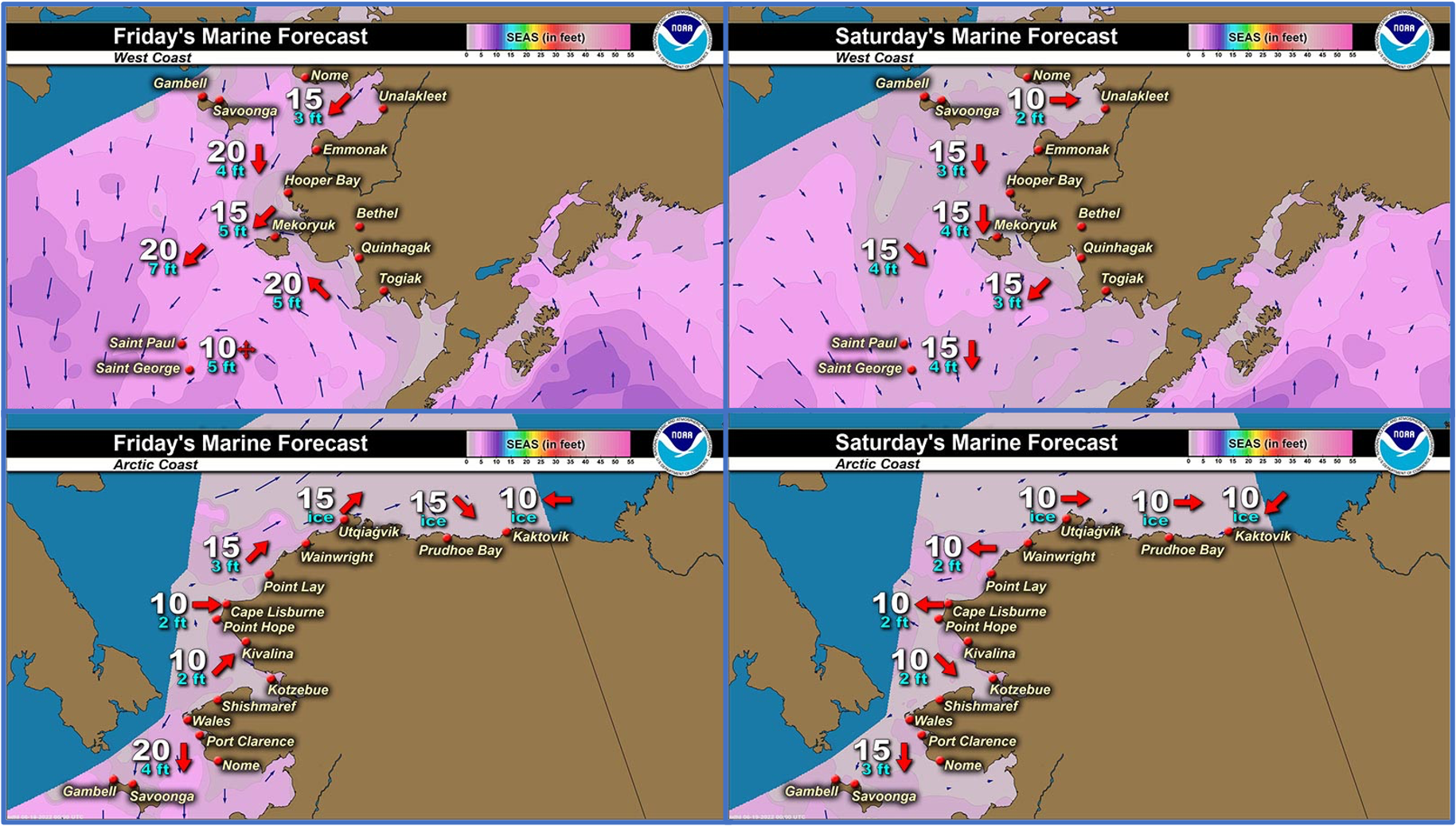
Synopsis High pressure will remain over the Alaska mainland and southern Chukchi and Beaufort seas through Monday as low pressure generally remains north of Alaska over the High Arctic.
Near St. Lawrence Island
The remaining sea ice is east of Savoonga off the northeast side of the island near Lietnik and Camp Kulowiye. Very open pack ice consisting of brash ice extends 35 miles (56 km) to the northeast of the shore, then there is an area of close pack ice consisting of brash ice and small floes beyond that. This ice is melting very quickly as it drifts off to the northeast.
Nome
The outlook has concluded for the season for this area.
Brevig Mission/Port Clarence Area
The outlook has concluded for the season for this area.
Wales to Shishmaref
The only remaining ice west of Espenberg is very open pack ice consisting of brash ice near the coast between Shishmaref and Espenberg that is quickly melting. Within Kotzebue Sound is very open to close pack ice consisting of brash ice and small floes.
Diomede
The outlook has concluded for the season for this area.
Forecast Discussion
Ice Forecast
The remaining sea ice in the St. Lawrence Island and Wales to Shishmaref areas will continue to melt very quickly through the weekend as it drifts northward with the combined southerly winds and currents.


Wind Synopsis
Strong south winds 20 to 25 mph (17 to 22 knots) from St. Lawrence Island to Shishmaref early Friday, June 23rd will dissipate slightly to 15 to 20 mph (13 to 17 knots) out of the southeast at St. Lawrence Island by Friday night, while winds at Shishmaref will become more variable at 10 to 15 mph (9 to 13 knots) going into Saturday, June 24th. These south winds of 15 to 20 mph (13 to 17 knots) at St. Lawrence Island will persist into Sunday, June 25th before weakening to 5 to 10 mph (4 to 9 knots) going into Monday, June 26th. At that point, winds will increase out of the south again at 10 to 15 mph (9 to 13 knots) at St. Lawrence Island before dissipating again on Tuesday, June 27th to variable 5 to 10 mph (4 to 9 knots) and persisting through Friday, July 1st.
At Shishmaref, winds will increase again 10 to 15 mph (9 to 13 knots) out of the south by the morning of Saturday, June 24th and persist into Monday, June 26th before south winds increase to 15 to 20 mph (13 to 17 knots). Winds at Shishmaref will again decrease to 10 to 15 mph (9 to 13 knots) out of the south by the evening of Tuesday, June 28th into Wednesday, June 29th and dissipating to 5 to 10 mph (4 to 9 knots) by Thursday, June 30th and persisting through Friday, July 1st.
Temperature Trend
For St. Lawrence Island, little variability of temperatures is expected over the next week, with highs in the mid to upper 40s and lows in the low 40s as cloudy skies and chances for rain persist over this period. For Shishmaref, temperatures will reach the upper 40s to low 50s and lows in the mid 40s over the next week.
Daily Weather, Wind, and Temperature Updates
The National Weather Service provides twice-daily, text-only updates on the weather, wind, and temperature conditions in specific geographical zones. An interactive weather map for access to other Alaskan zones can be found here: http://weather.gov/anchorage/ice
Higher resolution satellite images and wind maps (wind updated daily) can be viewed here: http://www.weather.gov/afg/SIWO_overview
The Alaska Ocean Observing System shares a variety of weather and sea ice related resources in their Bering Sea Portal at https://bering-sea.portal.aoos.org/.
Marine forecast for the West Coast and Arctic Coast
Remote Sensing Images


Observations and Comments
Observations of Sea Ice Development
Observations from Shishmaref
Thursday, 23 June 2022 – Curtis Nayokpuk
South winds gusting to 25 with occasional rain past week moved remaining loose pack ice off to the North. Ice free with 2-3 ft. waves out front and could see remaining grounded ice ridges off shore melting to the North East. Soon as weather /sea permits Salmon and white fish nets will be set and hunters on the lookout for chance at white whales passing along the shore line.