Assessment of Current Ice Conditions Relevant to Distribution and Access of Walrus
Near St. Lawrence Island
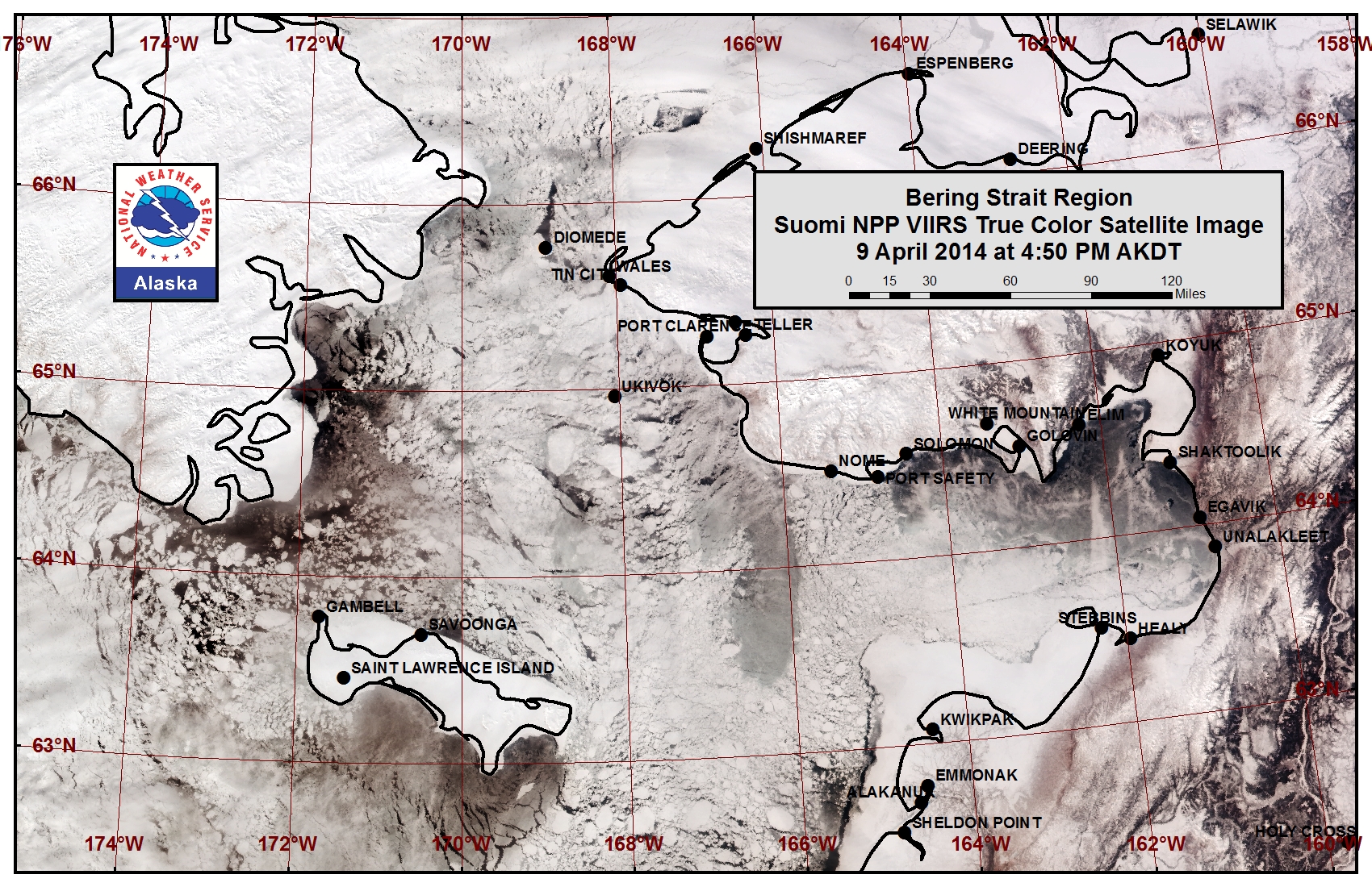
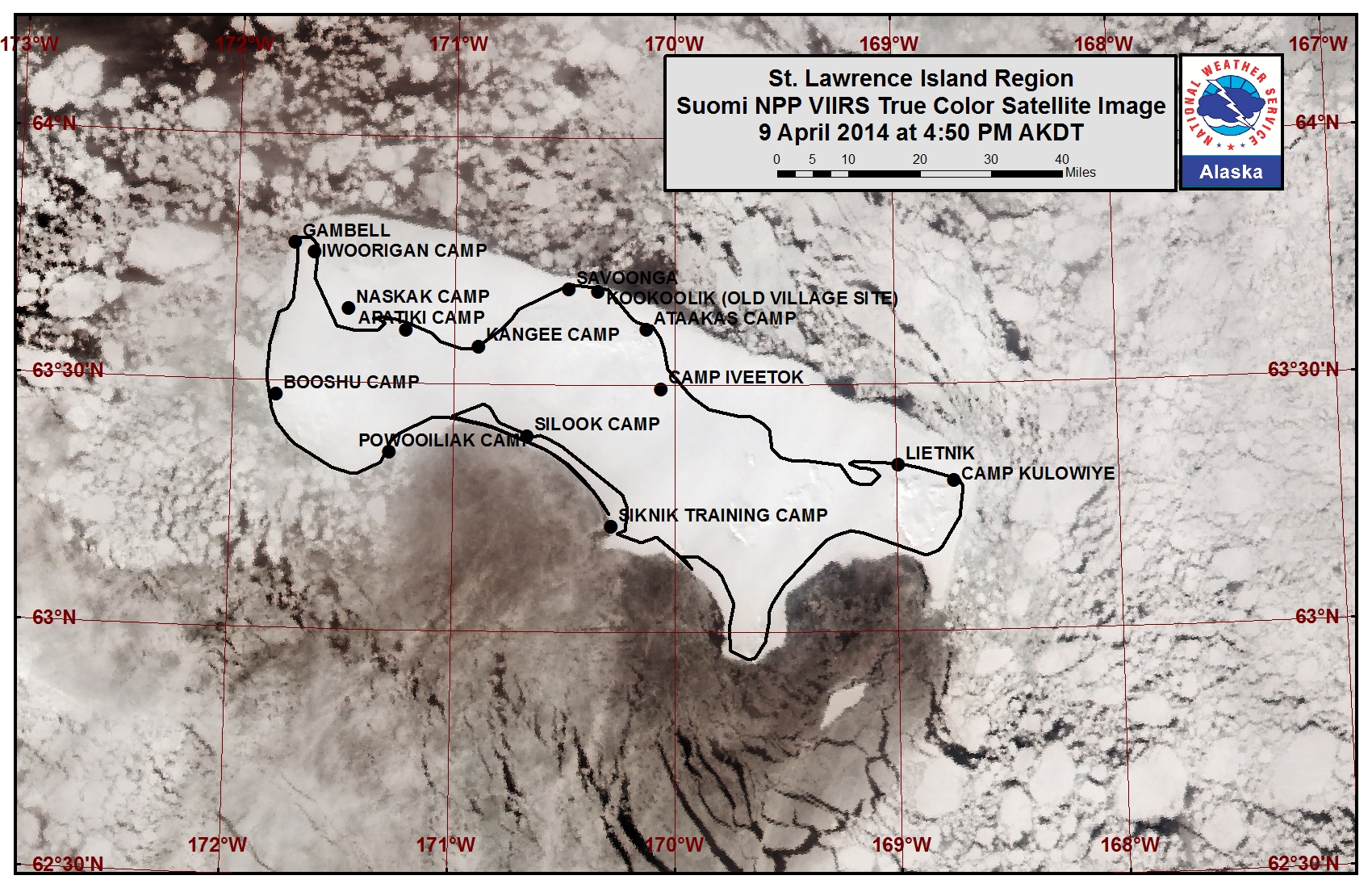
Satellite imagery shows that the polynya along the southern coastline of St. Lawrence Island has frozen over with new and young sea ice in an area stretching 20 to 50 miles beyond the shoreline. Close pack ice composed of small to vast floes lies off the northwestern coast of Gambell to Savoonga with new and young sea ice in between the floes. Along the northern coast east of Savoonga lies very close pack ice composed of medium to vast floes. The shorefast ice along the northern coastline of the island extends roughly 2 to 15 miles, while the shorefast ice along the southern coastline is mainly limited to the lagoons.
Wales to Shishmaref
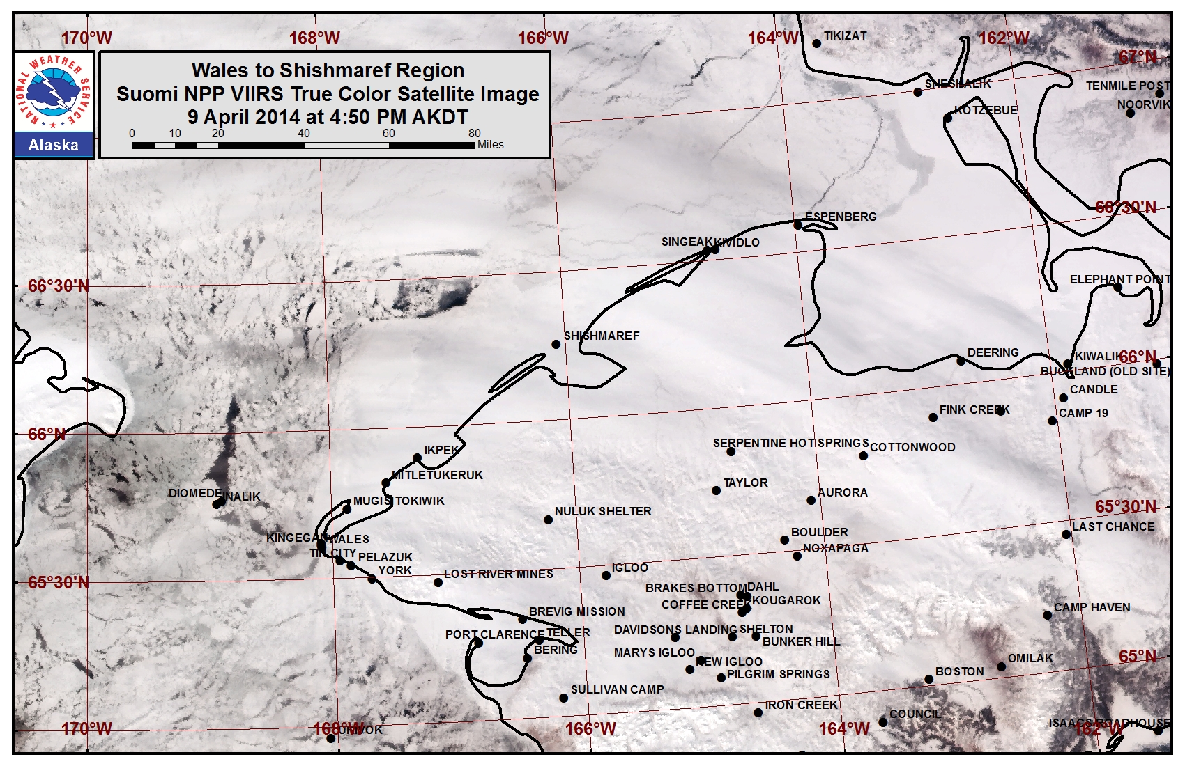
The shorefast ice extent along the coast varies from 15 miles off Shishmaref to 32 miles off Ikpek to 9 miles off Mugisitokiwik. The outer extent of the shorefast ice along this coastline formed later in the year and may not be as stable as the shorefast ice closer to the shore. Close to very close pack ice lies near the Bering Strait and mainly consists of medium to vast floes with areas of leads freezing over with new and young ice.
5 to 10 Day Forecast
Weather System/Wind Synopsis
On Friday, 11 April, low pressure positioned along the Eastern Aleutians combined with high pressure centered over the Beaufort Sea will bring light to moderate east to southeast winds through the Bering Strait and northern Bering Sea (10 to 15 kt, 15 to 20 mph). The low will wrap up into the central Bering Sea on Saturday, 12 April and result in stronger east to southeast winds in the region (10 to 20 kt, 15 to 25 mph). Another low-pressure system will push north through the central Bering Sea on Monday, 14 April sustaining the southeast winds (10 to 15 kt, 15 to 20 mph). Low pressure will remain in the southern Bering Sea through Thursday, 17 April although weakening the entire period allowing the high pressure over Eastern Russia to bring northeast winds of 10 to 15 kt (15 to 20 mph) Tuesday through Thursday. By Friday, 18 April, the low pressure has been pushed to the Aleutian Chain by the high pressure. Expect high-pressure transitions over the Bering Sea Saturday through Monday (19-21 April). Northerly winds will increase (15 to 20 kt, 20 to 25 mph) for Saturday and Sunday, 19-20 April, before turning southerly (5 to 10 kt, 10 to 15 mph) for Monday the 22nd.
Temperature Trend & Ice Forecast
During the forecast period, temperatures are anticipated to be below normal (10 degrees below normal) through Saturday, 12 April. These cold temperatures will allow for the development of new and young ice between large ice floes in exposed areas. Above normal (5 to 15 degrees) temperatures are expected for the remainder of the period. This pushes temperatures above freezing in areas south of the Bering Strait allowing for some thinning of ice and possible minimal melt-out occurring next week in thinner ice concentration areas. High concentrations of thick sea ice floes will shift around with the changing winds in the northern Bering Sea around St. Lawrence Island.
Arrows show wind direction and wind speed in knots


Remote Sensing Images


