Assessment of Current Ice Conditions Relevant to Distribution and Access of Walrus
Near St. Lawrence Island
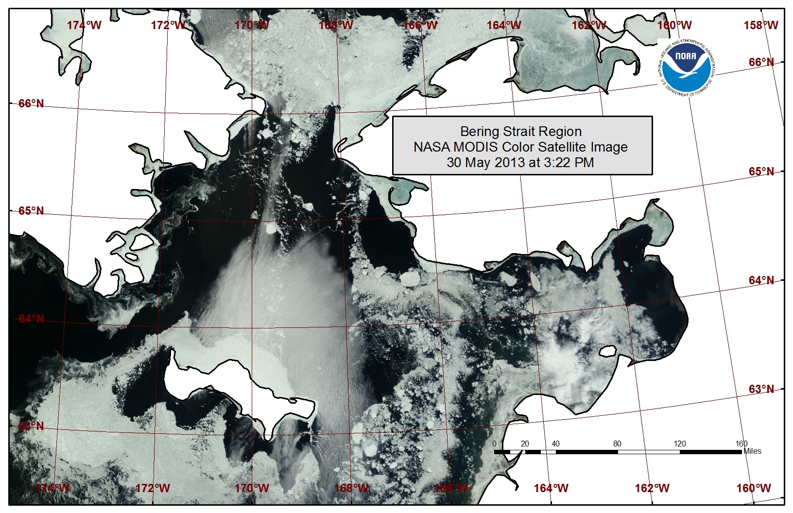
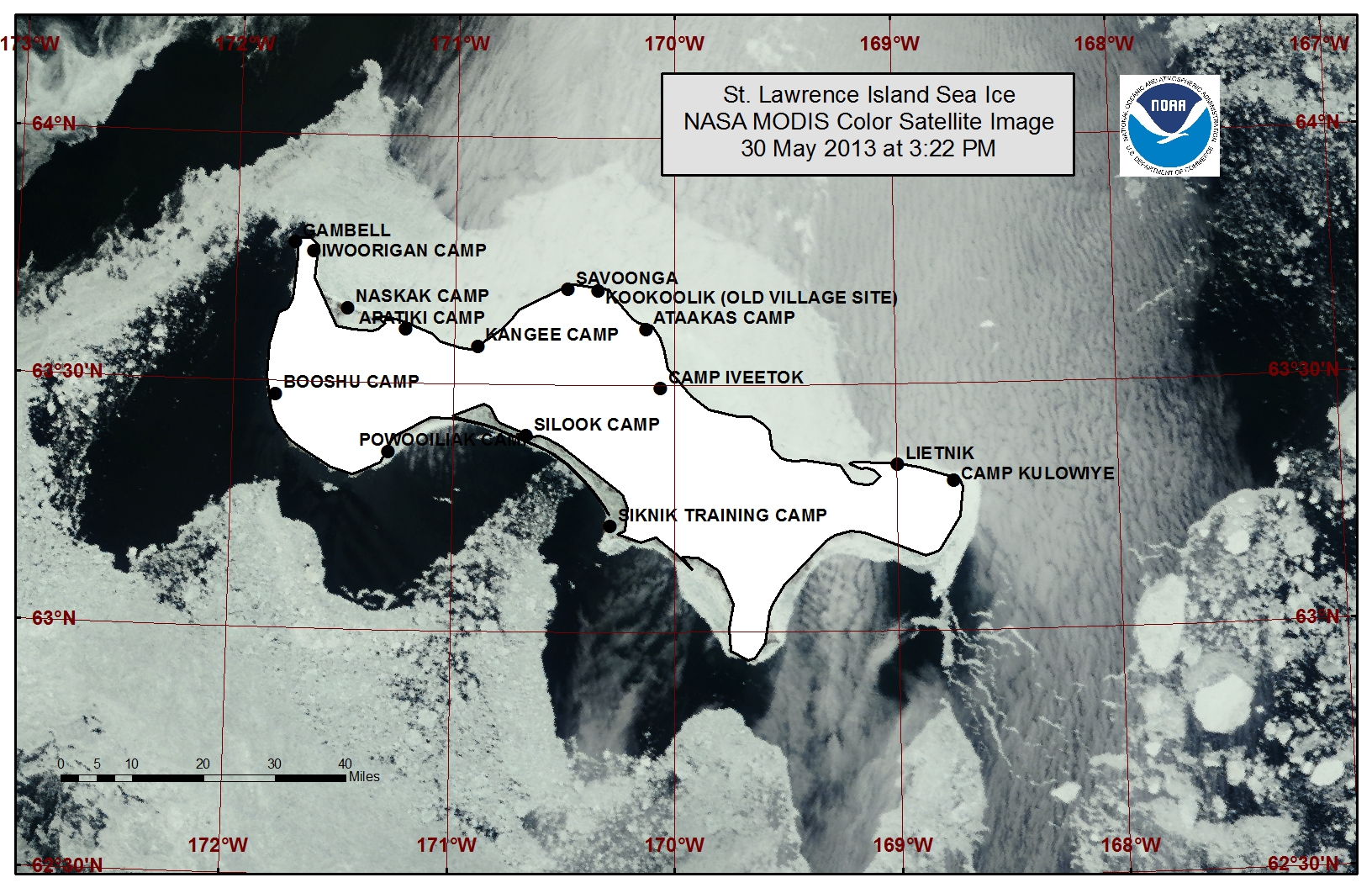
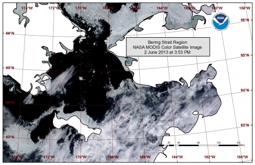
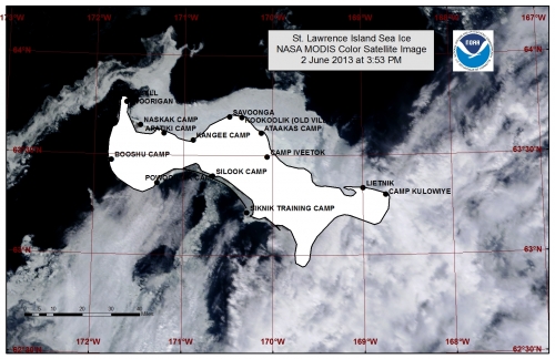
Close pack ice has consolidated along most of the northern coastline of St. Lawrence Island stretching 10 to 25 miles offshore. Beyond the pack ice lies an area of very open to open pack ice. Northerly flow has opened a polyna along the southern coastline of the island stretching 5 to 20 miles wide. Beyond the polyna lies a region of close pack ice. Shorefast ice is continuing to become further unstable.
Wales to Shishmaref
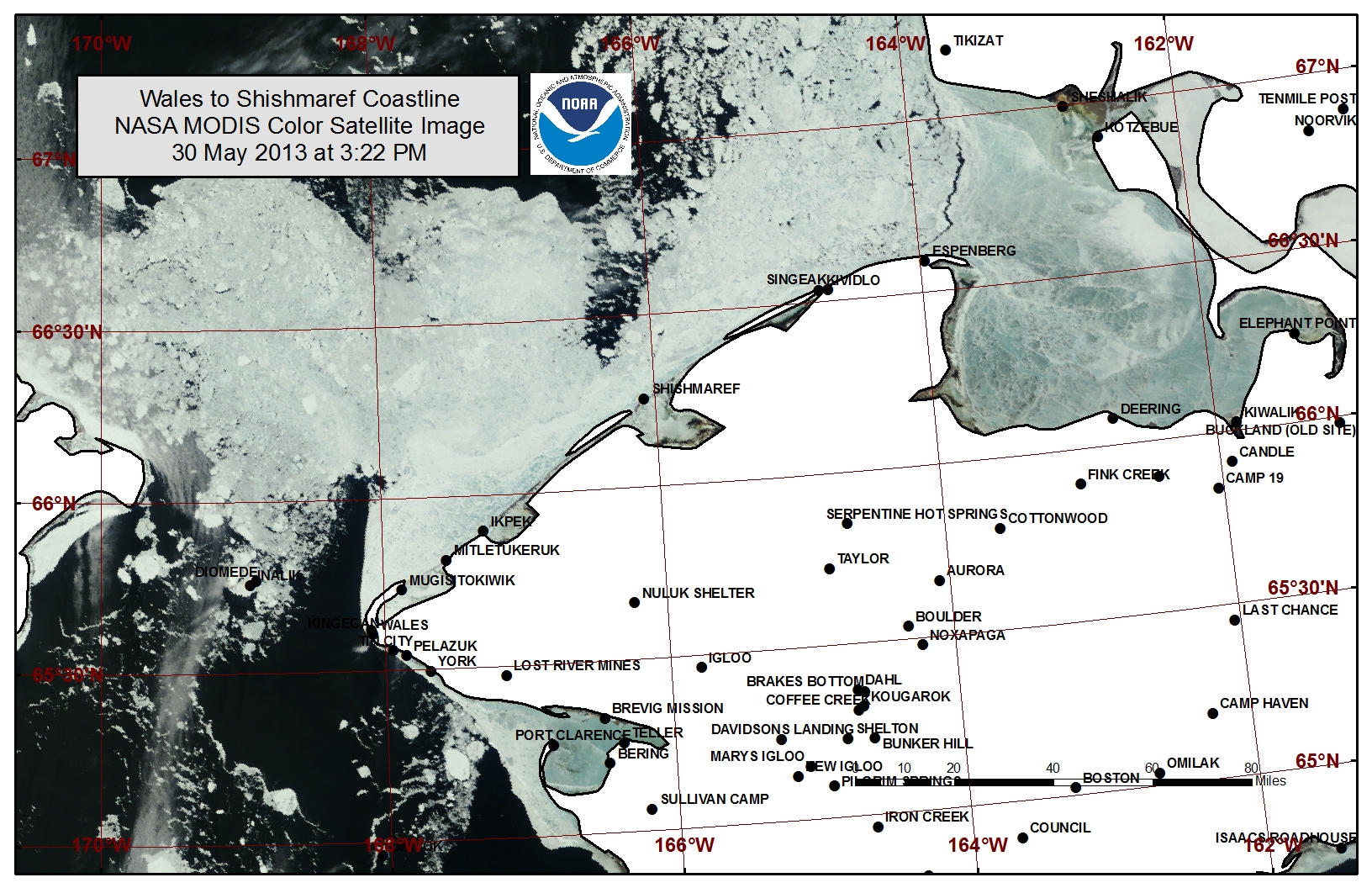
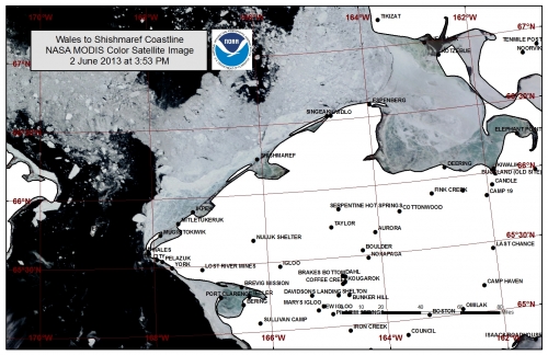
A polyna has opened off the west coast near Wales. Very close pack ice remains in much of the southern Chukchi Sea and is mobile along the shorefast ice edge. A polyna is filling with pack ice just off the shorefast ice edge near Shishmaref stretching to the north. The shorefast ice extent varies from 2 miles near Shishmaref to 14 miles off Ikpek to 13 miles off Mugisitokiwik. The outer edges of the shorefast ice are continuing to become more unstable and shorefast ice is beginning to flood near river deltas.
5 to 10 Day Forecast
A ridge of high pressure will remain over the western Bering Sea Friday, 31 May through Sunday, 2 June. A high-pressure system will also remain over the Chukchi sea Friday, with northeast winds of 20 to 30 mph (15 to 25 knots), shifting east Saturday. Winds will become light (<15 mph) Saturday through Sunday. Expect the polyna along the southern coastline of St. Lawrence Island to continue to expand through Friday and remain open through Sunday, and pack ice to continue drifting south through the Bering Strait through Sunday.
A low-pressure system will pass through the Chukchi Sea Sunday. A high-pressure system will build into the Chukchi Sea behind it Monday, 3 June through Thursday, 6 June, while a low-pressure system will move over northern interior Alaska, bringing stronger northeasterly winds 20 to 30 mph (15 to 25 knots) Monday and Tuesday (3-4 June) with winds decreasing and becoming southeasterly at 15 to 20 mph (10 to 15 knots) Wednesday and Thursday (5-6 June). The northeasterly flow will continue to move pack ice south along the shorefast ice edge from Shishmaref to Wales down through the Bering Strait on Monday and Tuesday. The polyna along the southern shoreline of St. Lawrence Island will also expand Monday and Tuesday, and begin to close Wednesday and Thursday with the southeasterly flow returning. A small polyna may form beyond the shorefast ice edge along the northern coastline of St. Lawrence Island Wednesday and Thursday.
Another low-pressure system will move into the northern Bering Sea Wednesday, 5 June through Saturday, 9 June. Lighter southerly winds will return at 15 to 25 mph (10 to 20 knots) Friday through Sunday, 7-9 June. These winds will keep the ice between St. Lawrence and the Bering Strait moving slowly to the north. Expect shorefast ice to continue to become unstable, and the polyna along the southern coastline of St. Lawrence Island to continue closing in.
Arrows show wind direction and wind speed in knots

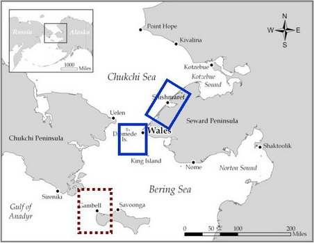

Remote Sensing Images
Observations and Comments
Observations of Sea Ice Development
Comments from Nome
6 June 2013 - Fred Tocktoo
Nome's shorefast ice is gone and right up to the beach right in front of town. Lots of ice out there yet.
29 May 2013 - Fred Tocktoo
Nome's landlocked ice has been breaking off but there is still lots of ice around. Hunters are happy and are able to launch water crafts close to the shores of Nome. Rivers are flowing freely; most of the river mouths have not opened up yet but will within a few more days. Lots of ice out there yet in the Norton Sound.
Updated images of the ice conditions from the NOAA/NWS Sea Ice Desk, dated 2 June 2013:
Comments from Shishmaref
31 May 2013 - Curtis Nayokpuk
Northerly winds over open waters and fog are hampering hunters in boats. Numerous reports of hunters falling through thin ice while hunting bearded seals. Very thin ice in all areas this year and the route from the village to the boat launch will be good for another week or two. A few walrus taken and drying racks show hunters are bringing in bearded seals but season has been slow. All boats are back on shorefast ice while launch areas are blocked with pack ice that moved in by winds from the north. Hunters are waiting for bearded seals along shorefast ice on any open leads they find favorable for hunting. North winds, fog, and cold temps form thin ice over leads making it hard to retrieve seals.
31 May 2013 - Ken Stenek, Shishmaref
South winds had blown out the ice a couple miles out last week (compare last Friday's satellite image to the one from yesterday) and many hunters harvested bearded seal. There were reports of thin ice on some of the cakes of ice. When I flew in last Friday, 24 May, the open water was very close to the shoreline compared to the satellite image from yesterday.
Comments from Wales
31 May 2013 - Winton Weyapuk, Jr.
Our shorefast ice is still solid. This past week we have had brisk north and northeasterly winds which have kept us from hunting. No pack ice near Wales for walrus hunting. Temperatures have gone below freezing each night during the past three nights and remain below freezing for parts of each day. We also have gotten fog which is typical for this time of the year.
