Assessment of Current Ice Conditions Relevant to Distribution and Access of Walrus
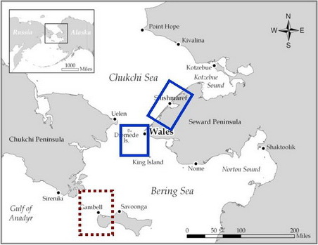
Near St. Lawrence Island
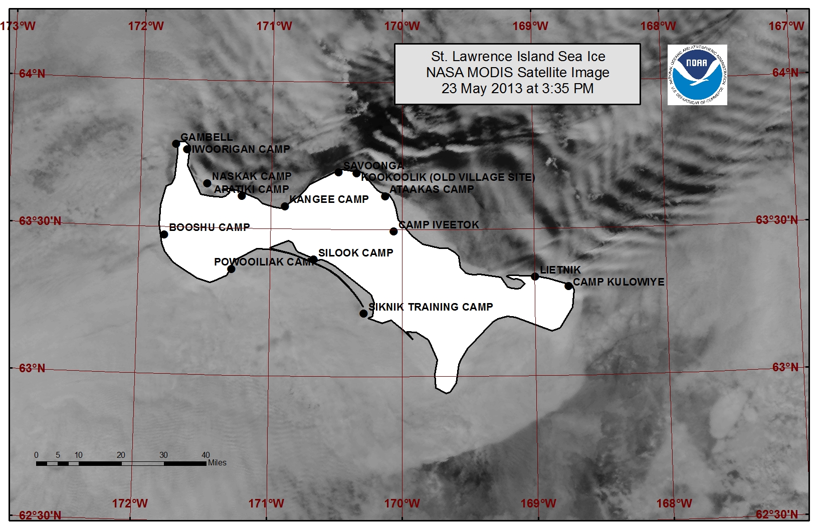
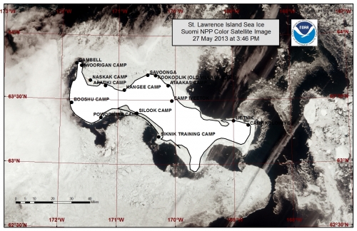
A large polyna is open along the entire northern coastline of St. Lawrence Island, stretching from 5 to 15 miles wide near Gambell up to 25 miles wide near Savoonga. Beyond the polyna lies an area of close pack ice. The shorefast ice along the northern coastline is continuing to become more unstable. Southerly flow has consolidated the ice pack along the southern side of the island and closed most leads.
Wales to Shishmaref
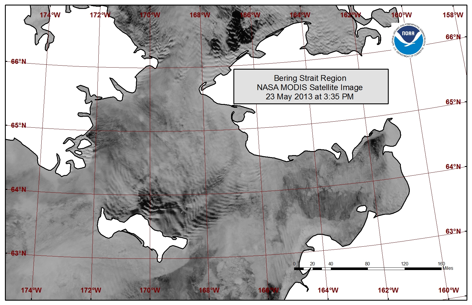
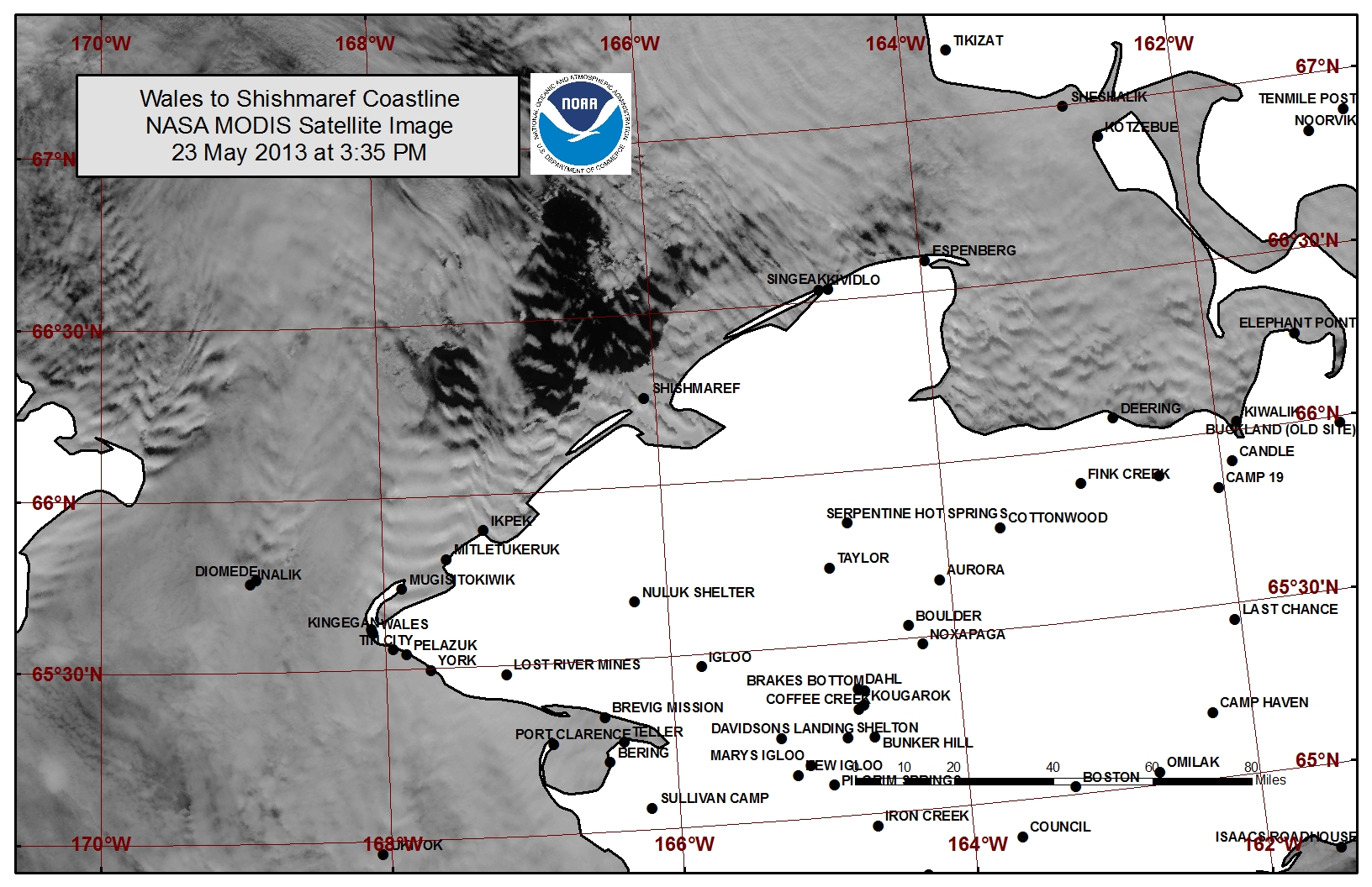
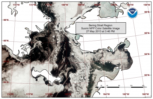
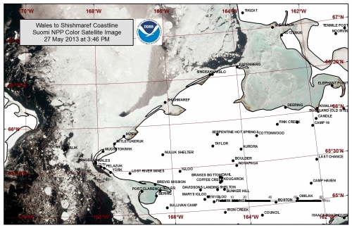
Open water to very open pack is present from the western third of the Bering Strait stretching up into the southern Chukchi Sea. Very close pack ice remains mobile along the shorefast ice edge and through the eastern two thirds of the Bering Strait. A large polyna 8 to 20 miles wide has formed just off the shorefast ice edge from near Ikpek stretching up to the entrance to Kotzebue Sound. The shorefast ice extent varies from 2 miles off Shishmaref to 18 miles off Ikpek to 10 miles off Mugisitokiwik. The outer edges of the shorefast ice are becoming more unstable.
5 to 10 Day Forecast
A low-pressure system will be in the Northwest Chukchi Sea Friday the 24th with southwest winds of 15 to 25 mph (10 to 20 knots). Expect the polyna along the northern coast of St. Lawrence Island to continue to expand through late Friday, and the polyna off the coast from Ikpek to Kotzebue Sound to continue to expand through early Saturday.
The low will move into the Arctic with high pressure sneaking in for a day of light winds (<15 mph) on Saturday the 25th. A large low-pressure system will move into the Southern Bering Sea Saturday afternoon with high pressure building over Eastern Russia. Winds will increase to 20 to 25 mph (15 to 20 knots) Sunday the 26th. As winds turn out of the northeast expect these polynas to begin closing over the weekend, and expect a new polynya to begin forming along the southern coast of St. Lawrence Island.
As the high pressure increases over Eastern Russia, low pressure will be over the mainland of Alaska. This will create stronger northeast winds Tuesday through Saturday the 1st of June. Northeast winds of 20 to 30 mph (15 to 25 knots) will be prevalent during this period. The high pressure transitions over the Bering Strait region Sunday and Monday with winds decreasing Sunday to around 10 to 20 mph (5 to 15 knots). During this time the polyna along the southern coastline of St. Lawrence Island will continue to expand. Ice will continue to drift through the eastern half of the Bering Strait into the northern Bering Sea and the ice pack will consolidate along the northern coast of St. Lawrence Island. The shorefast ice from Wales to Shishmaref will continue to become more unstable with the pack ice drifting along the shorefast ice edge.
Arrows show wind direction and wind speed in knots


Remote Sensing Images
Observations and Comments
Observations of Sea Ice Development
The NOAA/NWS Sea Ice Desk contributed additional satellite imaging with much clearer conditions, dated 27 May 2013:
Comments from Nome
24 May 2013 - Fred Tocktoo
The shorefast ice in front of Nome is starting to chip off here and there. With ice more and more unstable, break-up of the shorefast ice is approaching.
Comments from Wales
24 May 2013 - Winton Weyapuk, Jr.
We had a wet few days with considerable rain which kickstarted the spring thaw. The shorefast ice remains firm although it has melt water puddles. Some of the lower pressure ridges were removed by the pack ice moving north. We have had southeasterly winds all week which has kept the pack ice along the shorefast ice here. No walrus seen yet. Temperatures just above freezing so the slow thaw continues.
