Assessment of Current Ice Conditions Relevant to Distribution and Access of Walrus
St. Lawrence Island
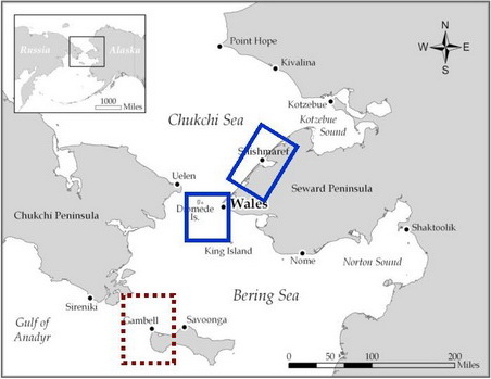
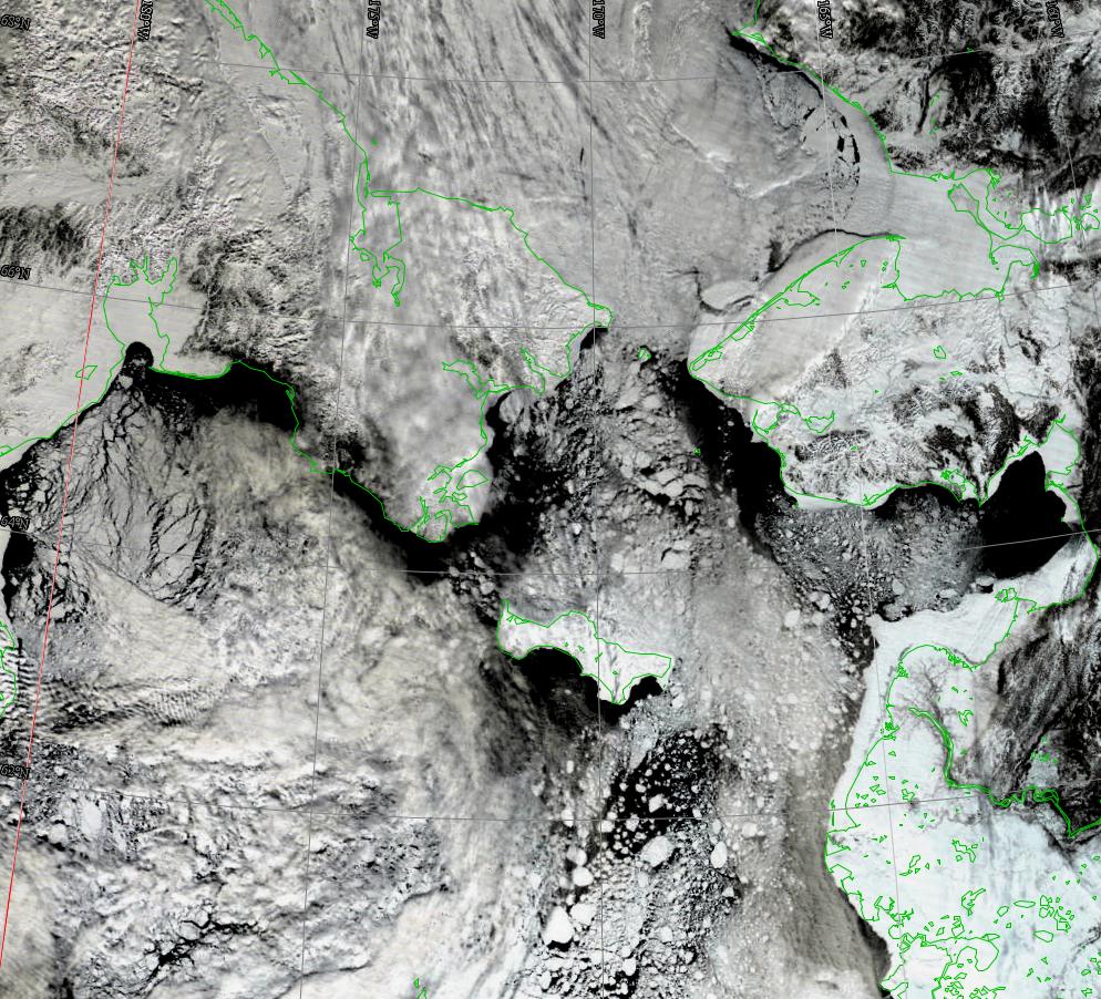
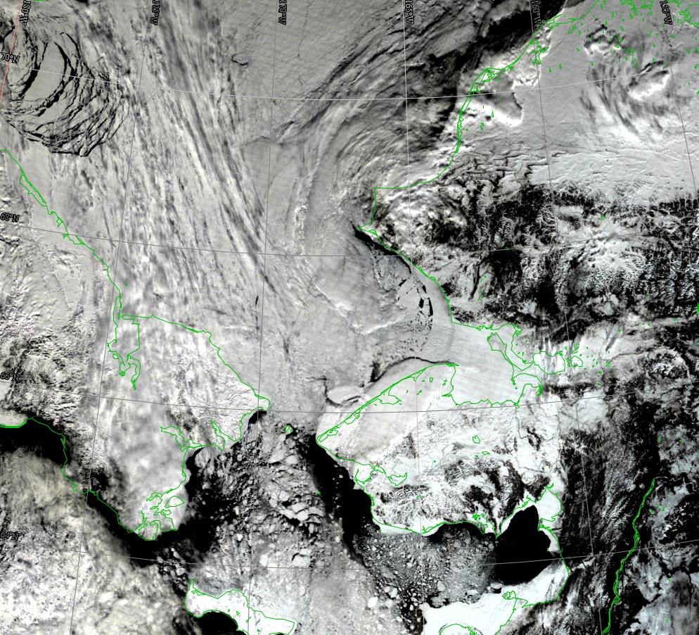
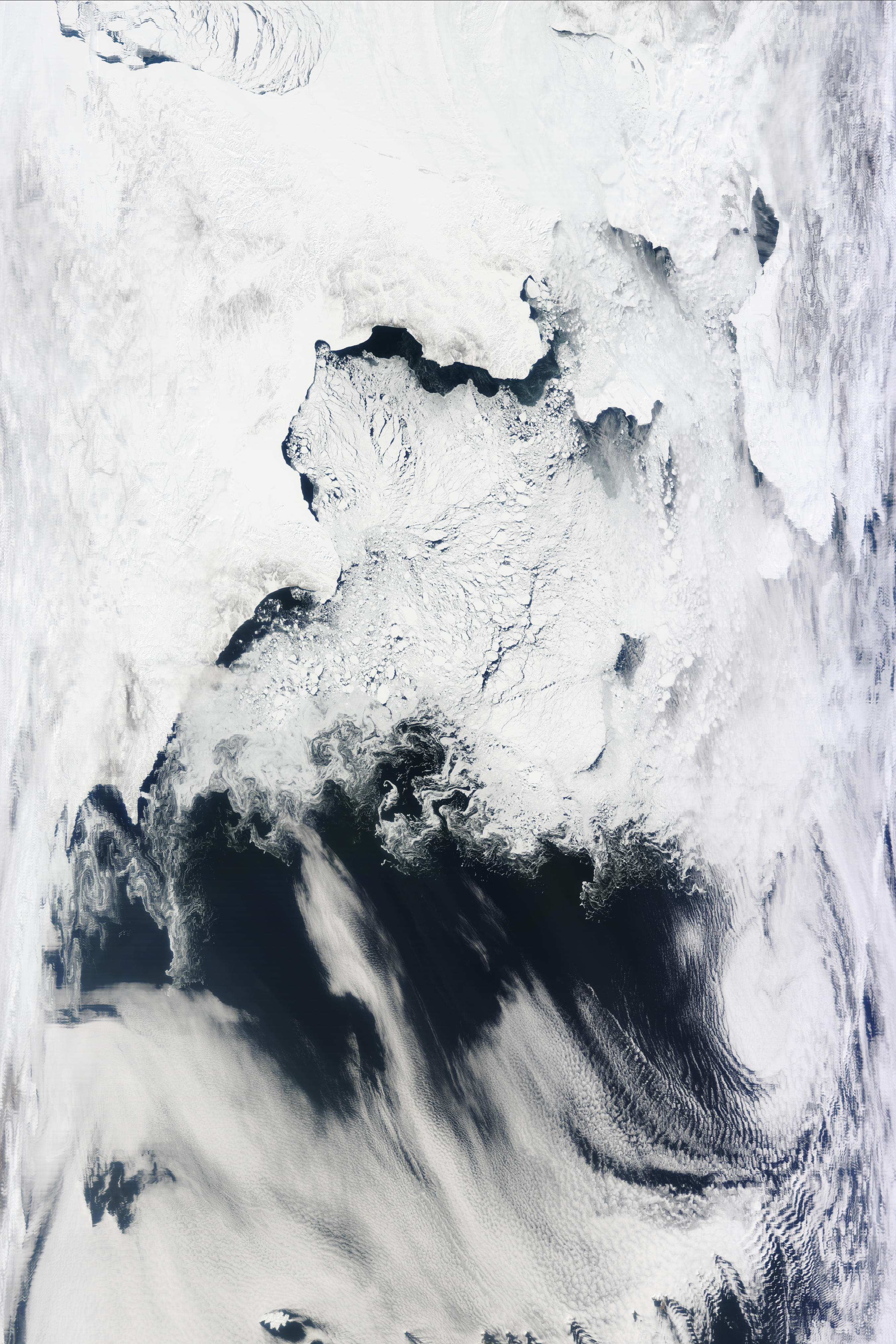
Satellite imagery shows that the pack ice in the Bering Sea is beginning to break up in earnest. Persistent northerly winds have pushed the ice away from the coast, especially those shores facing south. There is also a lot of erosion of the shorefast ice in Powooiliak Bay to southeast Cape. The presence of cloud streets over the area indicates large open leads offshore. There is also breakdown of the shorefast ice along the west coast of the island. There are numerous broken floes (Qerngayaak) just west and southwest of Gambel. Here the cloud streets indicate that there are areas of open water. The persistent northerly winds have compacted the sea ice pack up against the north shore of St. Lawrence Island.
Wales to Shishmaref
Persistent northerly winds have pushed the sea ice pack away from the shore and there are now large open water leads off of the shorefast ice. The shorefast ice is eroding from south of Wales to near Cape Prince of Wales. An ice ridge line extends northeast from Cape Prince of Wales 50 km. Just east of this line the shorefast ice has been breaking up since 7 April with a very large piece of shorefast ice seen detached in the satellite imagery on 12 April. This large shorefast ice is still present in the imagery below with large leads and broken ice between this floe and the shore.
5 to 10 Day Forecast
Through the weekend, a storm will drift slowly eastward from the Russian coast across the southern Bering Sea bringing an end to the northerly winds. Winds will become easterly reaching 30 knots near St. Lawrence and 20 knots in the Bering Strait on Sunday night and Monday. This storm will continue to drift eastward moving into the Gulf of Alaska Monday night. Another storm moves eastward off the Russian coast on Monday, and into the central Bering Sea bringing winds of SE 25 knots over St. Lawrence Island and E 15 knots over the Bering Strait on Wednesday, 25 April. Yet another storm moves eastward over the northern Bering Sea on Saturday, 28 April, bringing southerly winds to the northern Bering Sea and Bering Strait through next weekend. These storms should continue to slowly break up and fracture the sea ice with some erosion of south facing shorefast ice.
The present ice conditions and weather pattern are very similar to ice and weather in 1976. It is of interest that the sea ice edge that year reached north of St. Lawrence Island by 15 May and was north of the Bering Strait by 23 June.
Arrows show wind direction and wind speed in knots


Remote Sensing Images


Observations and Comments
Observations of Sea Ice Development
Comments From Gambell
22 April 2012 - Paul Siluk Apangalook
A week ago, Gambell boats were out hunting among thick sallek (newly-built young ice) and rough open leads at wind speeds of up to 22 mph. On Monday, 16 April two whales were struck and landed on a clear day (8°F, 15 mph winds out of NNE). During the week, Savoonga and Gambell had further hunting success. Huge ice floes several miles across west of the village were associated with big leads in which whales were concentrated. On Thursday, 19 April, large ice floes closed in on boats hunting southwest of the village in calm weather and blocked the onshore lead as winds shifted to the west in the afternoon. All boats made it home after breaking and dragging over ice. On 20 April, with the south current at its peak and 13 mph winds opening small leads several boats were out. Grounded ice and rough, piled ice interspersed with smooth, thinner ice created conditions that required boats to navigate carefully in order not to get trapped.
Comments From Wales
19 April 2012 - Winton Weyapuk Jr.
This past week winds have been from northerly to northeasterly directions at 15 mph. A lead has opened along the shorefast ice off town, ending roughly 4 miles north of town in a corner at the shorefast ice edge. A bowhead whale has been sighted in the lead. Access to open water is affected somewhat by a broader shorefast ice this year. A suitable trail location with level ice and access spots for boats has been identified, however, at the northern end of town. With calmer weather boats are expected to head out over the coming days.
