
By: Emily Eidam, Oregon State University; Christopher D. Arp, University of Alaska Fairbanks (UAF); Julianne Davis, University of North Carolina (UNC); Allen Bondurant, UAF; Sarah Clement, UAF; Lillian Marguerite Cooper, UNC; Ted Langhorst, UNC; Tamlin Muir Pavelsky, UNC; and Katie Spellman, UAF
Silt. Some might call it mud. Some might call it a nuisance when it makes trails impassable, clogs motors, and sticks to your shoes. Scientists like those on the Sediment, Ice, and Learning on the Tanana (SILT) team (University of Oregon, University of North Carolina, and University of Alaska Fairbanks) see fine, river-borne sediments as an important resource that isn't fully understood in the North because ice cover makes it challenging to measure year-round. The SILT project is centered on developing and testing low-cost sensor networks that can be deployed in the Tanana River when it is ice covered, including under-ice and during freeze-up and break-up, to better capture full sediment fluxes to downstream ecosystems. Additional new learning about silt and ice is coming from working with K–12 students in Nenana and Fairbanks, Alaska, who help in sensor construction, testing methods, and envisioning new hypotheses.
 to measure turbidity on the Tanana River in early October 2023. Photo courtesy of Emily Eidam.")
In Alaska, glaciers act like sandpaper over the landscape to wear down mountains into muddy sediments, including silt. This silt is what makes the Tanana run brown like chocolate milk. But, how much silt does the Tanana River carry, when does most of it get moved downstream, and why should we care? Sediment, including silt, clay, sand, and gravel (all of which flow through the Tanana), is a key resource for coastal environments. It builds beaches, deltas, barrier islands, and seafloor habitats in the coastal ocean. Scientists are interested in measuring how much sediment is delivered to coastlines globally to support coastal planning and predict how shorelines and offshore habitats will change with rising sea levels. But these measurements are particularly difficult in the Arctic, where wintertime ice makes traditional measurements of river sediment flows difficult. And yet, Arctic rivers account for a large portion of sediment delivered by rivers to the ocean globally.

Turbidity is a measurement of the optical clarity of water and we can relate turbidity to suspended sediment concentration to monitor the flux of sediment through a river. An optical backscatter sensor (OBS) measures turbidity with a wide range of linear response to sediment concentration. The OpenOBS—the first field-deployable open source turbidity sensor with a wide range of linear response to sediment concentration—provides low-cost feasibility for monitoring sediment flux in challenging environments (i.e., during freeze-up and break-up) and should lead to a more complete understanding of sediment budgets in northern rivers.
 and Sarah Clement (center) help students from Fairbanks CyberLYNX start thinking about how to measure river sediment with optical backscatter sensor (OBS) sensors and drones. Photo courtesy of Chris Arp.")
SILT project scientists are working with 40 middle school students from Fairbanks and Nenana to test two new strategies for measuring sediment under river ice and during spring break-up. To measure sediment under the ice, students developed hypotheses about where they thought sediment concentration would be highest, built low-cost OBS sensors to measure turbidity, and helped install the sensors in the river at Tanana Lakes, east of Fairbanks, and near the Nenana Ice Classic tripod (Nenana). After collecting data for a month, SILT team members extracted the sensors, (see Instagram-based video) and students analyzed and interpreted their data to determine if their hypotheses were supported. To measure sediment during spring break-up, students participated in a design challenge to develop effective methods for attaching the OBS sensors to drones. They each tested their designs by flying their drone and payload attachment system over a series of five-gallon buckets, dunking their sensors (but not their drones!) in each one.

The amount of silt in the water is especially difficult to measure during ice break-up. It is too dangerous to be on the river to collect water and silt samples directly. Most sensors that detect sediment in the water are really expensive, so scientists are hesitant to put them in the river due to the high break-up energy and risk of losing them. With use of the low cost OBS sensors in this project, we aren't as worried about sensor cost. So, during this period of dangerous river conditions, we're sending drones out to do what we cannot—carry the sensors to the water. By suspending an OBS from the drone and flying it over holes in the ice, we can lower the sensors into the water for a few seconds and then quickly bring the sensors and data back to shore without ever stepping foot in the river ourselves!
With river break-up on the horizon for the Tanana River in May 2023, the SILT team is collaborating with students in Fairbanks and Nenana to test drone-sensor techniques and collect these key data to understand how icy rivers impact downstream environments.
About the Authors
 Emily Eidam is an Assistant Professor at Oregon State University. Her research interests include sediment transport processes and rates in fluvial, coastal, and continental shelf systems, as well as event-scale to centennial-scale sediment deposition.
 Christopher D. Arp is a Research Associate Professor at the University of Alaska Fairbanks. His research interests include landscape and watershed-scale functions of lakes and wetlands; stream geomorphology, hydrology, and ecology; river and lake ice dynamics; surface-water interactions with permafrost; and climate change responses and adaptive management.
 Julianne Davis is a doctoral student in Dr. Tamlin Pavelsky's Global Hydrology Lab at the University of North Carolina. Her current research uses remote sensing to better understand the spatial and temporal variability in sediment transport through sub-Arctic rivers and deltas.
 Allen Bondurant is on the research staff at the Water and Environmental Research Center (WERC) of the University of Alaska Fairbanks. His Research focus is on permafrost and lake processes.
 Sarah Clement is the Alaska Climate Adaptation Science Center Program Coordinator for Inspiring Girls Expeditions of Alaska at University of Alaska Fairbanks. Her expertise is in program coordination and science education.
 Lillian Marguerite Cooper is an Undergraduate Lab Technician in Dr. Tamlin Pavelsky's Global Hydrology Lab at the University of North Carolina.
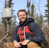 Ted Langhorst is a PhD Candidate at the University of North Carolina. Sediment transport in rivers can be viewed from many angles: as a natural process that shapes river valleys, as a threat to humans and infrastructure, and as an indicator of our changing climate. His research brings these many perspectives together to get the full picture and recent accounting of river sediment transport.
 Tamlin Muir Pavelsky is a Professor in the Department of Earth, Marine, and Environmental Sciences at University of North Carolina. The goal of his research is to develop and analyze global datasets of river form, including river width, sinuosity, number of channels, and basin area.
 Katie Spellman is a Research Assistant Professor in the International Arctic Research Center at University of Alaska Fairbanks. Her areas of expertise include ecology, science education, and vegetation.