Assessment of Current Ice Conditions Relevant to Distribution and Access of Walrus
Click the name of each community below to view more frequently updated and detailed information from the National Weather Service.
Synopsis An area of low pressure over the Gulf of Alaska will be reloaded several times over the next week. Broad and weak low pressure will extend over the ice pack. A front will enter the western Bering Sea early next week.
Near St. Lawrence Island
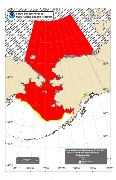
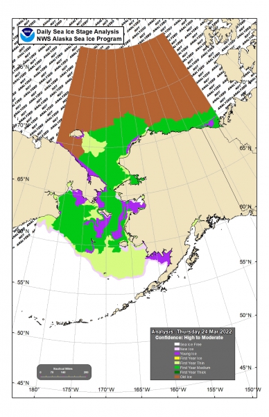
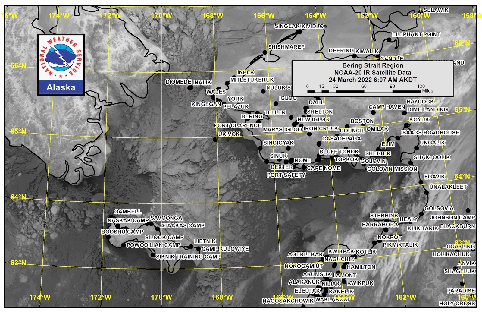
Shorefast ice extends out from the north, east, and south shores up to 6 miles. A polynya on the south side of the island extends 20 to 25 miles (32 to 40 km) from the edge of the shorefast ice and continues to quickly fill in with new ice. From Savoonga east, compact pack ice consisting of vast and giant floes extends from the north coast of the island to the Bering Strait and beyond. West of Savoonga and around the west side of the island, close pack ice consisting of medium to vast floes extends to 50 miles (80 km) west of Gambell and up to 20 miles (32 km) north of Gambell.
Nome
This area has not yet begun for the 2022 season.
Nome port entrance webcam (via AOOS webpage): https://bering-sea.portal.aoos.org/?ls=79875242-e362-65cb-914e-fed20ff9…
Brevig Mission/Port Clarence Area
This area has not yet begun for the 2022 season.
Wales to Shishmaref
Shorefast ice extends approximately 45 miles (72 km) north of Wales, 18 miles (29 km) north of Shishmaref. Beyond the shorefast ice is compact pack ice consisting of vast to giant floes for greater than 50 miles (80 km).
Diomede
Diomede is surrounded by consolidated ice that extends east to the shorefast ice near Wales.
Forecast Discussion
Ice Forecast
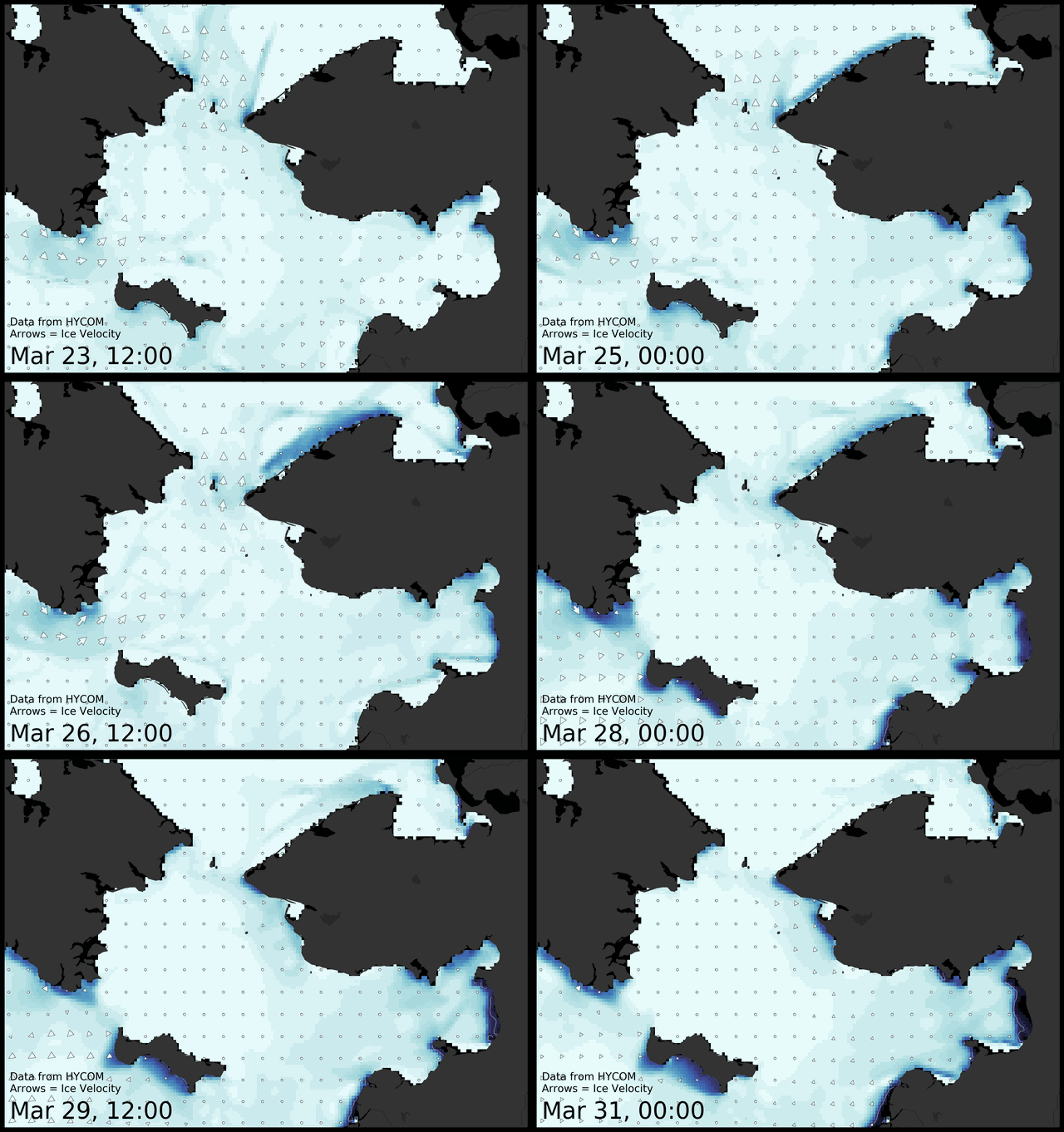
Sea ice will continue to gradually move south and southeast through the week, though movement will become driven by tides and currents with lighter winds through the weekend. Sea ice will continue to compact against the north-facing shores of St. Lawrence Island and the Seward Peninsula.
Wind Synopsis
Friday: NE winds 5 to 10 kts (6 to 12 mph) and then turning out of the SE later in the day. For Saturday, expect SW winds 5 to 15 kts (6 to 17 mph), becoming lighter and more variable later in the day. On Sunday, winds will increase out of the north with 5 to 15 kts (6 to 17 mph) to start the day and ending the day around 15 to 25 kts (17 to 29 mph) with strongest winds at the Bering Strait. On Monday, N to NW winds 15 to 25 kts (17 to 29 mph) will increase to near 30 kts (35 mph) at the Bering Strait later in the day. For Tuesday, NW winds gradually decrease to 15 to 20 kts (17 to 23 mph) early and turn more northerly to NNE late. Wednesday will see NNE winds 15 to 20 kts (17 to 23 mph) to start the day and increasing to near 25 kts (29 mph), especially near St. Lawrence Island and Diomede. On Thursday, expect NE winds 15 to 20 kts (17 to 23 mph), near 25 kts (29 mph) at the Bering Strait. And for Friday, NE winds will be 10 to 20 kts (12 to 23 mph).
Temperature Trend
Highs from St. Lawrence Island to the Bering Strait will be in the teens to 20's°F Friday, Saturday, and Sunday. High temperatures drop to the single digits and teens °F for Monday and Tuesday. Temperatures trend upward again for Wednesday, Thursday, and Friday with highs between 15 and 25°F.
Lows from St. Lawrence Island to the Bering Strait will be between 0 and 10°F Friday, Saturday, and Sunday. Lows then drop between -5 and 5°F for Monday, Tuesday, and Wednesday. Warmer lows on Thursday and Friday with temperatures ranging between 0 and 10°F.
Daily Weather, Wind, and Temperature Updates
The National Weather Service provides twice-daily, text only updates on the weather, wind, and temperature conditions in specific geographical zones. An interactive weather map for access to other Alaskan zones can be found here: http://weather.gov/anchorage/ice
Higher resolution satellite images and wind maps (wind updated daily) can be viewed here: http://www.weather.gov/afg/SIWO_overview
The Alaska Ocean Observing System shares a variety of weather and sea ice related resources in their Bering Sea Portal at https://bering-sea.portal.aoos.org/.
Remote Sensing Images
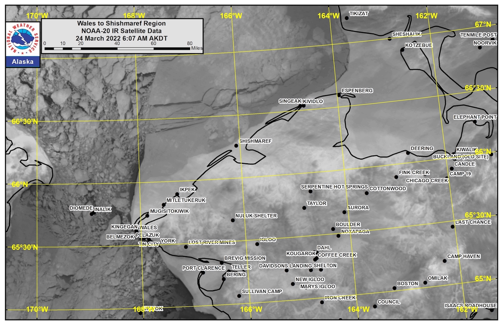
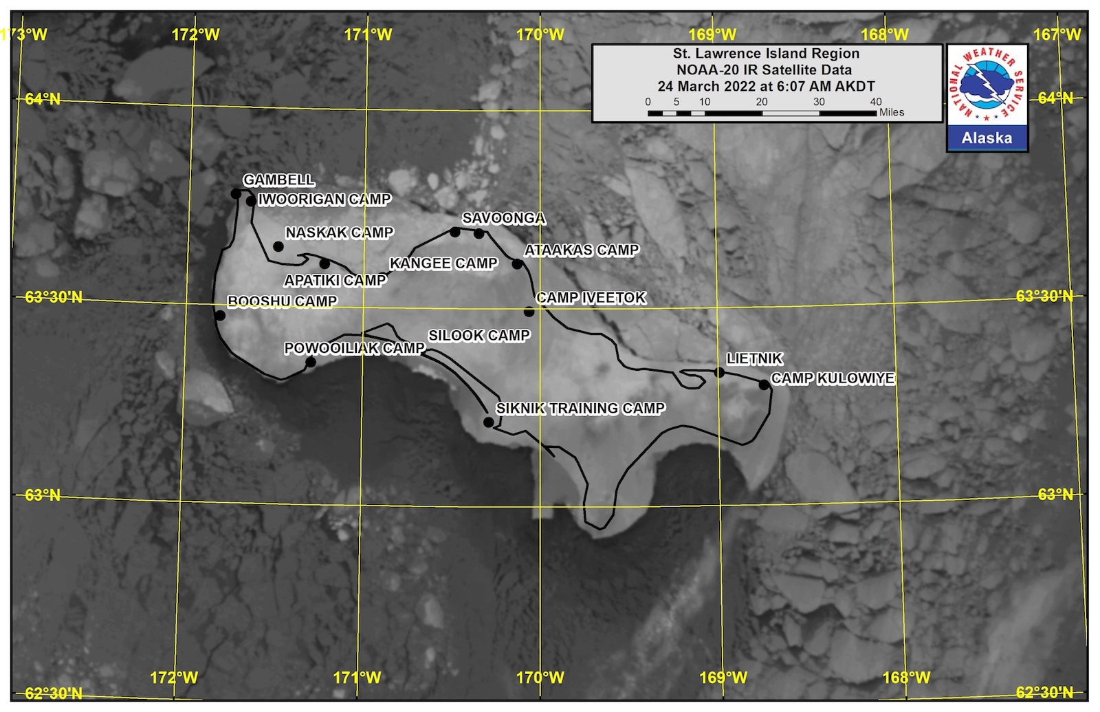
Observations and Comments
Observations of Sea Ice Development
Observations from Savoonga
24 March 2022 – Aqef Waghiyi
People been going fishing but nobody really been hunting since the ice closed up a while back. Weather’s been good, sunny calm past week or so. People been going crabbing and fishing down south toward Gambell. Not much luck I guess. Last month they walked onto the open lead and one of my friends got walrus. That’s about a month ago now. Any day any time I bet you somebody’s gonna hear a baby walrus crying.
Observations from Gambell
24 March 2022 – Clarence Irrigoo, Jr.
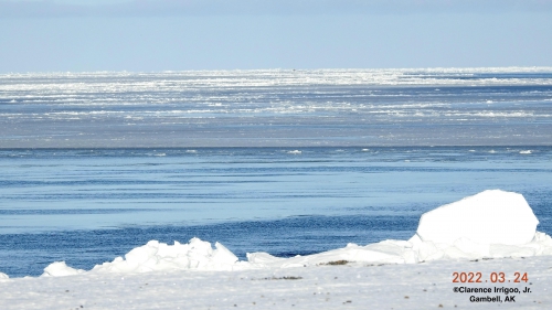
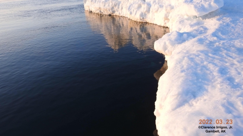
It’s 10°NE8mph at this time. One boat is out. Lots of young ice out.
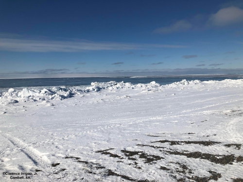
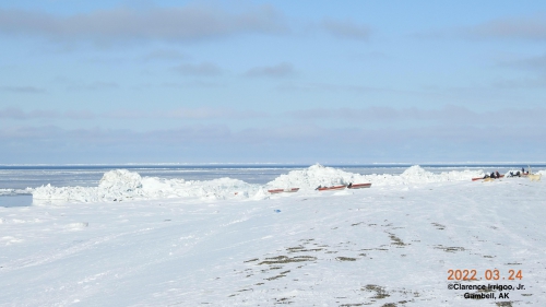
Bering Strait Hunters getting ready for hunting. Be Safe and good luck.
Observations from Wales
24 May 2022 – Robert Tokeinna, Jr.
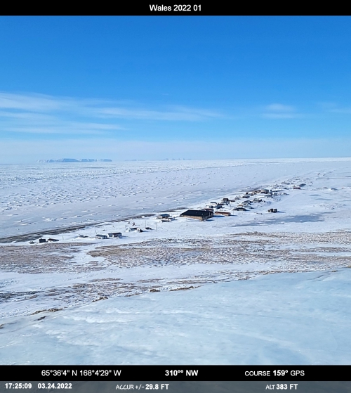
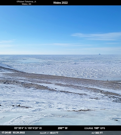
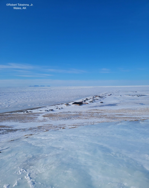
Here are pictures from 03/24/2022, you can see the glare ice all around town from a warm spell of rain. The Compass Pro app allowed me to show you what elevation I am at along with the direction I am facing. I did take a panoramic picture at my usual spot I take pictures. Today is a warm 12 degrees with variable calm 5 mph winds. It suppose to warm up and with warmth comes precipitation in the next couple days is my guess for what's coming our way. No sign of birds or seagulls, but usually see them end of the month or beginning of April as it warms up. Local hunters had luck with fresh meat and I predict hunters should be prepping their boat soon. In the image, you can see very ridged and bumpy ice conditions in from of Wales. I predict that it likewise north from Wales. Local teachers have been to the edge and the ice seems strong and ready with pressure ridges here and there with occasional flat spots, but for the most part stable so far. I am looking forward to giving updates in the near future. Till next time.

Observations from Diomede
25 March 2022 – Marty Eeleengayouq Ozenna
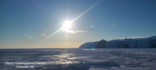
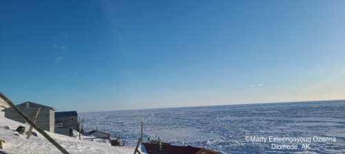
Winds was NNE 10-15 knots no open leads clear blue skys.
Observations from Port Clarence and Brevig Mission
25 March 2022 – Marcus Barr
Per crab pot setters from Brevig, ice is about 3ft thick near Cape Douglas.
Additional Comments Provided by Local Experts and Other Contributors
