Assessment of Current Ice Conditions Relevant to Distribution and Access of Walrus
Click the name of each community below to view more frequently updated and detailed information from the National Weather Service.
Synopsis – High pressure remains over the Arctic while weak low pressure stays over the mainland. Some stronger northerly wind will develop through the Bering Strait over the weekend.
Near St. Lawrence Island
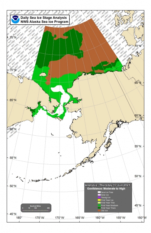
Please note that the most recent imagery we have for this area is the afternoon of June 15th. There is shorefast ice along the north side of St. Lawrence Island between Camp Iveetok and Camp Kulowiyi extending 1 to 3 miles offshore. Beyond the shorefast ice on the north side of the island is open water to very open pack ice that consists of brash ice up to small floes. Confidence is lower for concentration in this area. Close pack ice existed around 7 miles offshore, comprised of brash ice up to medium floes. That area extends northward through the Bering Strait. Offshore of Gambell and the western island hasn't been seen since the 14th. At that time, there was an area of close pack ice consisting of brash ice immediately off the coast. Imagery since then, while not definitive, suggested this ice was rapidly melting. Very low confidence analysis/forecast for this ice. South and east of the island is sea ice free water. Between Gambell and Savoonga an area of open water exists, followed by an area of close pack ice, all brash, generally around 10 miles offshore, closer to Gambell and Savoonga.
Nome
The outlook is finished for the season for this area.
Brevig Mission/Port Clarence Area
The outlook is finished for the season for this area.
Wales to Shishmaref
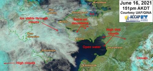
Previously shorefast ice extends up to 2.5 miles from the coast, mainly north of Ikpek. This ice continues to melt in place, so it is now considered compact pack ice although much of it is likely still fast to the shore/ocean floor. Beyond the shorefast ice is open water. There is some close pack ice comprised of brash to small floes coming through the Bering Strait 8 miles off the coast from Wales through Ikpek. The remainder of very close pack ice is just outside of Kotzebue Sound between Espenberg and Cape Krusenstern consisting of small to medium floes.
Diomede
The outlook is finished for the season for this area.
Forecast Discussion
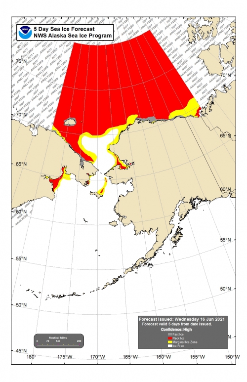
Ice Forecast
Savoonga
The remaining pack ice between Savoonga and Wales will continue to melt from the edges, reducing in areal coverage. Northerly winds over the weekend will bring it back southward toward St. Lawrence Island. By the end of next week only small areas of pack ice will remain with most of the area remaining being marginal concentration.
Shishmaref
Some of the ice that's recently come through the Bering Strait could still be in the area on Friday, but will be pushed back southward over the weekend by northerly winds. Any remaining previously shorefast ice will likely melt during this time. Some of the remaining pack ice outside of Kotzebue Sound could begin to drift southward, but it is more likely that it will continue to melt as well as get compacted against the coast between Shishmaref and Espenberg.
Wind Synopsis
Savoonga
Friday, June 18th southwest wind 10 to 15 Kts (12 to 17 mph) wind shift to the north on Saturday, June 19th during the afternoon. North wind increases to 15 to 25 Kts (17 to 29 mph) Sunday afternoon. Tuesday, June 22nd wind diminishes to northeast 10 to 15 Kts (12 to 17 mph) early in the morning. Wednesday, June 23rd during the late morning wind shifts north and increases significantly to 30 to 40 Kts (35 to 46 mph) lasting until Thursday, June 24th night when it slowly relaxes to north 10 to 15 Kts (12 to 17 mph) by Friday, June 25th in the afternoon.
Shishmaref
Friday, June 18th southwest wind 5 to 10 Kts (6 to 12 mph) increasing and shifting to northwest 10 to 20 Kts (12 to 23 mph) early Saturday, June 19th. Northwest wind increases to 20 to 30 Kts (23 to 35 mph) early Sunday, June 20th shifting and diminishing to west 10 to 20 Kts (12 to 23 mph) early Tuesday, June 22nd morning. Wind shifts northwest and increases rapidly on Wednesday, June 23rd in afternoon to 25 to 35 Kts (29 to 40 mph) then the wind starts to relax to northwest 10 to 15 Kts (12 to 17 mph) on Friday, June 25th.
Temperature Trend
Maximum temperatures in the 40s. Minimum temperatures in the mid 30s to near 40.
Daily Weather, Wind, and Temperature Updates
The National Weather Service provides twice-daily, text only updates on the weather, wind, and temperature conditions in specific geographical zones. An interactive weather map for access to other Alaskan zones can be found here: http://weather.gov/anchorage/ice
Higher resolution satellite images and wind maps (wind updated daily) can be viewed here: http://www.weather.gov/afg/SIWO_overview
Remote Sensing Images
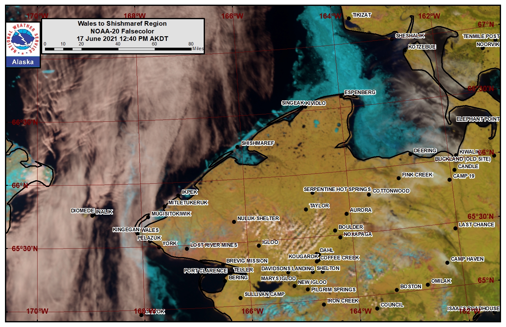
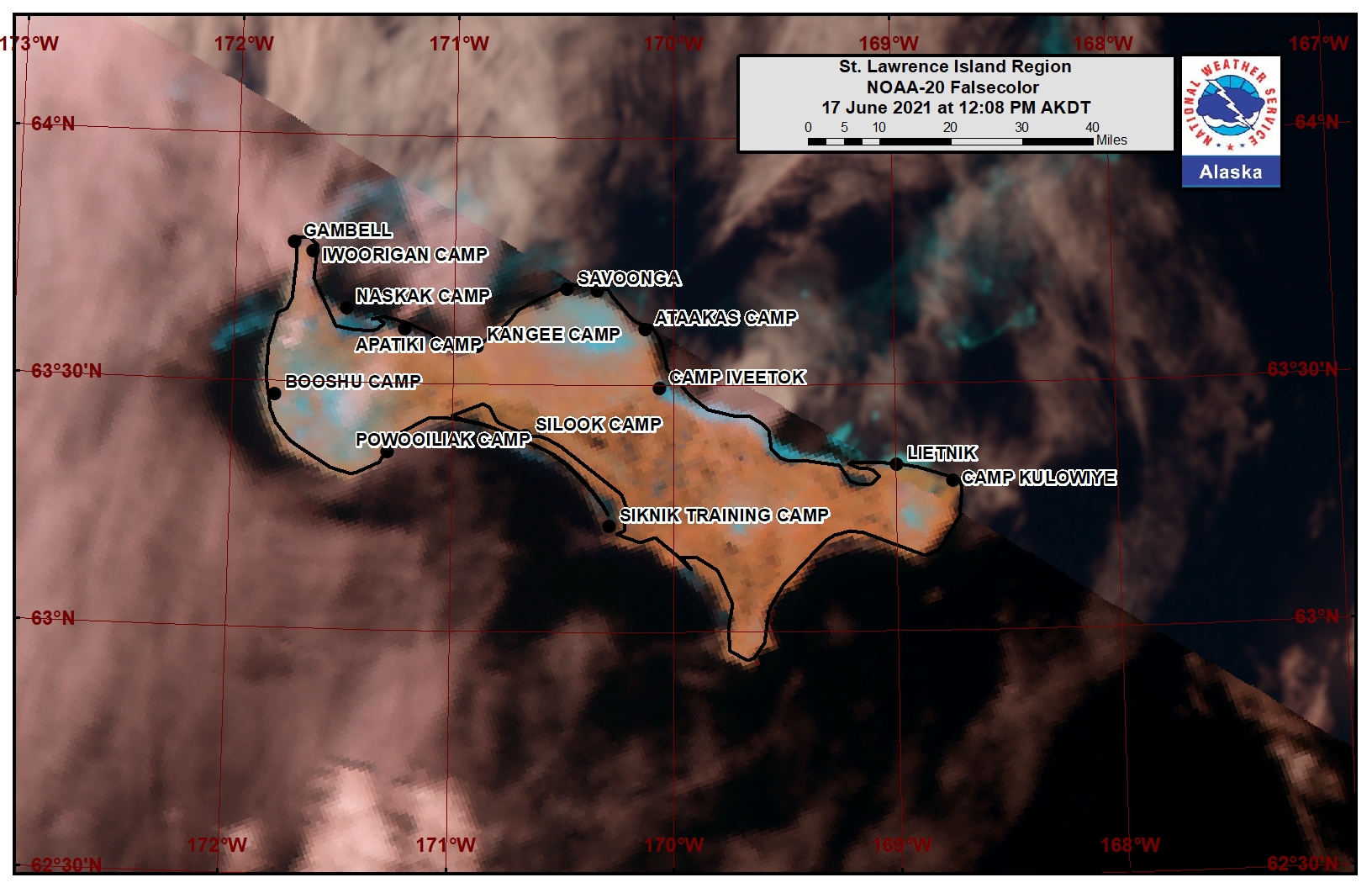
Observations and Comments
Observations of Sea Ice Development
Observations from Shishmaref
Monday, 14June 2021 – Curtis Nayokpuk
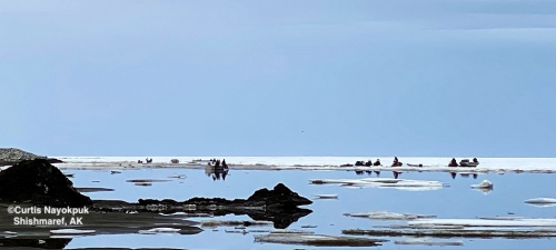
All hunters boats back on beach. Drizzle, rain, mist and fog conditions a concern as shore fast ice melting/rotting fast. I'll send some pictures later for the last week on SIWO report from Shishmaref. Looks like we will be waiting for break up and open leads to hunt with boats, hopefully within a few days w/ FC southerly winds.
This is the first time I've seen sea ice (loose pack outer waters) melt before our still solid lagoon! We can't boat to traditional egg hunting areas yet as lagoon areas blocked with ice."

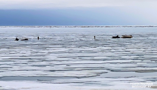
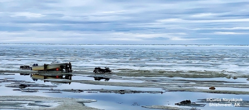
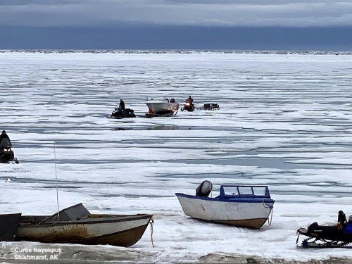
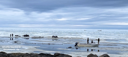
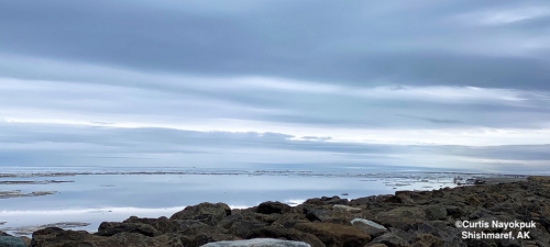
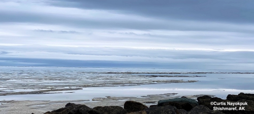
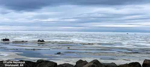
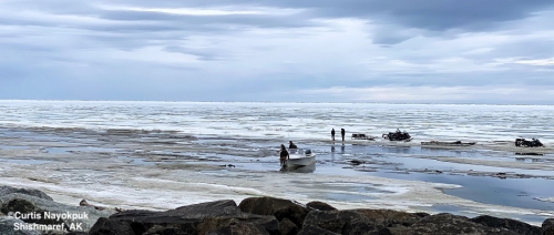
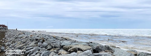
Thursday, 17 June 2021 – Curtis Nayokpuk
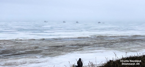
Mist, fog this AM. Few boats venturing 20-30 miles "up the coast" (east) along lagoon to access open channels to ocean. Travel hampered by shallow lagoon and hunters have to plan trips for high tides. Overall very poor season for community and hopefully when access to open sea permits hunters will be up the coast hunting in remaining pack ice in Kotzebue Sound area.
Observations from Savoonga
Thursday, 17 June 2021 – Aqef Waghiyi
14 miles north of Savoonga.
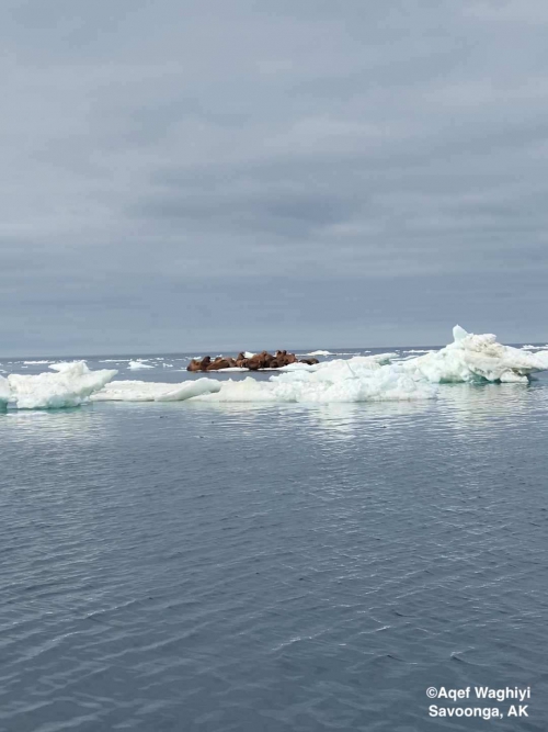
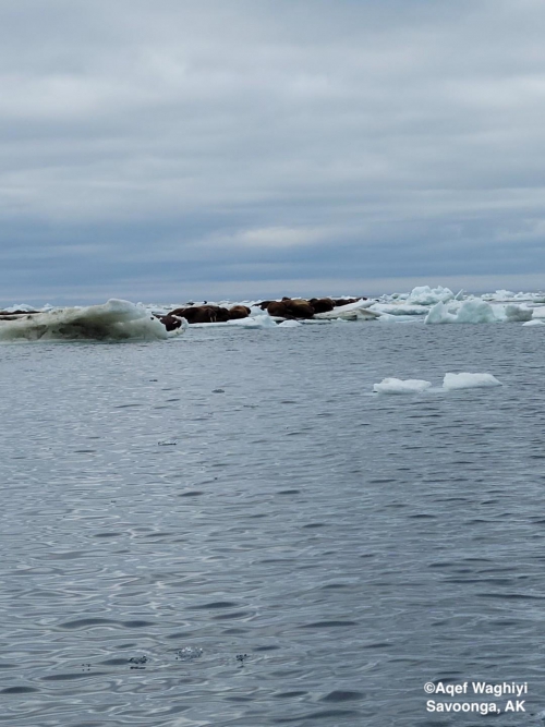
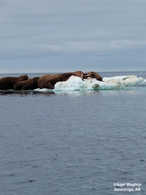
Additional Comments Provided by Local Experts and Other Contributors
Shared by Rick Thoman, ACCAP
Wednesday, 16 June 2021
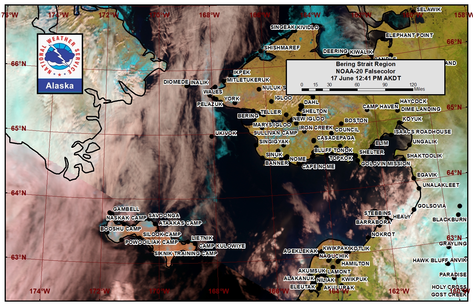
Mostly clear skies over Norton Sound Wednesday afternoon, and at the resolution of the NOAA-20 Polar-orbiting satellite (a few square miles), there is no ice to be seen east of Nome in this false-color image (sea ice is a turquoise blue color).
