Assessment of Current Ice Conditions Relevant to Distribution and Access of Walrus
Click the name of each community below to view more frequently updated and detailed information from the National Weather Service.
Forecast Synopsis for 9–13 May 2019
Synopsis. Low pressure will remain over the eastern Bering Sea through Saturday. On Sunday, another low pressure system will move northward from over the mainland. This low pressure system will move into the Bering and Chukchi seas on Monday.
Near St. Lawrence Island
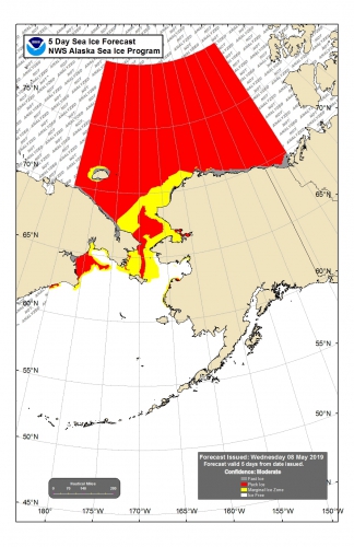
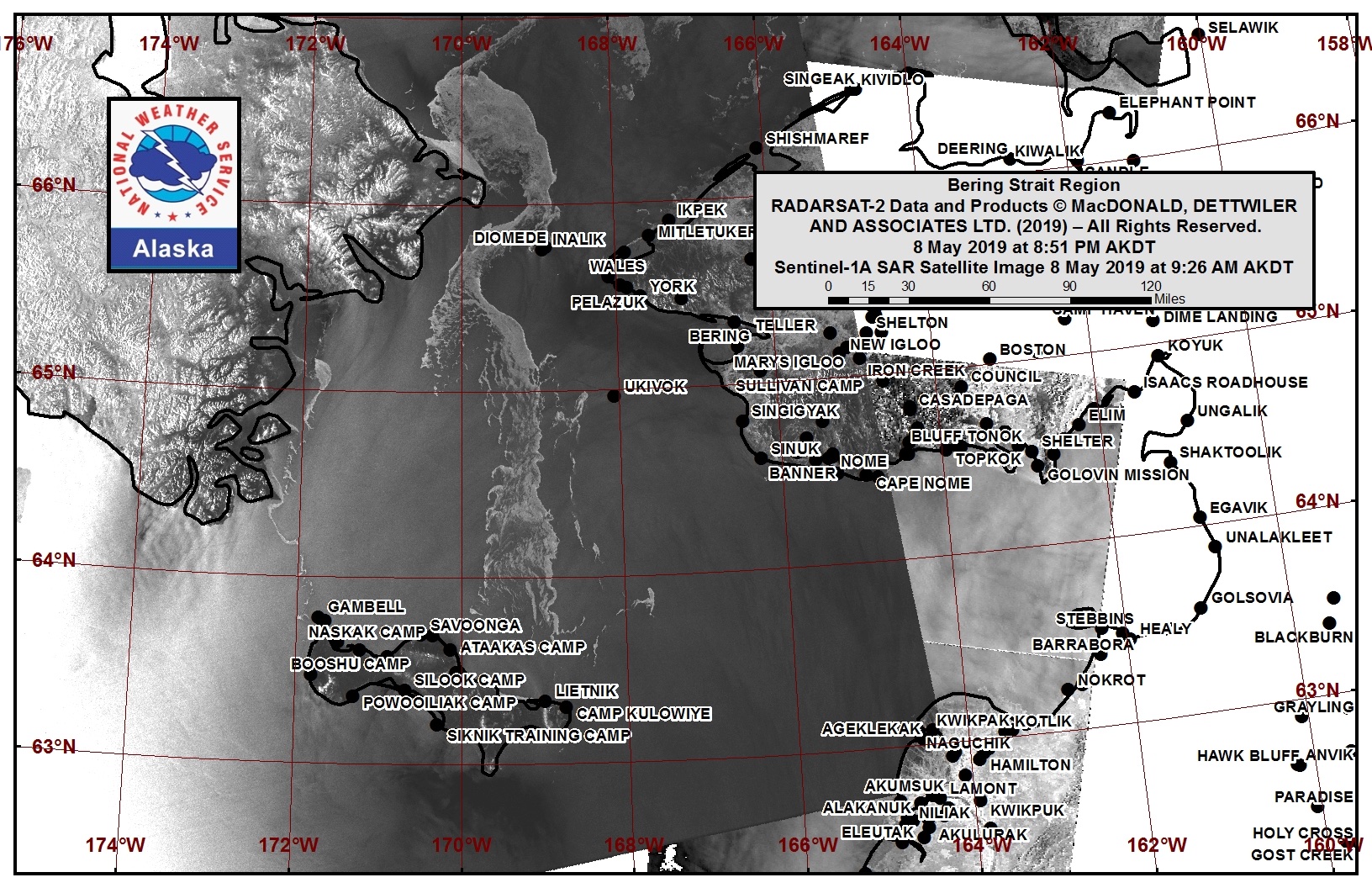
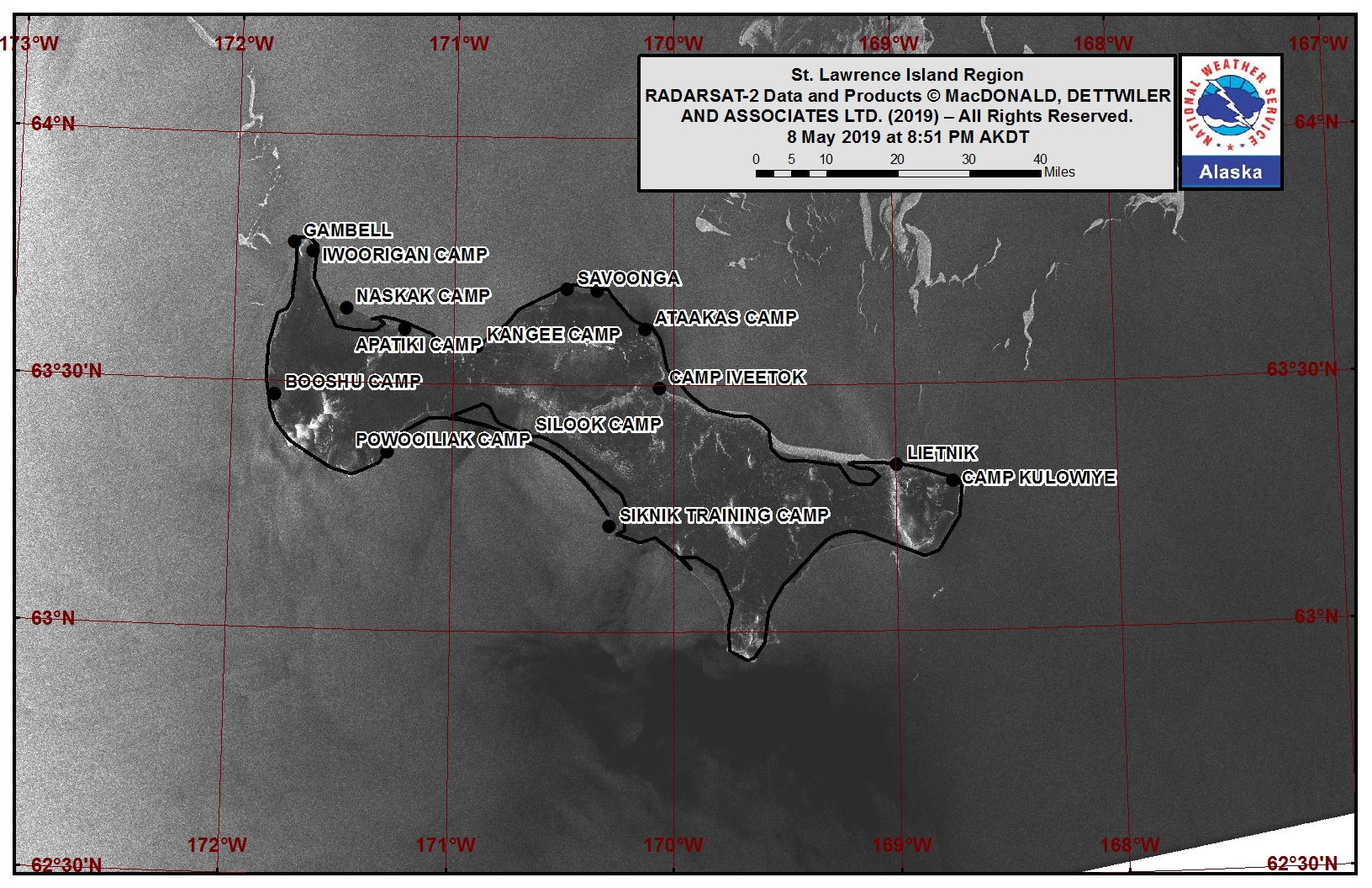
Strips of sea ice extend from approximately 3 nm west of Gambell northwest to the Russian coast, consisting of ice cakes to medium floes. Some shorefast ice remains along the northeast coast, east of Savoonga, and extends out up to one nm. Northeast of Savoonga, an area of sea ice begins from about 17 nm from Savoonga and extends north to the Bering Strait. This area of sea ice is approximately 25 nm wide and consists of small to vast floes. There may be some isolated multi-year ice floes within the sea ice near St. Lawrence Island.
Nome
The waters offshore of Nome are sea ice free. The nearest sea ice is 70 nm to the southwest of Nome and is open pack ice consisting of small to medium floes.
Brevig Mission/Port Clarence Area
Shorefast ice extends 6 nm west of Brevig Mission, then there is an area of open water to approximately 50 nm from Brevig Mission. Beyond 50 nm west of Brevig Mission is very close pack ice consisting of medium to vast ice floes.
Wales to Shishmaref
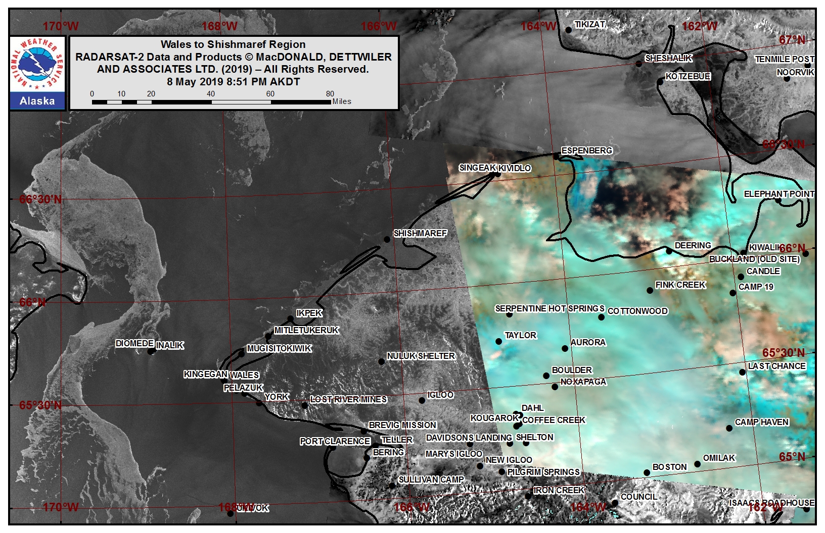
Open pack ice consisting of small to medium floes extends up to 6 nm from the coast from Wales to Shishmaref. Another area of pack ice extends from Shishmaref to the northeast and consists of small to big floes. Very close pack ice extends from approximately 40 nm northwest of Shishmaref (53 nm of Wales) to the north and west. West of Wales, a band of close to very close pack ice consisting of small to vast floes is approximately 20nm west and to the north and south. There may be some isolated multi-year ice floes within the sea ice near the Wales to Shishmaref coast.
Little Diomede
A band of close to very close pack ice consisting of small to vast floes extends to the north and south just to the west of Diomede. To the east, northeast, and southeast of Diomede is open water. There may be some isolated multi-year ice floes within the sea ice near Diomede.
Forecast Discussion
Ice Forecast
Sea ice will drift southward to southwestward as the northerly winds continue, then begin to drift northward again as winds switch to southerly. Overall, expect the sea ice to drift 20 to 30 nm southward through the next week. There could also be some new sea ice growth, especially during the cooler overnight hours. Widespread new sea ice growth is not expected.
Wind Synopsis
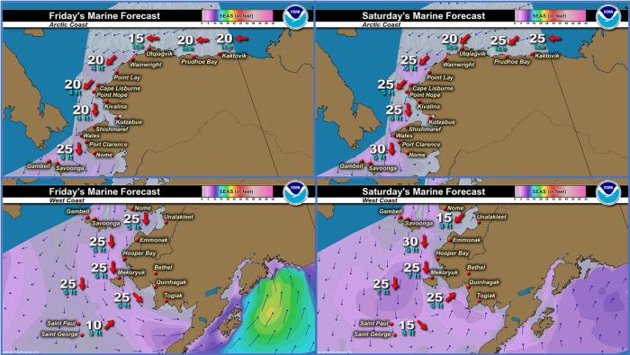
North winds 20 to 30 kt (23 to 35 mph) on Friday, May 10th will diminish to 10 to 20 kt (12 to 23 mph) on Saturday, May 11th. The strongest winds will be from Little Diomede/Wales to St. Lawrence Island. Winds will become variable 5 to 15 mph (6 to 17 mph) on Sunday, May 12th with northerly winds over St Lawrence Island and southeasterly winds along the Seward Peninsula. Winds across the region will gradually shift to south and southeast 5 to 10 kt (6 to 12 mph) on Monday, May 13th. Winds will become north 10 to 15 kt (12 to 17 mph) by Wednesday, May 14th. North winds will increase to 15 to 25 kt through Friday, May 17th.
Temperature Trend
High temperatures Friday, May 10th through Friday, May 17th will generally be in the 30's except into the lower 40's at times from Brevig Mission/Port Clarence to Nome. Low temperatures will be in the upper 20's to lower 30's Friday, May 10th through Friday, May 17th, with coldest temperatures from the Bering Strait to St. Lawrence Island.
Daily Weather, Wind, and Temperature Updates
The National Weather Service provides twice-daily, text only updates on the weather, wind, and temperature conditions in specific geographical zones. An interactive weather map for access to other Alaskan zones can be found here: http://weather.gov/anchorage/ice
Wind maps are updated daily and can be viewed here: http://www.weather.gov/afg/SIWO_overview
Higher-resolution versions of satellite images can be viewed here: https://www.weather.gov/afg/SIWO_overview
Marine forecast for the West Coast and Arctic Coast
Remote Sensing Images
Observations and Comments
Observations of Sea Ice Development
Observations from Port Clarence and Brevig Mission
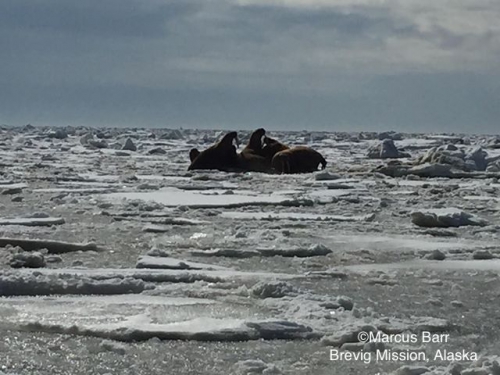
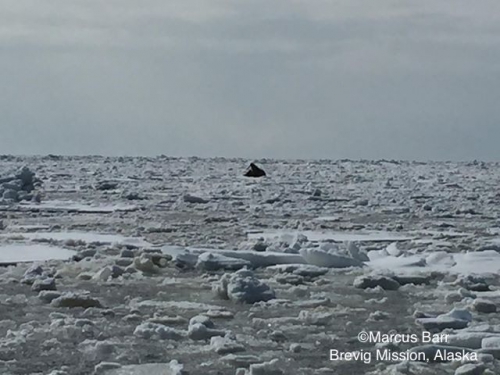
10 May 2019 – Marcus Barr
Last Sunday my crew and 3 other boats got walrus. As we were heading home more of the Brevig guys got a beluga. For ice report, the ice edge broke about 50 ft. The snow melted on top of the ice, now there’s a lot of water on top of the ice.
Observations from Savoonga
9 May 2019 – Aqef Waghiyi
No more ice just open water out there. No shore ice, nothing. Got walrus a six days ago before the south wind hit.
Observations from Gambell
9 May 2019 – Clarence Irrigoo, Jr.
Windy and foggy this morning. For last two days wind shift to SSE 22 mph hope the wind dies down.
