
Assessment of Current Ice Conditions Relevant to Distribution and Access of Walrus
State of the Ice at Season’s Start
Contributed by Matthew Druckenmiller (National Snow and Ice Data Center and SEARCH Sea Ice Action Team) & Hajo Eicken (University of Alaska Fairbanks)
The sea ice cover in the Bering and southern Chukchi seas got off to a remarkably late start in fall 2017. The Chukchi Sea was not ice-covered (> 95% ice concentration) until December 31, which was the latest ever observed since the satellite record began in 1978 (see Figure 1). During late fall, this permitted storms to take a toll on communities. During a storm with sustained 50-65 mph winds that began on November 11, the village of Kotzebue experienced localized coastal flooding and the break-up of their shorefast ice, which at the time was about one foot thick. During this same storm, Shishmaref, which lacked shorefast ice, lost a roadway to their landfill along a stretch of coast unprotected by the community’s sea wall. At Shishmaref, very little sea ice was observed until late December (see Figure 2), and almost no shorefast ice formed throughout the entire winter, with a narrow belt of shorefast ice breaking out during a February storm (Figure 3). At Wales, shorefast ice safe to travel on was not seen until early March.
, ©Rick Thoman.")
")
")
The reduced sea ice was due, in part, to both wind and storm patterns that pushed ice to the north. The storms also brought warmer air, which greatly delayed freeze-up and contributed to thinner ice. The Seward Peninsula and Norton Sound regions experienced a warm winter with temperatures generally at least 8F above average from December through February. The warm weather resulted in several periods of winter rainfall across the region, while the open stretches of water also contributed to higher-than-normal air moisture.
At the same time, anomalously warm waters in the southern Chukchi and Bering seas contributed to delays in the onset of ice formation and below-normal ice thickness and extent. In November 2017, the water of the unfrozen Chukchi Sea was up to 5˚F warmer than normal. In February 2018, the Bering Sea south of the ice edge was up to 3˚F warmer than normal.
In the western Bering Sea, the communities on St. Lawrence Island have experienced an even more extraordinarily low amount of ice throughout winter. Around the western side of the island near Gambell, vast stretches of open water—some extending all the way to the Russian coast—lasted through mid-March (see Figure 4). In February, the Bering Sea ice coverage as a whole was the lowest ever observed going back as far as the 1850’s (as reported by Zachary Labe from the University of California Irvine based on data analyzed from the Historical Sea Ice Atlas). During this time, local experts and SIWO contributors reported a near-complete lack of walrus in the area.
")
Thinner sea ice is more mobile and easily broken up in response to changing wind conditions. Also, thinner sea ice is less likely to securely ground along coastlines. Both factors have played roles in the abrupt changes in both regional and local ice cover experienced across the region. The abrupt shift to winds from the north experienced on March 9 quickly brought ice back to the Bering Sea and around St. Lawrence Island, and delivered the highest concentrations of ice seen all winter. Aqef Waghiyi of Savoonga reported the advancing ice as: “It is all broken up, not too good. No flat pieces and it is real rough. There are patches of open water here and there. Biggest open patch in front of town is maybe as big as a football field. People probably won’t go boating until it opens up.”
The March recovery of sea ice in the Bering Sea stopped on March 21 with a return to southerly winds and stormy conditions. The remainder of March and April will continue to see a broken and thin ice pack abruptly responding to changes in the weather. The conditions of this winter and spring will likely result in an early break-up of sea ice, especially along the coast of the Seward Peninsula, which historically experiences shorefast ice well into mid-May.
Additional community observations about this year’s sea ice conditions are available through the LEO Network’s Sea Ice Project.
Community Outlooks
Click the name of each community below to view more frequently updated and detailed information from the National Weather Service.
Near St. Lawrence Island
Mostly young ice remains west and south of the island, (up to 12 inches thick) extends roughly 40 nm to the south of the Siknik camp and 60 nm off the west side of the island. North of the island exists a mixture of first year thin and young ice (ranging from 12 to 28 inches in thickness) as far north as the Bering strait. There is a polynya along the northwestern coast that extends up to 1.5 nm from the coast near Gambell, with new ice beginning to fill into it.
Nome
The forecast has not yet begun in this region for the 2018 season. Please check back later for updates.
Wales to Shishmaref
The forecast has not yet begun in this region for the 2018 season. Please check back later for updates.
Little Diomede
The forecast has not yet begun in this region for the 2018 season. Please check back later for updates.
Forecast Discussion
Ice Forecast
Under persistent southerly flow, ice is expected to continue to compact and melt along the southern coast through Saturday, March 24th. North of St. Lawrence Island, ice is expected to continue to break away from the coast under this flow regime. As the winds shift to the east on Sunday, March 25th, ice will begin to compact into the eastern coast of the island, and break off the western coast. The polynya along the west coast, including Gambell, will continue to expand under both the southerly and easterly flow regimes through Tuesday, March 27th.
Wind Synopsis
Winds on Friday March 23rd will be brisk from the south 20 to 30 kt (25 to 35 mph) diminishing to 10 to 20 kt (12 mph to 23 mph) Friday night. Winds will shift to the northeast 10 to 20 kt (12 mph to 23 mph) by Sunday evening, March 25th and diminish to 5 to 10 kt (6 to 12 mph) on Tuesday March 27th. Winds shift to the south 10 to 15 kt (12 to 17 mph) on Wednesday, March 28th and remain steady through Friday, March 30th.
Temperature Trend
High temperatures will be in the lower 30s through Sunday, March 25th with lows in the 20s. Temperatures will cool on Monday, March 26th with highs in the 20s and lows in the teens, which will persist through Thursday, March 29th. A gradual warming back into the 30s is expected on Friday, March 30th.
Daily Weather, Wind, and Temperature Updates
The National Weather Service provides twice-daily, text only updates on the weather, wind, and temperature conditions in specific geographical zones. An interactive weather map for access to other Alaskan zones can be found here: http://weather.gov/anchorage/ice
Wind maps are updated daily and can be viewed here: http://www.weather.gov/afg/SIWO_overview
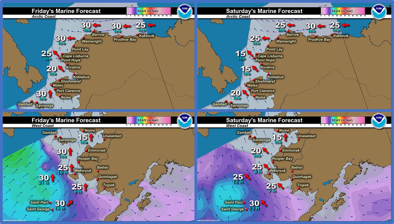
Marine forecast for the West Coast and Arctic Coast
Remote Sensing Images

Observations and Comments
Observations of Sea Ice Development
Observations from Gambell
23 March 2018 – Clarence Irrigoo, Jr.
This week we have rain and very high wind on SLI. No hunting and little ice from other side of the village. We're covered with ice, north and west.


Observations from Savoonga
23 March 2018 – Aqef Waghiyi
Stormy past couple of days. Snow mixed with rain. Ice is completely gone. Visibility is poor. Can’t even see 75 feet in front of you. If it clears up tomorrow, will take video and photos. Too stormy for hunting. Still low pressure on the way from the southwest side. Getting warm already out there, already had first rain. Might not see the ice again.
Observations from Wales
23 March 2018 – Robert Tokeinna, Jr.
This week of March 23, 2018 has been a windy week for Wales. I haven't seen or heard of any kind of activity on the ice, but seen growth of sea ice pressure ridges on the shorefast ice. Quite a bit of snow and wind from all directions have made it tough all winter. Our local water hole has been open and running this year and seems to be draining like it’s supposed to. The shorefast ice seemed to be holding up pretty well to our shoreline with intermittent overflow at the foot of the shoreline. This week we've seen temperatures in low minus teens to upper twenty degrees Fahrenheit, very cloudy winds, and intermittent snowing with most of time blowing snow. This ends my report. I will send pictures once weather breaks so be on the lookout for a couple pictures.


