Update
Status: The 2024 SIWO season began on Friday, 29 March. Follow us on Facebook at https://www.facebook.com/seaiceforwalrus for more discussion.
The Sea Ice for Walrus Outlook (SIWO) is a resource for Alaska Native subsistence hunters, coastal communities, and others interested in sea ice and walrus. The SIWO provides weekly reports during the spring sea-ice season with information on weather and sea-ice conditions relevant to walrus in the northern Bering Sea and southern Chukchi Sea regions of Alaska.
The Outlooks are produced with information on weather and sea-ice conditions provided by the National Weather Service - Alaska Region and Alaska Native sea-ice experts. SIWO is managed by the Arctic Research Consortium of the US (ARCUS), in partnership with the Eskimo Walrus Commission, the National Weather Service, the University of Alaska Fairbanks, and local observers. Funding for SIWO is provided to ARCUS by the National Science Foundation's Division of Arctic Sciences (PLR-1928794). During 2020–2021, SIWO received support from Alaska Sea Grant for a formal evaluation, which is being led by University of Alaska Fairbanks. Results of the evaluation will be shared publicly when available.
Sea Ice for Walrus Outlook This Week
Assessment of Current Ice Conditions Relevant to Distribution and Access of Walrus
Click the name of each community below to view more frequently updated and detailed information from the National Weather Service.
Synopsis: A low will move east across the southern Bering Sea through Thursday, then a second low will move south from the Bering Strait Region through the central Bering Sea toward the Aleutian Islands on Monday.
Near St. Lawrence Island
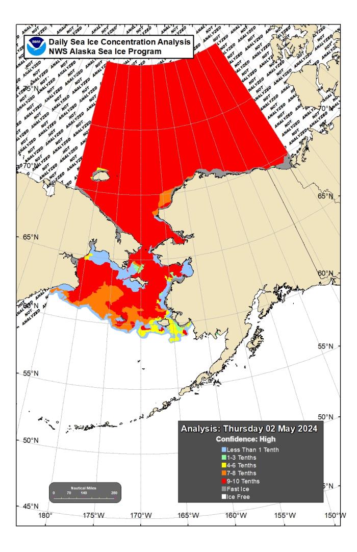
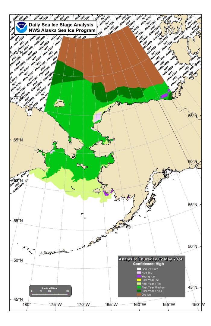
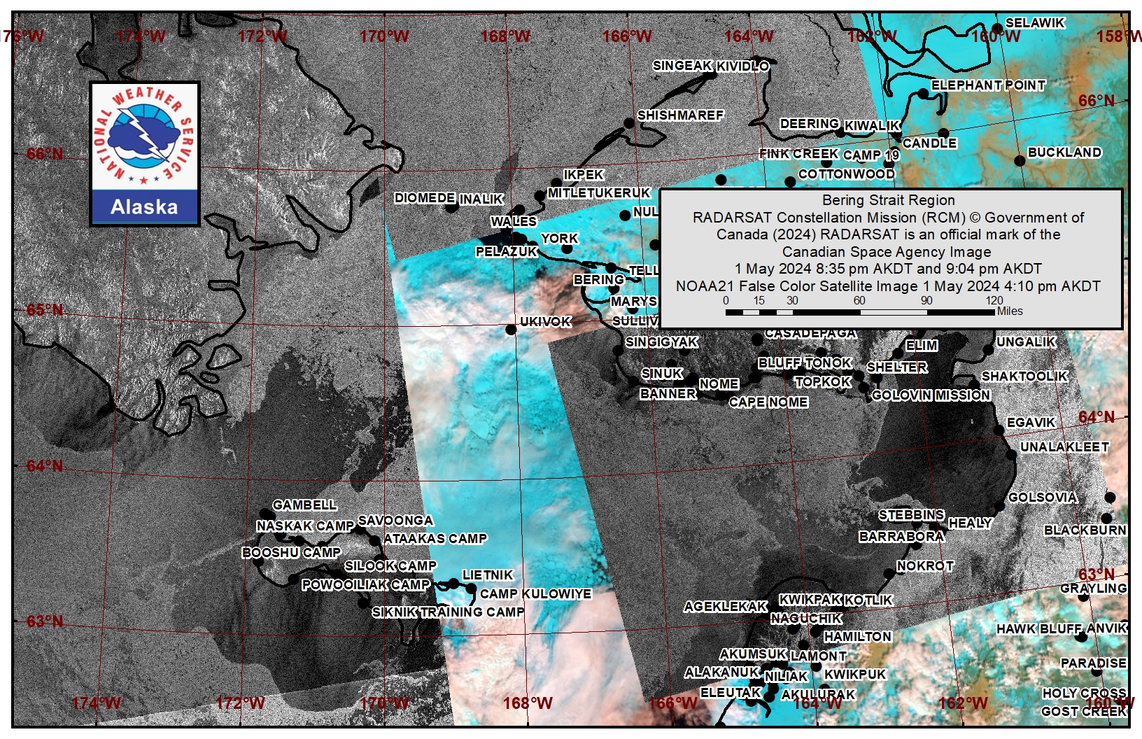
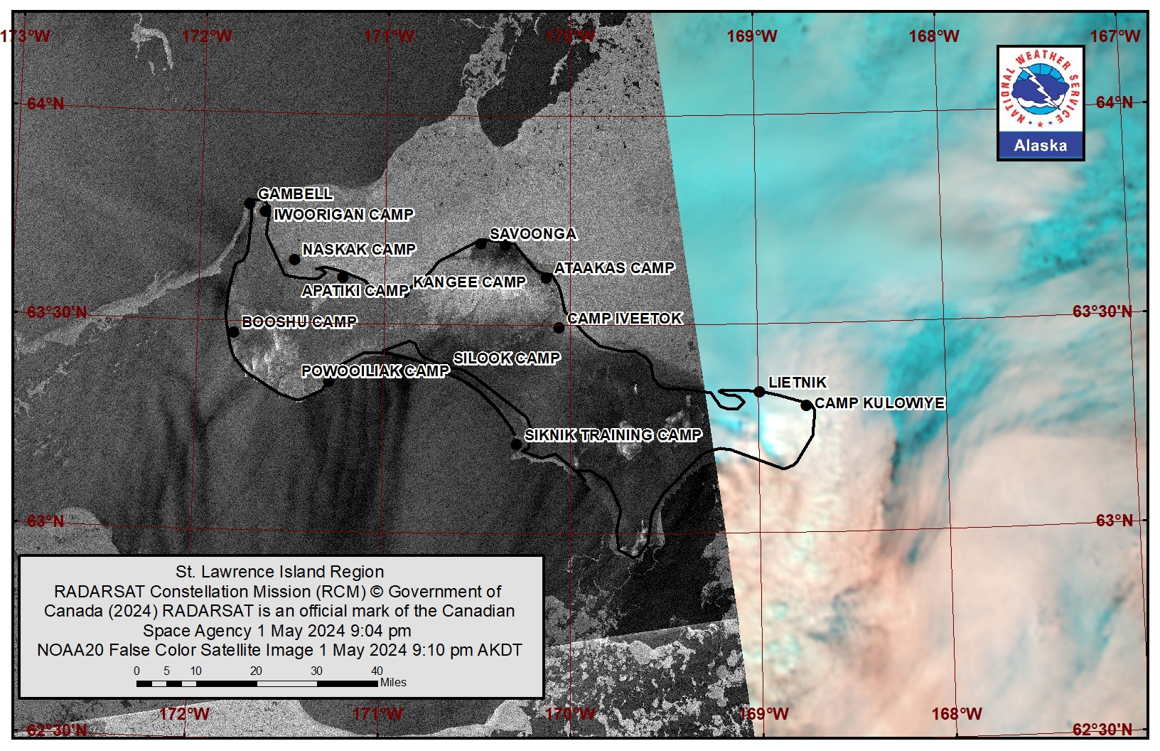
On Thursday, 2 May, a polynya south of the island extended up to 50 miles (80 km) from the coast, with little-to-no new ice formation within the polynya. There is another polynya west of Gambell that extends as far as the Russian coastline. Otherwise, close to consolidated pack ice consisting of big to giant floes surrounds the island.
Nome
This area has not yet started for the 2024 SIWO season.
Nome port entrance webcam (via AOOS webpage): https://bering-sea.portal.aoos.org/?ls=79875242-e362-65cb-914e-fed20ff9…
Brevig Mission/Port Clarence Area
To the west of Port Clarence, the polynya extends 22 miles (35 km) to the west and is open water with brash ice to ice cakes. Beyond the polynya is consolidated ice consisting of mainly vast to giant floes. Between Port Clarence and Wales is an area of close pack ice consisting of medium to big floes.
Wales to Shishmaref
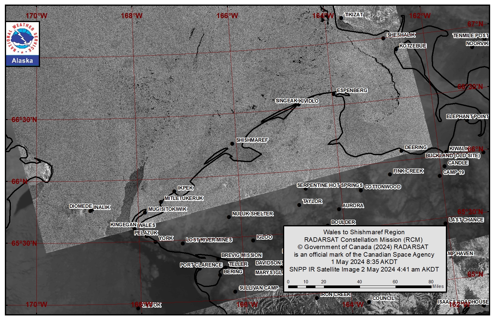
This area has not yet started for the 2024 SIWO season.
Diomede
Some compact ice remains between the islands. Consolidated ice consisting of mainly vast to giant floes surrounds the island and up to 15 miles east of the island. A polynya with open water then extends to the shorefast ice near Wales.
Forecast Discussion
Ice Forecast
The northeast to northwest winds will continue to move the ice south overall through Thursday, 9 May. When colder air moves over the region, new sea ice will likely form within the existing polynyas, though it may only last until temperatures warm during the day.
Wind Synopsis
Near St. Lawrence Island, winds will persist from the northeast at 25 to 35 knots (29 to 40 mph) through Saturday night (May 4) before diminishing to around 15 knots (17 mph) from the northwest on Sunday (May 5) and to 5 knots (6 mph) on Sunday night. Winds will turn back to form the northeast on Monday, 6 May and increase to 10 to 15 knots (12 to 17 mph). Northeast winds continue and increase to 15 to 22 knots (17 to 25 mph) on Wednesday, 8 May and persist through Friday, 10 May.
Near Brevig Mission, northeast winds 15 to 20 knots (17 to 23 mph) will persist through Sunday morning, 5 May before turning northwesterly and diminishing to 6 to 9 knots (7 to 10 mph) through Monday night, 6 May. On Tuesday, 7 May, north winds will increase to 10 to 15 knots (12 to 17 mph) and persist through Friday, 10 May.
Near Diomede, northeast winds of 25 to 30 knots (29 to 35 mph) will persist through Saturday night, 4 May before turning northwest and weakening to 15 knots (17 mph) on Sunday, 5 May. Northwest winds will persist at 15 to 20 knots (17 to 23 mph) through Friday, 10 May.
Temperature Trend
Near St. Lawrence Island, high temperatures will be in the upper 20s on Friday, 3 May before dropping to the low 20s on Saturday, 4 May and Sunday, 5 May. Highs will return to the mid-20s on Monday, 6 May and to the upper 20s on Wednesday, 8 May. Highs will likely reach the low 30s on Thursday, 9 May and Friday, 10 May. Low temperatures near 20 degrees on Friday, 3 May will dip to around 10 degrees by Sunday, 5 May before rebounding to the mid-teens on Monday, 6 May and Tuesday, 7 May, to around 20 degrees Wednesday, 8 May and Thursday, 9 May, and to the mid-20s on Friday, 10 May.
Near Brevig Mission, high temperatures in the low 30s on Friday, 3 May will dip to the low 20s on Saturday, 4 May before rebounding to the mid to upper 20s Sunday, 5 May through Tuesday, 7 May. Highs in the low to mid 30s are expected Wednesday, 8 May through Friday, 10 May. Low temperatures near 20 degrees on Friday, 3 May will dip to around 10 degrees by Sunday, 5 May before rebounding to the mid to upper teens on Monday, 6 May and Tuesday, 7 May, to around 20 degrees Wednesday, 8 May, and to the mid 20s on Thursday, 9 May and Friday, 10 May.
Near Diomede, high temperatures in the mid 20s on Friday, 3 May will dip to the mid-teens on Saturday, 4 May before rebounding to the low 20s on Sunday, 5 May and to the mid-20s Monday, 6 May through Wednesday, 8 May. Highs in the upper 20s are likely Thursday, 9 May and Friday, 10 May. Low temperatures in the mid-teens on Friday, 3 May will drop to near 10 degrees by Sunday, 5 May before rebounding to the mid-teens Monday, 6 May and Tuesday, 7 May. Lows around 20 degrees are likely Wednesday, 8 May through Friday, 10 May.
Daily Weather, Wind, and Temperature Updates
The National Weather Service provides twice-daily, text only updates on the weather, wind, and temperature conditions in specific geographical zones. An interactive weather map for access to other Alaskan zones can be found here: http://weather.gov/anchorage/ice
Higher resolution satellite images and wind maps (wind updated daily) can be viewed here: http://www.weather.gov/afg/SIWO_overview
The Alaska Ocean Observing System shares a variety of weather and sea ice related resources in their Bering Sea Portal at https://bering-sea.portal.aoos.org/.
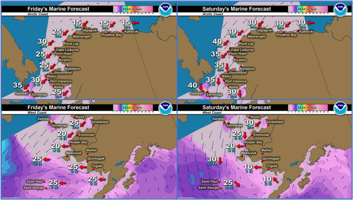
Marine forecast for the West Coast and Arctic Coast
Remote Sensing Images
Observations and Comments
Observations of Sea Ice Development
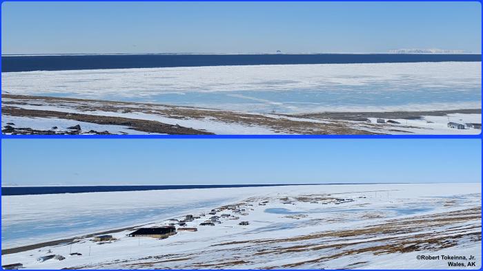
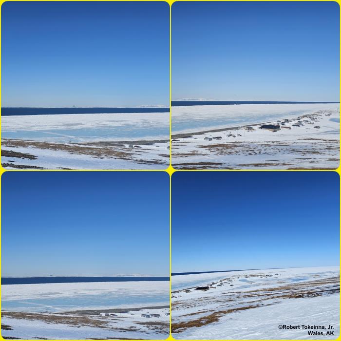
Observations from Wales
Thursday, 2 May 2024 – Robert Tokeinna, Jr.
These last two weeks have been interesting from warm winds and thawing out to clear and cold. It has been beginning of last week, ranging from warm 35 to 30 degree to our current weather of balmy 20 degrees and breezy 25 to 30 mph winds which kept our snow and ice around for a bit longer. I have noticed more Snow Bunting birds and the coming of Sea Gulls this past week around Wales. As you can see in the pictures, our shorefast ice has receeded some but remain strong in these brisk winds we have been having. Signs of spring are becoming more relevant and noticeable. Lots of open water in front of Wales as far as the eye can see. The Ice seems to be stable and strong, congratulations to Saint Lawrence Island to a successful catch of a whale, it looks like neighboring villages and local hunters are presently actively hunting and catching game.
Observations from Nome
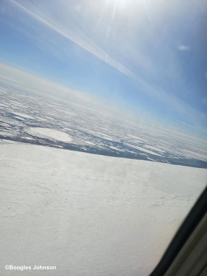
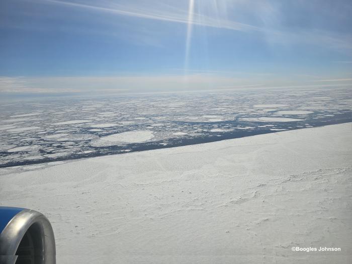
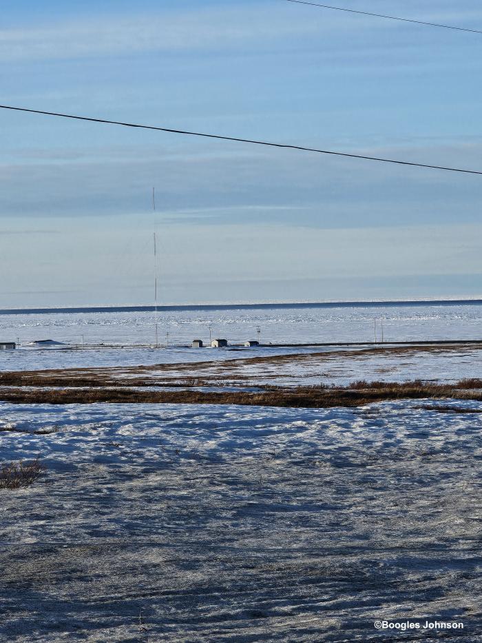
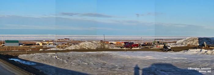
Thursday, 2 May 2024 – Boogles Johnson
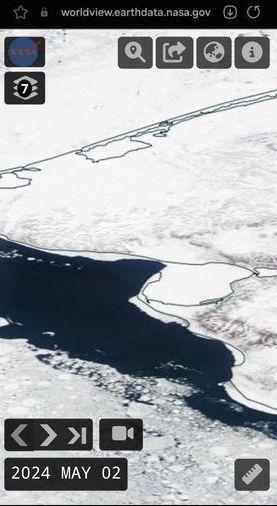
Photo taken approx. 1 mile east from Nome. The ice is finally moving where we can see from shore. The local hunters are all getting ready to head out here in the next week or 2.
Observations from Port Clarence, Brevig Mission, and Cape Douglas
Friday, 3 May 2024 – Marcus Barr
Little changes on Shorefast ice but open water changed alot. Lots of snow melt, water on top of the ice started. Nobody gone out for walrus yet but as soon as wind dies down there will be hunters going out.
Observations from Savoonga
Friday, 3 May 2024 – Aqef Waghiyi
41 deg F, wind is at 17 north, barometer is 990, dew point 21.6, humidity 52.3, chill is 37.1. Few days ago some boats got female with calf down at whaling camp. Nobody haven’t gone out since they were down south.
Observations from Diomede
Friday, 3 May 2024 – Marty Eeleengayouq Ozenna
We’re blowing from the northeast about 35-40 knots, nice clear sky's open halfway from Big Diomede on the south side an closed in to the north of the island.

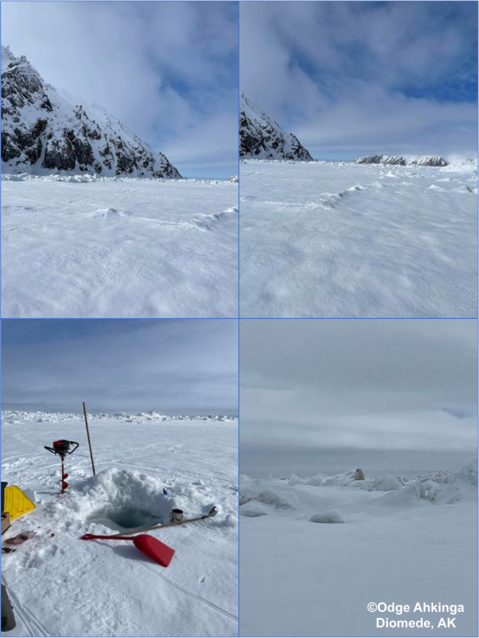
Friday, 3 May 2024 – Odge Ahkinga
Mild spring still in the freezing temperatures. Hand line crabbing is slow due to poor sea ice conditions. The polar bears are around now this bear was caught by my nephew at my crabbing area.
Observations from Gambell
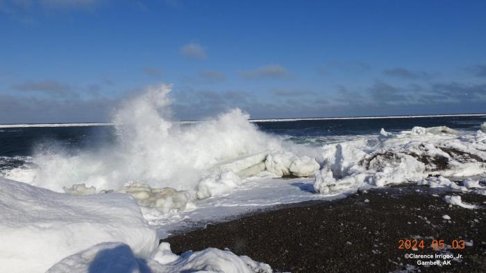
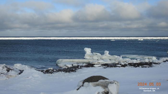
Friday, 3 May 2024 – Clarence Irrigoo, Jr.
We’re having high wind all week, hardly ice from land. 23° windy NNE 35 mph.
Additional Comments Provided by Local Experts and Other Contributors
Shared by the Alaska Ocean Observing System (AOOS) for 1–9 May 2024
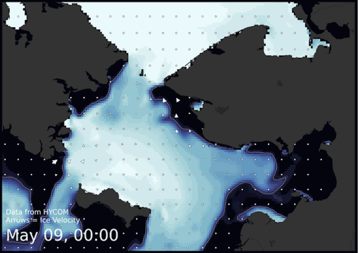
Visit the SIWO Facebook page @seaiceforwalrus to view this animation showing the predicted movement of ice predicted by the HYbrid Coordinate Ocean Model (HYCOM). Snapshots from the forecast show ice coverage from 0% (black) to 100% (white) and arrows show the relative speed and direction of the ice. A light boundary is drawn at 15% predicted ice cover to highlight the ice edge, but ice may be predicted to extend beyond it. Some bays, lagoons, and areas very close to shore are not covered by the model. (Image produced by the Alaska Ocean Observing System / Axiom Data Science).


