The Arctic is home to over 40 indigenous languages from at least six unrelated language families: Uralic, Altaic, Chukotko-Kamchatkan, Eskimo-Aleut, Dene-Yeniseian, Yukagir, and Nivkh. Rapid change in the Arctic has led to the endangerment or extinction of these indigenous languages and the relative geographic isolation of the Arctic makes it difficult to track the languages and their changes.
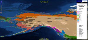
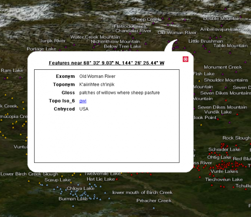
Digital mapmaking tools have created new opportunities for integrated interdisciplinary research in linguistics. These advances allow investigators to focus on tracking not only the languages and their locations, but also their relevant history, climatology, and ethnography. At Eastern Michigan University's Institute for Language and Information Technology (ILIT), researchers are developing geolinguistic datasets for the Arctic as part of Integrating Cartographic Elements (ICE), a project supported by the Arctic Social Science Program in NSF's Division of Arctic Sciences. The data is then used to generate maps in combination with another NSF-funded ILIT project, Language and Location: A Map Annotation Project (LL-MAP).

The maps provide a transparent way to organize and analyze diverse, cross-disciplinary data. ICE and LL-MAP researchers have converted over 500 static paper maps and other stand-alone data into interoperable digital datasets represented on a single base map. The collection is constantly being expanded through the digitization of new paper maps and other stand-alone datasets. Current projects include climatological maps from the Red Book of the People, which provides historical information about the languages of Siberia; and a set of Pleistocene paleogeographic maps, which cover global changes in sea-level dating back 100,000 years.
During the research process, the ICE team discovered that some lesser-documented languages were not included in a system developed by the International Organization for Standardization (ISO) to provide a comprehensive list of codes for all living, extinct, ancient, and constructed languages. Whenever an unlisted language is encountered, ICE researchers submit a request for a new code to the ISO. This encourages scholarly recognition for the minority languages of the Arctic, and is in keeping with ILIT's mission of encouraging interoperability between language data and data from other fields.
Maps on specific topics can be located through searching or browsing by country or language. Multiple maps can be layered in order to compare different datasets, such as the historical and modern locations of various languages.

In addition to the ICE and LL-MAP teams, the map collection is being expanded by users. The site includes a login feature called "Scholar's Workbench", which allows users to create new maps by uploading geocoded data, or by layering existing maps.
For further information, please contact Helen Aristar-Dry, at hdry [at] linguistlist.org.
