
A Framework for Assessing the Economic Impacts of Arctic Change

The scientific literature on physical changes in the Arctic region driven by climate change is extensive. In addition, the emerging understanding of physical feedbacks and teleconnections between the Arctic and the rest of the world suggests that the warming in the Arctic region is likely to cause impacts that extend well beyond the region itself. However, there is only limited research on how Arctic change may affect economies and individual industry sectors around the world. We argue that there is a pressing need for more research on this topic and present a conceptual framework to guide future research for assessing the regional and global economic impacts of Arctic change, including both possible benefits and costs. We stress on the importance of a transdisciplinary approach, which includes an integration of the natural sciences, economics and social sciences, as well as engagement with a wide range of stakeholders to better understand and manage the implications of Arctic change.
A Multidisciplinary Arctic Observatory: Seismic, Meteorological, and Environmental Observations of the Alaska Transportable Array

The Alaska Transportable Array (www.usarray.org/Alaska) is a network of 280 ground-based, autonomous, telemetered stations installed at a spacing of 85 km across Alaska and western Canada. Supported by the National Science Foundation (NSF), the network was installed to record earthquakes and map Earth's structure beneath the North American plate. While the primary mission of this network is to collect high-quality ground motion data, 140 of the most remote stations have been outfitted with a meteorological sensor through collaborations between IRIS, UCSD, NASA ABoVE, NOAA NWS, and Yukon Wildland Fire Management. Data, including pressure, precipitation intensity, wind speed, wind direction, and temperature, is sent year-round in real-time to be archived along with the seismic and infrasound channels. The University of Utah MesoWest group repackages incoming data for NOAA, NCAR, and graphical displays for weather forecasting, meteorological research, and wildfire management. Soil temperature data is also recorded onsite at 78 stations. Leveraging collaborations with local, state, federal, and international agencies has enabled the ongoing collection and dissemination of extremely valuable and cross-disciplinary data from a sparsely-sampled region. An NSF Dear Colleague Letter (19-048) encourages proposals for further repurposing the Alaska Transportable Array for environmental observations in the Arctic.
A Socio-Ecological System Framework for Effective and Efficient Natural Resource Management

The effective and efficient management of natural resources involves policy, science, traditional knowledge, governance, decision-making and legal considerations. However, these multi-dimensional aspects need to form a cohesive structure that additionally functions aligned below an overarching management goal that connects social and ecological subsystems. The use of the term “resilience-thinking” has exponentially grew over the last couple of decades and it is under this philosophy that we constructed a dynamic management framework to address social and ecological challenges and opportunities. We will provide a historical overview of natural resource management, describe the elements and functioning of the framework while being applied to a particular regulatory Federal agency. In light of recent findings and reports, legal and policy considerations will also be addressed emphasizing the appropriateness of the proposed science-based framework for Arctic resource management.
A Values-Focused Approach to Science-Informed Decision-Making for Arctic Communities

The rapid pace of socio-ecological change in the Arctic underscores the value of long-term data sets for understanding the context of scientific observations, for forecasting future conditions, and making informed decisions on how to adapt to these large-scale challenges. However, data and models that provide status and trend information are only as useful as the human-mediated processes that utilize these information products for decision-making. This poster provides an overview of how Structured Decision Making (SDM) can be used to support science-informed decision-making. SDM has been successfully employed in various contexts to empower stakeholders with tools to help them make informed, defensible, and transparent choices for complex environmental challenges at the nexus of environmental, social, and economic needs. We present a framework for capturing these needs in a web-accessible, collaborative tool so that arctic communities can collaborate on shared challenges. SDM provides a framework for explicitly linking stakeholder values to data, and models to help guide decisions that are transparent, reproducible and technically defensible. SDM also allows for probabilistic consequence modeling that can be used for forward and backward reasoning, sensitivity analyses, and value of information analyses used to address sources of uncertainty.
Application of a Bayesian Network Framework for Assessing the Vulnerability of Integrated Arctic Systems
The complexity of the Arctic, the intricacy of its systems, and the challenges that come with assessing the vulnerability of its components to natural and anthropogenic drivers of change require a framework that can integrate Indigenous knowledge, scientific data, engineering assessments, and the expert opinion of governance bodies. Here we present the first version of the Arctic Bayesian Network (Arctic BN), a causal-probabilistic model that assimilates and combines these different types of information. The Arctic BN is a community-based, adaptable, and transparent model that provides spatially-explicit, cause-effect relations to assess the state of risk for each component of the system and its vulnerability to each driver of change. Diagnoses can also be obtained by running the model backwards, such that a state of risk can be assigned to any given component of the model and used to back-calculate the strength of the driver needed to induce that consequence. Overall, this framework can help harness the power of existing but disparate datasets, identify key knowledge and data gaps, drive technological advancements, assess the state of risk of natural and anthropogenic systems, facilitate clear and coordinated actions between stakeholders, and help prepare visionary leadership for the future.
Arctic Answers: Informing Policy with Science in a Rapidly Changing Arctic

Arctic Answers: Informing Policy with Science in a Rapidly Changing Arctic
Kimberly Aiken¹, Brendan P. Kelly², and Andrea M. Fisher²
1: MA Candidate International Environmental Policy, Middlebury Institute of International Studies at Monterey, Monterey, CA USA
2: International Arctic Research Center, University of Alaska, Fairbanks, AK, USA
Correspondence to Aiken, Kimberly (kaiken [at] miis.educlass="spamspan"), Kelly, Brendan P. (bpkelly [at] alaska.educlass="spamspan") and Fisher, Andrea M. (afisher13 [at] alaska.educlass="spamspan")
Abstract. The pace of environmental change and the impacts on Arctic communities call for broad discussions of what we know, what we need to know, and how we can improve processes for informing policy with science. The Study of Environmental Arctic Change (SEARCH) advances Arctic research through synthesis and communicates the findings to decision makers. One-way SEARCH informs policy is by producing short research briefs that answer policy-relevant questions regarding environmental Arctic change. The briefs are written by experts in accessible language and cover topics, related to diminishing land ice, sea ice, and permafrost. The briefs are available on the SEARCH website along with the supporting scientific literature. Briefs are reviewed by scientific experts and policy staff to ensure scientific accuracy and readability. Arctic Answers communicate the current understanding of Arctic environmental change and connect policy makers with scientists committed to clear, timely communication. Arctic Answers help ensure that Arctic policy is informed by scientific understanding, and they help establish collaboration between Arctic scientists and policy makers to keep pace of environmental change in the Arctic.
Arctic Coastal Risks – What We Need to Know and How We Need to Communicate

Arctic coastal communities face numerous challenges in the areas of economic and environmental security. Communities tell us that the rapidly changing environment is posing challenges to the subsistence lifestyle and threatening food security, and it is exposing communities to increased coastal hazards and risks including coastal erosion, coastal flooding, permafrost thaw, salt water intrusion, and infrastructure loss. The environmental challenges lead directly to economic challenges as threatened communities expend resources to reduce their risks, adapt to change, and develop resilience. Environmental uncertainty is one of several critical obstacles to planning and adaptation. Because the condition of the environment in the future is uncertain, communities have difficulty determining the best path forward. The Arctic Coastal Risk Network is working with coastal communities to develop tools to forecast coastal hazards and risks – and communicate likely scenarios - at both short times scales (days) and longer time scales (decades). These tools, when fully developed, will bolster both economic and environmental security, by enabling wise deployment of resources against short term threats (e.g., individual storms) and long term threats (flooding, erosion, permafrost thaw, infrastructure loss). They will also promote sustainable adaptation efforts that make wise use of limited resources.
Arctic Hydrocarbons for Future Energy Security (Case: Arctic Offshore Projects)
")
The Arctic is critical contemporary geopolitical issue. It is a vast and uninviting region covering about 6% of the Earth’s surface and is thought to contain more than 20% of remaining undiscovered petroleum resources. Unprecedented sea ice reduction opens prospects for offshore drilling and its subsequent marine transportation. Several Arctic states (Russia, U.S.A., Norway, Canada) are global exporters of hydrocarbons, with this being essential for their energy security both in meeting domestic demand, and in providing export revenue. Their Arctic resources are considerable: Russia and Norway hold 72% of Arctic gas resources, with the remaining 28% equally split between U.S.A. and Canada. Oil resources are evenly split among U.S.A, Russia, Canada and Greenland. Thus, the Arctic region can significantly contribute to securing 'Arctic5' energy production.
However, despite potentially vast offshore hydrocarbon resources in the Arctic, exploration and production rates remain low, with only two oil and one natural gas field currently in production. Factors underlying this include technical challenges, low oil prices, the great environmental risks in offshore drilling there. This paper aims to identify the main knowledge gaps restricting offshore developments in the Arctic, and by extension, how accurate prediction and risk forecasting are in Arctic marine drilling.
Arctic Indigenous Voices Amidst Increased Polar North Shipping
This poster will showcase efforts by Arctic indigenous peoples to be part of decision-making when it comes to shipping in the Arctic. In 2016, I was part of the first official Arctic indigenous people’s delegation to attend the International Maritime Organization (IMO) in London, England. IMO is the United Nations specialized agency that regulates international shipping. This poster will present a timeline, policy initiatives, and other information related to efforts by indigenous peoples to be heard on shipping regulatory matters. In 2018, the Polar Code for the maritime shipping community went into effect without little, if any input from Arctic indigenous peoples. Since then, indigenous peoples have begun a quest to be heard at the US domestic as well as international level to help decision-makers understand their views in regards to shipping policies. I hope to help educate others about why this is important for both Arctic indigenous peoples, the shipping community itself and leaders who decide on policy initiatives as Arctic shipping increases due to climate change and less sea ice. I may use other visuals and alternative methods to educate others during the poster session (such as video and possibly food if allowed).
Arctic Land Ice Loss Is Directly Affecting U.S. Coasts Now, with Growing Future Impacts

Arctic land ice, including the Greenland Ice Sheet and glaciated regions across Canada, the U.S., Russia, Iceland, and the Nordic countries, is experiencing rapid melt, with levels of ice loss during the last 30 years unprecedented during modern human history. Arctic ice loss raises sea levels around the world, including U.S. coasts. Higher local U.S. sea levels lead to exacerbated flooding, coastal erosion, and saltwater inundation of freshwater sources. The resulting impacts include infrastructure damage, local to national scale economic losses, ecosystem degradation, and threats to water resources, drainage infrastructure, and public health. The pattern of sea level rise around the U.S. is not even, but is influenced by the location of ice loss. For example, Greenland ice loss has a higher impact on Florida sea level rise than Maine. With continued Arctic and global ice loss certain, impacts of land ice loss will increase across the U.S. Understanding the magnitude and range of future ice loss – both losses that are guaranteed by past climate change and losses that are possible based on current and future human action – is critical to understanding the fate of U.S. coastal infrastructure, economies, security, and communities.
Arctic Ocean as a Significant Source of Atmospheric Methane: Year-Round Satellite Data

Seven operational Thermal Infrared (TIR) spectrometers launched at sun-synchronous polar orbits supply huge amounts of information about Arctic methane (CH4) year-round, day and night. TIR data are unique for estimating CH4 emissions from a warming Arctic, both terrestrial and marine. This report is based on publicly available CH4 concentrations retrieved by NOAA and NASA from spectra of TIR radiation delivered by EU IASI and US AIRS sounders. Data were filtered for high thermal contrast. Validation versus aircraft measurements at three US continental sites reveal a reduced, but still significant sensitivity to CH4 anomalies in the lower troposphere. The focus area is the Barents and Kara Seas (BKS). BKS is impacted with warm Atlantic water and mostly free of sea ice. It is a shelf area with vast deposits of oil and natural gas (~90% CH4), as well as submarine permafrost and methane hydrates. Although AIRS and IASI observe no significant difference in CH4 between summer BKS and N. Atlantic, a strong, monthly positive CH4 anomaly of up to 30 ppb occurs during late autumn-winter. We propose that this difference is explained by stable summer thermal ocean stratification and its fall/winter breakdown, which enhances BKS emissions due to deep winter mixing.
Arctic research requires infrastructure + presence to serve U.S. National interests

Arctic research is limited primarily by access and support. As Arctic waters open, increased international activities will place greater demands for domain awareness to inform services and security. There is a compelling need for a comprehensive US Arctic research infrastructure to address pressing needs. We identify the opportunity for a comprehensive multi-agency US High Arctic Research Center (HARC) and network as a national asset to address opportunities and challenges of Arctic change and impacts on energy, food and water security, economic and environmental health, and national security. HARC will contribute to a network that serves all stakeholders in addressing infrastructure, emergency response, search and rescue, domain awareness, environmental change, and Arctic technology challenges. Unique assets at the Prudhoe Bay area include: access via land, sea and air; coastal, marine and terrestrial landscapes; controlled airspaces across land and ocean; medical and logistic support; connections to Utqiagvik and Toolik research sites; broadband fiber-optic cable; Unmanned Aircraft Systems (UAS) experience; an airstrip and hangar for UAS. Combined with the Toolik Field Station and Utqiagvik facilities, HARC would provide complimentary opportunities via a network of US Arctic Stations, and ideally, a cooperative Pan-American network of stations for access and support of Arctic research.
ArcticNet IRIS Portal: A Tool to Accelerate Knowledge Mobilization in Support to Decision and Policy Making
Over the past several years, many different national and international efforts have been invested in the development of scientific syntheses and assessments to gather and expand knowledge in order to better evaluate past, present and future impacts and implications of changes for Arctic environments and societies. ArcticNet’s Integrated Regional Impact Study (IRIS) framework is among the most advanced mechanism at this time to take the needs of end users into account in creating and mobilizing knowledge. However, the edition in layperson terms and in book form of a full assessment at intervals of several years is too slow and does not reach some of our stakeholders. The science is neither fully accessible nor timely. ArcticNet and several partners are now jointly developing web-based, dynamic, editable online, accessible versions of their IRISes. The IRIS Portal aims to accelerate the mobilization and transfer of the vast volume of science and northern expertise to address in a more responsive fashion the evolving needs for evidence-based knowledge supporting decision and policy making.
ARCTOS: Creating Synergies for Research, Training, and Dissemination to End-Users at the Cutting Edge of Arctic Marine Ecosystem Studies

Since 2002, the ARCTOS Network for Arctic Marine Ecosystem Research has combined the expertise of north Norwegian and international institutions to achieve an integrated view of marine ecosystems, both locally and across the Arctic. ARCTOS facilitates interdisciplinary research among partner institutions for science, industry, and environmental management in a region where the knowledge needed for assuring sustainability is not yet met by existing data and models. ARCTOS focuses much of its efforts on the training of young scientists, from MS to postdoctoral levels, through supporting courses and colloquia, infrastructure, finances, and mentoring. Strong links with international networks such as ArcticNet and the Arctic Science Partnership extend ARCTOS internationally, and provide exciting research opportunities for young scientists. More than 17 years of support from the six member institutions, and dedication of network members, have elevated ARCTOS nationally and internationally as a provider of cutting-edge and relevant research, and a new generation of high-level ecosystem scientists for science and society.
Are Invasive Species a Threat to the Bering Sea?
Arctic ecosystems are thought to be less at-risk from non-indigenous species (NIS) because of the region’s low vessel traffic and cold water temperatures. We evaluated whether suitable conditions exist in the Bering Sea for the introduction, survival, and reproduction of NIS. To do so, we explored patterns of vessel traffic and connectivity in the Bering Sea. We used species-specific temperature and salinity thresholds and compared them to ocean conditions under recent (2003-2012) and mid-century (2030-2039) projections. We found that vessel traffic was centered on the port of Dutch Harbor, with connectivity throughout the Bering Sea. The most likely points of introductions were also the areas predicted to support the highest number of NIS. The southeastern Bering Sea was highly suitable for the year-round survival of ~80% of NIS assessed (n=42), while suitability was low north of 58° N in areas that experience seasonal sea ice. Suitable reproductive conditions were also largely limited to the southern Bering Sea. Ocean warming is expected to expand suitable conditions northward. Recent observations of sea ice conditions reveal that Arctic marine systems are experiencing climate change far faster than predicted, with the potential to increase the risk of NIS establishment in the region.
Atmospheric Radiation Measurement (ARM) User Facility
 User Facility")
The U.S. Department of Energy (DOE) Atmospheric Radiation Measurement (ARM) user facility provides the research community with strategically located in situ and remote-sensing observatories designed to improve the understanding and representation, in climate and earth system models, of clouds and aerosols as well as their interactions and coupling with the Earth’s surface. ARM has deployed atmospheric instrumentation to measure high latitude cloud, aerosol, and radiative processes on the north slope of Alaska at Barrow/Utqiavik since 1996. In addition, all three of ARM’s mobile facilities (AMFs) will be operating in the Arctic in 2020 to support studies on atmospheric processes. The AMF1 will be studying marine cold air outbreaks in Norway, AMF2 will be participating in the international Multidisciplinary drifting Observatory for the Study of Arctic Climate (MOSAiC) experiment, and the AMF3 will be continuing its multi-year deployment at Oliktok Point, Alaska. ARM’s measurements, complemented by process level research funded by the DOE Atmospheric System Research (ASR) program, are a key component supporting the “High Latitudes Sceintific Grand Challenge” of the DOE Climate and Environmental Science Division (CESD) strategic plan.
Better Decision-Making: Knowledge, Analysis, Awareness

To responsibly manage the energy and mineral resources of the Outer Continental Shelf, the United States Bureau of Ocean Energy Management (BOEM) applies both science and indigenous knowledge throughout its decision-making process. The use of these two distinct, but comparable, knowledge systems, coupled with substantive consultations and collaborative partnerships, provides for a more holistic view of the environment and of the activities we to manage. This in turn provides for a greater awareness of the potential impacts of resource management decisions and affords the opportunity for better decision-making. In our efforts to better understand and protect Iñupiat whaling practices, BOEM collaborated with local whalers to examine the impacts of vessel traffic on subsistence activities. This 12-year study included outfitting Beaufort Sea whalers from Nuiqsut, Alaska with GPS units to record offshore hunting tracks, whale sightings, and whale strikes. The combination of traditional knowledge with GPS technology and data analysis documented the importance of specific areas for subsistence and other marine interests of the Iñupiat. This information, developed in a collaborative process, allowed for the development of mitigation measures (i.e., decisions) to reduce and/or avoid interfering with subsistence whaling.
Better Policy Through Meaningful Youth Inclusion

Most would agree that the best policy results from a thorough understanding of the topic, and requires consulting and developing policy alongside a range of stakeholders.
Youth make up more than 1/3 of the Canadian population, and increasingly governments, corporations, and NGOs are providing space for a youth representative at policy tables. “Youth participation in policy-making processes is an action-oriented process involving young people in institutions, initiatives and decisions, and affording them control over resources that affect their lives,” and their futures. Single representation however leaves youth feeling tokenized and under pressure to speak for ‘all youth’.
One youth is token, two is a minority, and three means we’re getting there.
Dozens of Arctic youth organizations, including the National Inuit Youth Council, Saami Youth Council, Arctic Youth Ambassadors Program, and Arctic Youth Network, are pushing for meaningful space in policy and decision-making arenas. The most authentic and meaningful way these youth can be involved is by valuing their expertise in other relevant perspectives as well. Include youth representatives for their community knowledge, their scientific research, or their Indigenous voice AND their youth perspective. Moving towards integrated youth representation in policy spaces will result in richer, more effective policy.
OECD (2017), "Engaging youth in policy-making processes (Module 6)", in Evidence-based Policy Making for Youth Well-being: A Toolkit, OECD Publishing, Paris, https://doi.org/10.1787/9789264283923-10-en.
Building Arctic Resilience: A Case Study of Plants and Their Uses in Southern Greenland
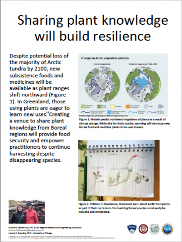
Our previous work in southern Greenland demonstrated that despite a long history of colonization by the Danish, people are passionate about plants as healers and sustenance. They acquire knowledge about plants through a vast number of resources, not only Inuit knowledge from elders, but also published European sources and experimentation. We documented over 205 plant uses in seven categories: medicine, beverages, food, herbs and spices, fuel, ritual, and material culture, the last category consisting primarily of decorative uses. Although medicinal uses account for the largest amount (~27%), the combination of the food, beverage, and herbs and spices/condiment categories make up nearly half of all the uses. In addition to our findings, other publications demonstrate the cultural value of plants in the Arctic. Given the importance of plants as food and medicine in the Arctic, I believe we can build resilience in Arctic communities by anticipating the arrival of new plants into warming regions, and sharing traditional knowledge of their uses with naïve communities. We need to anticipate which plant species are moving north, and how quickly, in order to prime communities for the arrival of new healers.
Causes of Environmental Change near Toolik Lake, Arctic Alaska
Long-term data near the Arctic LTER site in Alaska show 40 years of environmental change on land and in surface waters. While some changes have been substantial, other expected changes are small or undetectable. In addition, changes in the drivers of these trends, e.g., increases in air temperature or permafrost thaw, have been muted. These terrestrial and aquatic ecosystems are vulnerable to change, and the stressors causing the changes are either undiscovered or hidden from our ability to detect them. We think the differences in ecosystem response are due to the integrating effects of a climate signal on multi-year to decadal time scales, acting as a medium-pass filter of climate that reduces the year-to-year signal variability yet allows the effects of long-term warming to emerge. Other likely effects of climate change are seen in dramatic land-surface disturbances such as thermokarst failures and tundra fires, which have the potential to rapidly alter land and water biogeochemistry and may result in larger alterations than will the trends of climate change. Similar environmental changes may be occurring in unmonitored regions of the Arctic, even when the obvious drivers of climate such as air temperature have changed little over time.
Changing Sea and Hunting Communities

The 21st century introduced unprecedented alterations in the Chukotkan coastal communities life. In the villages of Neshkan and Enurmino, there is at least one generation of sea hunters, for whom the entire experience of traditional subsistence has occurred in new climatic conditions. They grew up and began to hunt the sea, which is covered only by freezing ice, sometimes merely for a couple of months.
Sea ice is an important habitat for many species of marine mammals. It also generates temperature boundaries that shape the food chain of the Arctic Ocean. Changing ice conditions affected the seasons and migration routes of marine mammals, which are the basic source of food and the key agency of the coastal community sociocultural patterns.
Observing how hunting communities perceive fluctuations occurring in the sea and adapt to its changes, I found that the younger generation of hunters obtains subsistence-oriented knowledge by combining three sources: personal observations, knowledge of older generations, and generally accepted information. Apparently, that is why, despite the extraordinary shifts in interaction with the sea, they are successful hunters and are able to “feed the villagers”, as their predecessors did.
Characterization of Heterogeneity in Marine-Terminating Glaciers in Greenland

The amount and duration of outlet glacier terminus retreat across the Greenland Ice Sheet is non-uniform and exhibits high intra-regional variability. Terminus changes result from both calving and melting at the front of the glacier where it interacts with the ocean, substrate, atmosphere, and interior of the ice sheet. As a result, the terminal zone is a complex environment where change can arise from numerous processes that depend on a suite of glacier and fjord properties, such as the geometry of the fjord, ice thickness, the presence and location of subglacial channels, the strength of ice mélange, floatation boundary conditions, etc. We argue that an extensive database of these properties is required in order to aid process-level understanding of terminus change and eventual coupling of ice sheet and climate models. Here we present a model for a database of glacier-fjord characteristics for Greenland that will be executed for this purpose. This database could be used in conjunction with terminus change data to validate different parameterizations of processes occurring at the termini of outlet glaciers in Greenland. These parameterizations, in turn, can be used to understand the exchange of freshwater between the Arctic Ocean and the Greenland Ice Sheet.
Charting a Path Forward: A Vision for Safe Arctic Shipping

As the sea ice retreats and the Arctic becomes more accessible, increased vessel traffic poses a significant risk to the Arctic region. Arctic waters are a life source and key component of culture for indigenous communities who have been part of this ecosystem for thousands of years. These waters are also home to unique and iconic wildlife. Threats from increased vessel traffic and shipping include the risk of an oil spill, vessel noise, vessel discharge, air emissions, increased potential for ship strikes, invasive species, conflicts between subsistence hunters and large vessels and potential impacts to human safety. We have a unique opportunity in the Arctic to put regulatory measures in place before these impacts occur. Now is the time to develop and implement a network of shipping safety measures and protocols that ensure the highest possible safety and protective standards for shipping from the Aleutians to the Canadian border. This poster outlines a vision for safe shipping in the Arctic, including existing measures and new standards and practices designed to safeguard the region for a rapidly changing future.
Climate Change in Community Contexts
Climate change is a major challenge to Arctic and other Indigenous peoples, but not the only and often not the most pressing one. We propose re-framing the treatment of climate change in policy and research, to make sure health, poverty, education, cultural vitality, equity, justice, and other topics highlighted by the people themselves and not just climate science also get the attention they deserve in research on global and regional environmental change. Climate change can often exacerbate other problems, but a singular focus on climate change—as is often the case in much existing environmental literature on the Arctic and elsewhere—can distract from actions that can be taken now to improve the lives of Arctic peoples. Our proposed approach to regional and global environmental change research draws on the ideas of decolonization, emphasizing collaborative approaches and Indigenous voices in research and policy instead of top-down measures designed outside the affected communities. Only in this way of contextualizing human-environmental experiences can the full effects of climate change be understood—and appropriate responses developed and carried out to adapt to global change.
Climate Change in the Eyes of Alaska’s Media

For science and policy issues that are contentious, abstract, or otherwise difficult to understand, the media play an important role in mediating what different people think about a given issue. The resulting perceptions explicitly and implicitly influence dialogue, decision making, and policy making. For example, when the minimum sea ice extent was documented in 2007, the subsequent media framing caused many people outside the Arctic to perceive the risks of climate change as something distant, which inhibited the sense of urgency to pass climate policy. Despite the evidence of climate change in Alaska, many Alaskans continue to develop their opinions about climate change based on the tone set by political elites outside of the Arctic. The future of the Arctic will be determined by individuals and governments both within and outside the region, and so how the media covers climate change both within and outside the region matter. To date there has been not been an analysis of how Alaska’s media outlets cover climate change. This study aims to determine how the Alaska media has uniquely represented the causes, impacts, and solutions to climate change in order to assess whether cross-scale differences in perception, problem definition, and risk evaluation exist.
Climate Change Increases Habitat Connectivity in Arctic Alaska
Climate-induced shrub expansion is altering wildlife habitats and community structures in arctic environments. Yet, how changes in shrub habitats will impact the distribution and range expansion dynamics of large herbivores is not well understood. We used climate-shrub-moose interactions as a case study to examine how climate change influences the processes and patterns of range dynamics of large herbivores in arctic tundra. Moose range may have expanded onto the North Slope of Alaska in early 1900s, providing a hunting resource for indigenous residents. However, it is unknown how tundra moose habitat will respond to the future warming as shrubs expand and shrub patches possibly coalesce. Combined with field shrub surveys and observed moose locations, our temperature-based model predicted moose habitat in river corridor systems in northern Alaska, which was validated by 1) observed moose locations (82% accuracy) and 2) Maxent Model output (95% accuracy). Based on two IPCC warming scenarios (viz. A2 and B1) with regional downscaling, our results showed that the habitat may more than double (130% on average) by 2090s if warming continues. In addition, we found that warming induced habitat expansion will likely increase spatial cohesion of habitat networks and diminish the effect of fragmentation, which will enhance the range expansion and dispersal dynamics of tundra moose. Our findings illustrate how climate change may alter the distributions of arctic species, including creation of novel communities and ecosystems, with implications to subsistence-based communities.
Co-Development of Knowledge: Creating a Collaborative Environment to Create New Knowledge from Indigenous and Science Perspectives

This poster will discuss the benefits of co-production of knowledge, where science and Indigenous knowledge (IK) holders stand together as equals, generating knowledge that is stronger than one alone and more powerful than the sum of its parts. Examples will be highlighted where both Indigenous and Science knowledge-holders worked together to create new knowledge to successfully influence policy development. It will outline the best practices for creating a collaborative environment and necessary conditions to enable sharing of information.
Coastal Resilience Mapping with Local Communities in Alaska’s North Slope

Alaska’s North Slope has among the highest erosion rates in the world, driven by sea ice melt and permafrost thaw. As with many localities, North Slope managers have limited access and capacity to leverage the full range of scientific and local knowledge about climate risks when making land use and other decisions. Limited access and capacity in the North Slope and elsewhere has motivated research on effective methods to engage local stakeholders in climate assessments to build decision support networks and enhance information usability. Coastal resilience mapping is one approach, and methods continue to evolve. This study contributes to the approach by using an evaluation lens to design the mapping process. A front-end evaluation in the study to “ground-truth” local risks using community mapping workshops is based on the perspectives of over fifty North Slope locals in three communities with coastal knowledge that collectively extends across the National Petroleum Reserve – Alaska and the Arctic National Wildlife Refuge. The local input identifies at-risk places and assets for a coastal risk web map developed for the study and installed on the Borough’s land use GIS. Sixteen land use managers evaluated the web map in an interactive usability workshop. The mapping process initiated a coastal observing network that includes hunters and other residents who identified ~300 at-risk places. A conclusion of the study is that the networking that occurs in the process of creating coastal resilience tools enhances access to local knowledge of coastal impacts that is relevant for sustainable land use decision-making.
Cold Regions Convergence Research: Science and Engineering for Innovative Solutions to Hard Problems and Informed Decisions and Policy
The Cold Regions Research and Engineering Laboratory (CRREL) is one of seven laboratories that comprise the Engineer Research and Development Center, the R&D arm of the U.S. Army Corps of Engineers. CRREL is the National resource for cold regions science and engineering. The CRREL mission is to solve scientific and engineering challenges in cold and complex environments through effective, interdisciplinary solutions for the Army, DoD and the Nation. That is, CRREL practices convergence research — bringing together scientists and engineers to address specific and compelling problems that require deep integration across disciplines — and has been doing so since it was established in 1960. This poster will describe some examples of convergence research at CRREL that has led to innovative solutions to hard problems, and contributed to science- and engineering-informed decisions and policy.
Collaboration Across Disciplines, Geographies, & Knowledge Systems: Case Studies from the Arctic Research Consortium of the U.S.

The Arctic Research Consortium of the U.S.(ARCUS) is a 501(c)(3) not-for-profit membership organization that serves the Arctic research community. For over three decades, ARCUS has played a key convening and coordination role for those looking to work more collaboratively across institutions, disciplines, knowledge systems, and sectors to address Arctic challenges.
ARCUS programs and activities focus on: 1) research community support, including fostering community-driven research initiatives; 2) interdisciplinary networking and community-building events and meetings; 3) collaboration with Indigenous communities and knowledge systems, including integration of Indigenous knowledge with weather and ice predictions, and support for Indigenous scholars; and 4) communications and outreach to share knowledge.
This poster will highlight some of the collaboration challenges currently faced by the ARCUS membership community; discuss the role of ARCUS programs and new initiatives in addressing these obstacles as well as lessons learned in best practices; and share how ARCUS programs, services, and our consortium network can be utilized by other researchers, policy-makers, and indigenous knowledge holders to encourage the collective actions needed to respond to Arctic change and prepare for the Arctic of 2050
Collaboration of the NWS and Rural Communities to Improve Weather and Climate Decisions in Southwest Alaska
Alaska is a unique challenge when it comes to obtaining weather and climate data compared to other parts of the country. One focus of the National Weather Service (NWS) is to understand what type of weather information is being used by rural communities in Southwest Alaska and what services could be provided in the future. Rural communities have local observations that are not only helpful verifying current weather events, but also in understanding long term changes that have occurred in the past. This study
focuses on communicating weather information to individuals within rural communities help fill the gaps that are missing from these data sources. Enhancing communication between the NWS and rural communities of Southwest Alaska will help to improve forecasts as well as support the mission of the NWS of protecting life and property for the future.
Combining Satellite Remote Sensing and Traditional Knowledge to Understand Mechanisms of Shorefast Ice Breakup in the Arctic
Shorefast ice, which forms along Arctic coastlines and within fjords, provides an important platform for transportation and access to traditional hunting and fishing grounds during winter and spring. However, despite its sociocultural importance, relatively little is known about the processes responsible for shorefast ice breakup or how it will respond to climate warming. Here, we use MODIS satellite imagery to document the timing of shorefast ice breakup in 28 communities in West Greenland and Northern Canada over the past 19 years. We identify a strong relationship between springtime air temperature and breakup in 25 of 28 communities, suggesting that air temperature is the dominant control on breakup timing. Breakup in comparatively colder communities is more sensitive to springtime air temperature than in warmer communities, a result that has implications for both seasonal prediction of breakup and forecasting future changes in breakup timing. Through interdisciplinary fieldwork conducted in Uummannaq, Greenland in spring 2019, we find that local knowledge substantiates our remotely sensed time series and provides unique perspectives for understanding the mechanisms responsible for shorefast ice breakup. Future work will investigate the extent to which shorefast ice loss will impact individuals and communities of the Uummannaq region and elsewhere.
Community-Based Observations of Coastal Alaskan Arctic Change
Northern Alaska coastal communities are the “first responders” to experience and detect changes in the ecosystem given a deep connection to place and integral reliance on traditional marine resources. Coordinated community-based observing efforts provide sustained long-term observations of the shifting template of environmental conditions in the Arctic necessary for regional policy-making. The Alaska Arctic Observatory & Knowledge Hub (AAOKH) is an ongoing observing network, with an overarching goal to empower communities with the tools, resources, and support to share their expertise and knowledge through observations of the changing coastal conditions and associated impacts to their access of traditional marine resources. AAOKH focuses on coordinating observations from Indigenous Knowledge Bearers across a network of seven coastal communities that collectively provide a broad-scale and synoptic view of changing coastal sea ice and ocean conditions, and ultimately impacts at the community scale. Local observations are shared via an online portal serving as a forum for observers, scientists, and community members to exchange aspects of seasonal ice and ocean changes, related to traditional harvesting, and how this matters to each community. AAOKH provides examples of the holistic breadth of knowledge in communities, communities tracking Arctic change, and weaving connections between Indigenous and scientific perspectives.
Connecting Across Arctic Barriers: The International Arctic Science Committee

The International Arctic Science Committee (IASC) is a non-governmental, international scientific organization. With 23 member countries, IASC encourages and facilitates cooperation in all aspects of Arctic research. In addition, IASC is an accredited observer of the Arctic Council supports its work, its Working Groups (WGs) and Permanent Participants (PPs) by providing scientific expertise from all its members, including the non-Arctic countries. Overall, IASC promotes and supports leading-edge interdisciplinary research in order to foster a greater scientific understanding of the Arctic region and its role in the Earth system.
To achieve this mission IASC: Initiates, coordinates and promotes scientific activities at a circumarctic or international level; Supports science development; Provides independent scientific advice and communications; Seeks to ensure that scientific data and information from the Arctic are safeguarded, freely exchangeable, and accessible; Promotes international access to all geographic areas and the sharing of knowledge, logistics and other resources; Provides for the freedom and ethical conduct of science; and Promotes and involves the next generation of scientists working in the Arctic.
In this poster, IASC will describe its international and interdisciplinary activities, its role in connecting science to policymakers, and how those interested in Arctic science can get involved with IASC.
Creating Actionable Science in Alaska

With rapidly changing climate and environmental conditions, the Arctic is attracting increasing attention nationally and internationally related to oil and gas extraction, international shipping, spill detection, infrastructure damage, extreme events, natural security, and social and ecological changes. The Alaska Center for Climate Assessment and Policy (ACCAP), one of the Regional Integrated Sciences and Assessments (RISA) programs funded by the National Oceanic and Atmospheric Administration (NOAA), has been working for over a decade to foster collaborations among scientists, resource managers, policy makers, Indigenous peoples, and community leaders to create actionable science in Arctic. This poster will highlight several collaborations from a range of disciplines and applications, including tribal climate adaptation planning, wildfire forecasting, flood risk management and response, and sea ice domain awareness. From these examples we will illustrate approaches that ACCAP (and our partners) have found effective in supporting collaborations between scientists and decision makers and across disciplines and knowledge systems. We also discuss obstacles we have faced when conducting actionable science in the Arctic as well as recommended approaches for overcoming these challenges.
Decision Relevant Alaska Climate Information: From Use-Inspired Toward Co-Production

Science is potentially more useful in resource management and policy if it is developed with those who make decisions related to it. In practice, the iterative co-development and evaluation of scientific information takes time, capacity, and funding exceeding the duration of individual projects. Programs must therefore plan for capacity and resources for successful co-production. Sometimes, useful information is developed independent of a co-production process, and this use-inspired information can still be helpful for decision makers. Here we highlight two evolving partnerships in Alaska that develop decision-relevant climate information. The first, initiated by Federal partners and further refined for related needs, developed information exchange pathways among collaborators, decision makers, and scientists to apply future snowpack scenarios to forest planning and species status assessments. The second grew from coastal resilience dialogues initiated among participants of Alaska's landscape conservation community and focuses on developing climate information that can be used alongside Indigenous Knowledge in adaptation planning in Alaska's tribal communities. In both cases, climate information developed for one purpose inspired refinement for evolving needs of community partners. We emphasize considering timeframe, partner and community needs, and information required when deciding where to work along the continuum between use-inspired and co-produced scientific information.
Detailing Glacier Bay National Park Ice Cover Changes - 1972 to 2018 from Landsat
Through the Earth to Sky Partnership (www.earthtosky.org) and supported by the Global Learning and Observations to Benefit the Environment (www.globe.gov), a request to NASA Goddard Space Flight Center from personnel at Glacier Bay National Park & Preserve (www.nps.gov/glba) for updated insights on the impacts of climate change has led to the creation of a 46-year time series of Landsat imagery over the entire Park. This has enabled intuitive visualization of the continued loss of ice from glaciers within and near the Park as well as increases in debris cover on glacier termini, and changes to lake areas as glaciers retreat and change flow direction.
Direct observations over the past decade+ by the Interpretation Division at GLBA of the changes observed park-wide by Landsat help bring the story of change into focus at the level of the thousands of visitors who visit this part of Alaska every year by cruise ship and other means of transportation.
Detecting and Forecasting Alaskan Permafrost Degradation in a Warming Climate

The timing and rate of permafrost degradation are two of the major factors in determining the anticipated negative impacts of climate warming on the Arctic infrastructure. These changes in permafrost vary both temporally and spatially. Critical information on this heterogeneity is provided by our permafrost observations in Alaska. Most of the permafrost observatories in Alaska show substantial warming of permafrost since the 1980s. The magnitude of warming varies with location, but is typically between 0.5 and 4°C. However, this warming is not linear in time and not spatially uniform. From the mid-late-1980s to the late-1990s, the permafrost and active layer temperatures in Alaska were rapidly increasing. During the first half of the 2000s, permafrost temperatures were not changing significantly at almost all sites in Alaska. The warming resumed on the North Slope of Alaska in the mid-2000s and only in the mid-2010s in the Alaskan Interior. Most of these changes can be explained by changes in air temperature and snow cover. These observations confirm that the future changes in permafrost temperature, in natural undisturbed conditions, will closely follow the changes in climate and as such can be successfully predicted using numerical models forced by established climate change scenarios.
Early Sami Play and Games: Sustainability and Peace

With climate change expanding trade routes in the Arctic and the resultant pursuit of oil, gas, mineral deposits, and fish, it is imperative that the eight Arctic countries find paths towards sustainability and peace in the region. Revisiting and understanding the early play and games of the indigenous people of these regions can go a long way towards helping those determining the region’s future to work cooperatively towards these goals. The aforesaid are timely and important, especially as they relate to indigenous people throughout the world who are trying to preserve their traditions in a fast changing modern world. The poster presentation will offer, based on my research and experiences in the Arctic, lessons learned from early Sámi play and games that may help promote sustainability and peace in the Arctic world. Hopefully by acknowledging these lessons we can pursue a path forward, together reconnecting with the early games of the Arctic with the hope of building meaningful bridges between the past and present and moreover, helping to enhance our understanding of the important role early games can play in shaping an Arctic where sustainability and peace flourish.
Embracing Interdisciplinary Collaboration: Lessons Learned from the NGEE Arctic Project
The Next-Generation Ecosystem Experiments (NGEE Arctic) project seeks to better represent tundra ecosystems in Earth System Models through model-inspired investigations near Utqiaġvik and Nome, Alaska. To understand the complexity that underpins the structure and function of these landscapes, our team of more than 140 people has built a collaboration among hydrologists, geomorphologists, ecologists, soil scientists, and computer modelers. Since 2012, NGEE Arctic has embraced the challenge of working across disciplines, cultural backgrounds, and stages of career development. We share a goal of translating data into knowledge and further into numerical equations for tundra ecosystems, now and many years from now in a changing climate. We acknowledge and value different needs and perspectives of an interdisciplinary team—balancing cost and complexity of global climate simulations against equally detailed and hard-won field observations—and work toward a solution where the integrated whole is more than a sum of its parts. This allows our science to be broad in scope, moving us from plot-scale measurements to comprehensive system-scale understanding. Our shared strengths and mutual respect connect us as we work to represent Arctic ecosystems in models and mathematically describe what the future may hold for these important, sensitive, and beautiful landscapes.
Enabling Effective Communication and Collaboration Across Boundaries Through Online Science Communication Training
Arctic scientists are often expected to share their research with policy makers and the public but they rarely receive training in how to do so effectively. Further, with a growing emphasis on collaboration across disciplines and geographies, scientists must also become adept at communicating their work to peers outside of their field who may not be familiar with the discipline’s base-level knowledge and terminology. The Interagency Arctic Research Policy Committee (IARPC) maintains an open collaborative platform that catalyzes connections between polar research communities around the world and supports interdisciplinary communication and collaboration. In order to enhance the effectiveness of this platform, IARPC provides training to early career scientists to improve their public speaking and communication skills. Students learn skills that they can apply when communicating with any audience, from scientists in other disciplines to policy-makers to the public. These include storytelling, public speaking, audience consideration, data visualization and slide design. They then produce a 5-minute “lightning talk” on their research and present it to a public audience. Videos of these presentations continue to be accessed by a public audience and shared via websites and social media. IARPC offers this training to early career scientists on an annual basis.
Examining Alaska Native Concerns About Vessel Waste Discharges in the Northern Bering Sea and Bering Strait
Northern Bering Sea and Bering Strait tribes are concerned over how quickly climate change is happening and because they are experiencing it and increased shipping’s many impacts, tribes are concerned for their future and food security. There are up to 40 waste streams that may be associated with vessel operations, the co-authors contributed to an article soon to be released that focused on three of the largest ship-generated streams that may be discharged into the water: oily waste, sewage, and grey water. These waste streams and the threat they pose to ecosystems are particularly concerning to Indigenous people in the region, whose culture and subsistence hinge upon preservation of a pristine marine environment. The poster will provide brief text and photos of northern Bering Sea and Bering Strait Alaska Native perspectives, graphic estimates of the amount of waste vessels generate while transiting the area, potential impacts from those waste discharges, ship- and area-based options to reduce the cumulative impacts of vessel waste to the region, and what we still need to know to address this growing problem.
Expanding Resource Recovery in Alaska
Alaska’s fossil energy resources continue to play an important role in meeting the nation’s energy needs. Alaska’s mineral wealth includes an estimated 350+ trillion cubic feet of technically recoverable unconventional natural gas resources in coalbed methane, gas hydrates, and shale gas. There are also approximately eight billion barrels of technically recoverable unconventional oil present as viscous and heavy oils.
As the only National Laboratory dedicated to researching fossil energy issues, the National Energy Technology Laboratory (NETL) is uniquely positioned to support and conduct key research dedicated to better understand the potential resources located within the North Slope. NETL is currently pursuing two research opportunities to further research and development opportunities for heavy oil and gas hydrate resources in Alaska.
These opportunities include a project focused on improving the recovery efficiency of viscous oil resources in the Schrader Bluff formation by injecting polymers to improve conformance control and sweep efficiency in the reservoir. NETL is also continuing to invest in developing technology to safely produce natural gas from the estimated 85 trillion cubic feet of natural gas held within the gas hydrate resources located on the Alaskan North Slope through advanced characterization of hydrate bearing zones in preparation for production testing.
Expanding the Reach of Polar Research

The 2007-2009 International Polar Year (IPY) was the catalyst for many successful scientific endeavors around the world and included a global effort with the largest investment in polar science outreach to date. A decade later, the polar research community has become increasingly invested in the issues surrounding the polar regions. Although the response of the public lagged, interest in and curiosity about the Arctic and Antarctica is now growing rapidly. It’s this intrigue that draws people to hear stories that have worked in the region decades later. This is important as the conversations surrounding the value of science need to continue in order to advance polar science, polar literacy, and effectively expand the reach of polar research. In this poster presentation, the Arctic Research Consortium of the United States (ARCUS) will share the results of two education focused programs that have been implemented with the specific goal to educate K-16 students and formal and informal educators about the Arctic, fostering partnerships and ongoing collaborations with researchers as well as communities in the Arctic.
Expert Assessment of Organic Carbon Stocks and Vulnerability in Subsea Permafrost

Many Earth systems are both complex and data limited. Understanding the response of these systems to climate change is necessary to achieve international climate targets. However, a detailed quantitative understanding of complex Earth system feedbacks is often not available in time to inform policy decisions, which themselves will influence the magnitude of the feedback. In such cases, expert assessment (combining expert judgements) can complement modeling and empirical approaches by synthesizing formal and informal knowledge about the system to inform decision makers and identify future research priorities. Here, we performed an expert assessment of the stocks and emissions of organic carbon in subsea permafrost. The continental shelves of the Arctic Ocean and surrounding seas contain large stocks of particulate and dissolved organic matter and greenhouse gases in dissolved, free, and hydrate forms. The quantity of these carbon deposits and their vulnerability to climate change are highly uncertain, though it has been hypothesized that they may influence the global climate system on decadal to centennial timescales. We used a quantitative questionnaire to obtain estimates of: 1. Past and current extent of subsea permafrost, 2. Past and current organic matter and greenhouse gas stocks on the continental shelves, and 3. Emissions trajectories for two IPCC warming scenarios (RCP4.5 and RCP8.5). Estimates of past and present subsea permafrost extent showed a relatively tight grouping, but future emissions were highly uncertain. Despite the spread, there was general agreement that a policy-relevant increase of carbon emissions could occur for both CH4 and CO2 to the water column and atmosphere by 2100 and 2300. We discuss major sources of uncertainty and research priorities as identified by participants. While these estimates will certainly be revised by future research, expert assessment is an efficient way to inform policy makers and the public about the possible magnitude of the subsea permafrost feedback to climate change.
Fostering International Research in the Arctic
Unprecedented change in the Arctic calls for extraordinary collaboration not hindered by borders, knowledge systems, or organizational silos. The International Arctic Research Center (IARC), at the University of Alaska Fairbanks, works as a hub bringing together the international research community and Arctic Indigenous people to jointly understand the Arctic as a system for the shared benefit of all. We connect researchers, Arctic inhabitance, the private sector, and others who need climate data to understand and prepare for the Arctic’s future. This poster will highlight several modeling, long term observing, and process study collaborations. We will illustrate how IARC partners and coordinates with international partners to serve the research community and solve problems that are beyond the scope of any one group or nation. We also discuss the importance of coordination, communication, and education to respond to unprecedented change, foster the next generation of scientists, integrate local Indigenous knowledge, and share Arctic change with a global audience.
From Scientific Excellence to Social Impact: Mapping the Public Values Associated with a Multi-Disciplinary Arctic Science Network in Canada

There is increasing demand for publicly funded scientific research that contributes towards solutions for the complex problems facing the Arctic. Public value failure can occur when a research program prioritizes scientific excellence and economic outcomes over other societal outcomes. This study employs Public Value Mapping (PVM) to unpack the different public values (e.g. social, cultural, environmental, scientific, economic) associated with ArcticNet, a publicly funded Canadian Arctic scientific research network over a 14-year period. Analysis of network-specific documentation (e.g. annual reports, strategic plans, compendia and governance policies) identified the procedural and logical connections between research goals and reported public values over the network’s existence. Identified public values were interpreted in the context of ArcitcNet’s evaluation criteria: management and governance; networking and partnership; excellence of the research; highly qualified personnel (HQP) development; knowledge and technology exchange and exploitation. Preliminary findings suggest that the public values that were emphasized in the earlier phases of ArcticNet’s research program (e.g. scientific excellence and HQP development) shifted towards other public values as the network matured (e.g. policy relevance, societal impact). In order to reduce the potential for public value failure in arctic science, research management strategies need to account for multiple and evolving public values.
Future Scenarios for the Russia’s Arctic

The paper presents scenarios for the Russia’s Arctic until 2050, produced by a diverse group of academics, local officials, Indigenous leaders, and business representatives at integrated Expert Foresight Seminar* in the Arctic city of Naryan-Mar, Russia in November 2018. They included projected futures for economic development, international cooperation, shipping, human and social capital, and Indigenous Peoples in the context of climate change in the Arctic.
Four driving forces: ‘Domestic Policy,’ ‘International Affairs,’ ‘Global Raw Materials Market,’ and ‘Technologies’–were identified by participants as the most important determining factors of change for the Russian Arctic. Combination of these factors resulted in building twelve thematic scenarios for three areas of Arctic development–coastal zone/shipping, economic, and social.
To build integrated scenarios the Foresight Seminar developed and used a new circular-axial systematization technique. This method allowed synthesizing and combining multiple thematic scenarios to present four final cross-cutting integrated scenarios. The main advantage of this approach is making it possible to preserve all proposed scenarios while also accomplishing their integration. Four integrated scenarios for the Russia’s Arctic coastal zone included: 'Harmonious Arctic,' 'Self-sufficient Arctic,' 'The Resource Arctic,' and 'Forgotten Arctic.'
(*This Seminar was supported by NSF: Arctic-COAST project, PLR # 1441381.)
Geoengineer the Ice Sheets to Stop Sea Level Rise
By 2100 most large coastal cities will face sea levels more than a metre higher than currently. Flood defences will cost tens of billions of dollars a year to construct and maintain. The ice sheets of Greenland and Antarctica will contribute more to sea-level rise this century than any other source, stalling the fastest flows of ice into the oceans would buy us a few centuries to deal with climate change and protect coasts. Greenland’s glaciers could be slowed in 2 ways: warm ocean waters could be prevented from reaching their bases and accelerating melting; the ice shelves where they start to float could be buttressed by building artificial islands in the sea. The engineering costs and scales of these projects are comparable with today’s large civil engineering projects, but with extra challenges due to the remote and harsh polar environment. There are potential risks, especially to local ecosystems, but a greater risk may be doing nothing. The impacts of construction would be dwarfed locally by the effects of the ice sheet’s collapse, and globally by rapid sea-level rise. If greenhouse gases emissions peak soon, it should be possible to preserve the ice sheets until they are again viable.
Going with the Floe as Arctic Sea Ice Variability Increases

The Arctic sea ice is changing rapidly as the ice becomes younger and thinner, often growing and melting within the span of a year. As it becomes thinner, the sea ice becomes more easily navigable and marine access for shipping, research, and tourism is expected to increase in the future. In autumn 2019 the icebreaker RV Polarstern will travel to the central Arctic to study the sea ice in the rapidly changing climate. We analyze climate model data from a group of 30 experiments and track virtual sea ice floes throughout a year to understand how predictable and variable the sea ice state is in the Central Arctic. We find that during the summer melt season the sea ice thickness, concentration, and surface conditions have substantially higher variability than a few decades ago. In the autumn predictability increases when the sea ice begins to freeze again, but as the Arctic region warms and ice freezes later in the year the onset of this predictability is delayed. The increase in variability and resulting decrease in predictability as the sea ice concentration and thickness decline are important considerations relevant for ships planning trips into Arctic waters.
Greenland Ice Sheet Response to Stratospheric Aerosol Injection Geoengineering
Geoengineering by stratospheric sulfate aerosol injection might slow Greenland ice sheet melting and sea level rise by reducing summer temperature and insolation, however such schemes would also reduce precipitation and affect large scale climate drivers such as the Atlantic Meridional Over-turning Circulation (AMOC). We examine the changes on the Greenland Ice Sheet resulting from climates simulated by four Earth System Models running the stratospheric sulfate aerosol injection experiment G4 and the RCP4.5 and RCP8.5 greenhouse gas scenarios. We utilize runoff estimates from the surface energy and mass balance model, SEMIC, with eight different surface albedo parameterizations that frame best estimates of runoff over the 1979-2004 period. There is a 20% reduction in Greenland runoff under G4 relative to RCP4.5, while under RCP8.5 it is increased by 17%. The mechanism is through weakened AMOC, increased Arctic sea ice concentration, and reduced humidity all leading to surface cooling of the ablation zone. An ice dynamics model that simulates glacier retreat driven by ocean temperatures and surface runoff suggests 15% lower ice losses under G4 than RCP4.5. Thus total sea level rise by 2070 from the Greenland ice sheet under G4 geoengineering is about 15-20% lower than under the RCP4.5 scenario.
High-Resolution Permafrost Modeling and Mapping in Alaska
We develop ecotype-based high resolution models for the Alaska North Slope, Seward Peninsula and Selawik National Wildlife Refuge regions. The developed models allow computations of the mean annual ground temperature, active layer thickness and talik thickness projections into the future for various climate scenarios. We demonstrated that the projections with the IPCC Representative Concentration Pathway 4.5 and 8.5 scenarios will result in a drastic difference in the future near-surface ground temperature regimes in 2050s and 2090s. Development of the taliks will have serious implications for ecosystems, human activities, and potential feedbacks to climate change.
We are increasing the spatial resolution of all developed models to 30-m in order for the community planners and engineers to understand potential hazards related to the permafrost degradation on the local scale near the relevant infrastructure. The permafrost thaw projections and other related products are posted at the permamap.gi.alaska.edu in order to help to visualize results at the fine scale and transfer projection to the selected communities.
In order to conduct the public outreach more effectively, we designed a publically-downloadable application for iPhone to show how permafrost temperature might response to changes in air temperature, snow thickness and ground moisture.
How Do Aquatic Ecosystems Respond to the Paired Stressors of Cultural and Climatic Eutrophication in the Arctic?
Eutrophication, inputs of excess nutrients, is a global problem that leads to low oxygen conditions, harmful algal blooms, and altered biogeochemical cycles in lakes, streams, and estuaries. In the Arctic, eutrophication may be “cultural”, with nutrients sources primarily from urbanizing communities and wastewater, or “climatic”, as thawing permafrost and warming temperatures leads to the release of nutrients stored in soils. The short growing season, with cold temperatures and low-angle light 24 hours a day, could produce different effects in Arctic lakes than commonly found in temperate lakes undergoing nutrient enrichment. A growing literature addresses the release of nitrogen from permafrost soils, and subsequent ecosystem response. However, the localized impacts of anthropogenic nutrient inputs, through either surface runoff or wastewater inputs, remain poorly understood. With increased industrial development and growing communities across the Arctic, anthropogenic nutrient inputs could become an important stressor on ecosystems already vulnerable to climate-driven environmental change. Preliminary data from ponds in the Alaskan Coastal Plain show increased nitrogen availability from both human development and permafrost degradation, relative to sites with intact permafrost. Here, we discuss the potential differential impacts of cultural versus climatic eutrophication, and how the scientific community might address this gap in our knowledge.
How Much Mercury Is in the Yukon-Kuskokwim Delta and Does Fire Influence Its Release?
The release of Mercury from thawing permafrost in Arctic regions has great potential to affect both aquatic food resources and human health. Mercury is a toxic contaminant which has a neurotoxic effect on humans – at high levels it can damage the developing brains of babies (including unborn babies) and children. It can also impact wildlife dependent upon fish and threaten Alaskan commercial fisheries.
Little is known about Mercury concentrations in deltaic environments such as the Yukon-Kuskokwim (Y-K) National Wildlife Refuge. This is important as wetlands are potential hotspots for the production of the toxic form of mercury which accumulates in fish and animals. The Y-K delta is the ancestral home of the Yup’ik Eskimo, hosting more than 40 Yup’ik villages whose residents continue to live a largely subsistence lifestyle.
Here we present mercury measurements in Y-K waters, soils and permafrost and estimate the amount stored in the region. We also examine if tundra fire – a natural yet increasing threat to the area, influences the release of mercury to inland waters.
Our research will inform policy makers to enable management of aquatic food resources and advise on appropriate changes to indigenous practices such as fishing habit.
How the German Arctic Office Informs Arctic Policy

The German Arctic Office at the Alfred Wegener Institute Helmholtz Centre for Polar and Marine Research serves as an information and cooperation platform for German stakeholders invested in Arctic science, politics and industry. It enhances the visibility of Germany‘s engagement in the Arctic on a national and international level.
The office serves as a central point of contact for political and scientific bodies, NGO‘s and German industry, advises the Federal Government on Arctic issues through statements and briefings based on the most current state of research and fosters Germany‘s participation in the Arctic Council‘s scientific activities.
The German Arctic Office provides scientific organizations with background information on current policy relevant developments in the Arctic Region and informs German stakeholders from science, politics and industry with consistent information from the global Arctic research community. It initiates and organizes national Arctic meetings and events in cooperation with partners from science, politics and industry and supports the federal government in the representation of German Arctic research and policy at international conferences.
How the Polar Research Board Informs Arctic Policy
The National Academies of Sciences, Engineering, and Medicine (NASEM) is a unique institution that provides objective guidance on some of the most pressing science-related challenges facing the nation and the world. The Polar Research Board (PRB) is the focal point within the Academies for addressing issues related to the Arctic and Antarctic. The PRB does not conduct primary research, but instead works closely with leading subject-matter experts to gather, analyze, and synthesize existing information so it is useful to decision makers and other stakeholders, and to help polar science have a broader impact on society. In this poster, we will highlight examples of recent activities that illustrate the challenges and opportunities of implementing collaborative, multi-disciplinary projects. We will focus this “big-ideas” poster specifically on activities that offer meaningful outcomes for a wide variety of key stakeholders.
How the Saami Council Informs Arctic Policy

Main point: The Saami Council (SC) voice adds a persepctive based on year round monitoring of environmental change and impacts of international and national political decisions on the ground in the Nordic /Northwest Russian Arctic.
How we work: The Saami Council is an International Indigenous Peoples’ Organisation with nine main Saami organisations as members. These consist of local chapters, thus SC brings the voice of Saami communities, at grassroots level all the way to the Intergovernmental fora such as UN, Arctic Council and EU. SC conveys the importance of indigenous knowledge to science fora such as SEARCH, ensuring at least co-production of knowledge. This is a bottom-up approach.
If the intergovernmental and science fora embrace these perspectives, it potentially would commit and /or inform the national level decision-making of the countries the Saami peoples inhabit, and ultimately impact the management of the Saami regions in a way that will benefit the Saami people and not harm our culture. This will be illustrated with a graph.
The international level, the SC collaborate with other Arctic or global indigenous peoples to amplify the power behind the messages and unite with environmental protection agenda (where it matches our agenda) to amplify both the indigenous peoples agenda and the environmental protection agenda.
How the U.S. Arctic Research Commission informs Arctic Policy
The U.S. Arctic Research Commission (USARC) is an independent federal agency of presidentially appointed commissioners who advance Arctic research through advisory and policy means. USARC helps establish the national policy, priorities, and goals necessary to construct a federal program plan for basic and applied scientific research. USARC promotes Arctic research, recommends Arctic research policy, and communicates research and policy recommendations to the President and Congress.
USARC has:
a. Materially contributed to national policy on the Arctic region by advocating for, and helping to draft key policy documents, such as: (a) Arctic Region Policy, 2009; (b) National Strategy for the Arctic Region (NSAR), 2013; (c) Implementation Plan for the NSAR, 2014; (d) Executive Order 13689 Enhancing Coordination of National Efforts in the Arctic, 2015.
b. Created the enduring staff position of “Assistant Director for Polar Science” in the White House Office of Science and Technology Policy, and supported the inaugural appointee.
c. Helped revitalize the Interagency Arctic Research Policy Committee (IARPC), the 5-year Arctic research program plan, and, via presidential memorandum, moved IARPC under the National Science and Technology Council.
d. Helped negotiate and implement the legally binding Agreement on Enhancing International Arctic Scientific Cooperation.
e. Helped established and conduct international Arctic Science Ministerial meetings.
Hydrologic Modeling of Supraglacial Streams and Their Impact on Albedo

Supraglacial streams are prevalent on the surface of the Greenland Ice Sheet. These streams decrease the surface albedo and contribute to frictional melting. Their flow variability also plays a significant role in defining the efficiency of the subglacial drainage system. How quickly meltwater is routed through these systems therefore dictates how much they contribute to further melting. Routing times depend on the morphology of the stream channel and the friction applied by the bed. Here we measure a single supraglacial stream in southwest Greenland using high resolution GPS mapping, velocity and stage measurements, and UAV imagery. Analysis of these inputs produced a centimeter scale bathymetric map, a week-long stream discharge time series, and bed friction parameterization values that could be input into a HEC-RAS hydrologic model. Model outputs are able to accurately replicate observed stream geometries and show a decreasing positive feedback loop between discharge and water extent. Bed roughness values vary significantly within the study region and have a large effect channel geometry. Using hydrologic models proves to be a useful tool for better understanding how supraglacial streams will influence the energy balance of the Greenland Ice Sheet in response to climate change.
Identifying Risk Factors for Permafrost Thaw and Degradation on U.S. Army Alaska Training Lands
The U.S. Army and Air Force are constructing new facilities and expanding training land infrastructure at numerous locations in interior Alaska. Most of this development is on discontinuous permafrost that is exhibiting signs of change with a warming climate. This permafrost has moderate to high risk of thermokarst (degradation of ice rich permafrost that causes subsidence, increased stream sedimentation, and changes in wetland extent). The vulnerability of permafrost to thermokarst degradation is controlled by static characteristics like high ice content and dynamic environmental factors that trigger changes like warmer summers, increased fire severity, and drying or wetting. Recent efforts combining field and remotely-sensed measurements with modeling have demonstrated that geospatial information can be used to identify terrain vulnerable to thermokarst. We are applying a similar geospatial framework to assess trajectories of ongoing permafrost degradation and hydrologic reorganization projected to 2050 and 2100. To develop this framework we are linking field measurements, data synthesis, repeat imagery analyses, remote sensing measurements, and model simulations focused on land cover dynamics and characteristics. Our framework is designed to support decision making for conservation management and habitat monitoring, land use, infrastructure development, and adaptive management across the interior Alaska DoD domain.
Images as Information: Context-Rich Images and the Cognition of Place-Based Information in the Management of Social-Environmental Change

Practitioners widely acknowledge the importance of including place-based information like local and Indigenous knowledge in environmental research and decision-making. Still, it remains a challenge to achieve this integration in a meaningful way. This formative study is a necessary step toward developing improved methods for communicating place-based information, with a focus on public sector practitioners as audience and visual content as medium. The aims of the methodology applied in this study were to 1) assess if and how context-rich images – detailed visuals that address the particularities of specific environments and cultures – assist in communicating knowledge across cultural and professional barriers, and 2) develop practical recommendations for reporting information from both Western science and local/Indigenous knowledge systems to inform environmental decision-making. With a focus on practical application, public sector conventions for reporting qualitative information to decision-makers are explored, including the limitations associated with these conventions and the potential value-added of context-rich images. Insights from both theory and practice informed the research methodology and guided the design of a sample report and survey tested with upper-level public sector practitioners who have influence on environmental decision-making in Alaska.
Indigenous Participation Working Group Poster Series
1. Our Resources: Uncertain Food Security - Rural Alaskan Natives share concerns and their observations of shifting animal migrations in response to environmental changes, also: changes in animal behavior; new plants, insects, and animals; sea mammal, sea bird, and fish die-offs. This poster will also relay how important subsistence resources are to Alaska Natives and their future generations.
2. Our Home: Environmental Changes - Rural Alaskan Natives share concerns and observations of the dramatic changes in weather including seasonal shifts and more variable and dramatic storm cycles that have a huge impact making both air and land transportation more dangerous. This poster will also focus on the increase in erosion, melting permafrost, and warming waters. This poster will also highlight how land ownership impacts village relocation and property adjacent to rivers and coastal waters.
3. Our Families, Our Future - Alaska Natives share their thoughts, feelings, and concerns about the future of the Arctic. Climate change has been so heavily politicized that most people in the US forget that it is our home. To rural Alaska Natives, when you say “Arctic Futures 2050”, we are thinking about our children and grandchildren’s lives. Will they be able to go hunting and live off of the same resources that have sustained us for, not just our own lives, but for our our people for thousands of years? Will our kids and grandchildren face hunger in the future? What will they face in 10 years, 50 years, or 100 years? People across the Arctic are very concerned for the future of their people right now. This poster will be a chance for people to share these concerns as well as introduce folks to their families, children, grandchildren, and communities.
4. “Ways Forward” - Rural Alaska Natives share what they think about possible solutions to problems that we face in the Arctic, and potential ways for Indigenous folks in the Arctic to better inform policy that has impacts on our lives. This poster will focus on ideas and solutions to problems we face on the local, statewide, national, and international levels.
Innovative Technologies to Advance Ocean Observation
Extreme physical changes are underway in the marine Arctic, including a transition from multi-year to seasonal sea ice, an increase in open water, and changes in water chemistry, all of which impact Arctic ecosystems. And in a region where ice rules, monitoring this change as it occurs is a challenge. Traditional ship, satellite and mooring based data collection techniques are the backbone of oceanographic research but are limited in time and/or space, and there is a paucity of data from under the ice, from the marginal ice-edge zone, and during seasonal transitions. Novel autonomous vehicles and sensors are being developed to supplement traditional observation infrastructures. NOAA’s Innovative Technology for Arctic Exploration program focuses on the development of these specialized tools – many developed through public-private partnerships and tailored to the challenging environmental and logistical conditions found in the Arctic. Since 2015, we have tested ~15 technologies and platforms to foster collaboration and enhance foundational knowledge of the U.S. Arctic environment. Here, we provide a big picture idea of how these tools enhance our current observing systems to cost-effectively monitor and predict change while providing the foundational knowledge required for informing policy with science and encouraging collaboration across disciplines.
Integrating Knowledge Mobilization with Evidence-Based Approaches to Inform Policy in Canada’s Northern Regions
The Arctic Institute of North America at the University of Calgary works in partnership with community partners, Indigenous organizations, researchers, governmental and non-governmental institutions to develop solutions to the suite of challenges (social, environmental, economic) faced by Arctic communities in response to the near-term effects of climate variability.
Through a range of interdisciplinary research activities, AINA strategically employs evidence-based approaches coupled with knowledge mobilization techniques to develop realistic policy options for addressing the impacts of environmental change in the Arctic. For example, a recent study aimed at understanding the risk to infrastructure along a Canadian Arctic hamlet was initiated by community members who noticed increased loss of land fast sea ice and permafrost thaw. The study provided a platform for incorporating non-research evidence from community members who were engaged as equal participants during all stages of the investigative process, along with quantitative research-based evidence obtained from remote sensing and numerical models. Results from the study have been used to inform proposed policy-relevant resilience initiatives.
Inuit Insider-Outsider Perspectives Through the Lens of the Indigenous Research Agenda
The trajectory of Indigenous research has focused on reinstating Indigenous communities in a position of central power, rather than the passive focus of Western paternalism. To this aim, the evolution of Indigenous research methodologies has been driven by attempts to address questions pertaining to self-determination, specifically in terms of being beneficial to Indigenous People: “Who is determining what is beneficial?”; “Who is conducting the research?”; and “Who is in control of the research process?”. One of the central issues within this debate is a deeper understanding of the roles of insiders and outsiders within the research process. A small sample of Inuit social science research papers were subject to a thematic analysis to identify if any trends emerge within collaborative insider-outsider research versus research conducted exclusively by insiders or outsiders respectively.
Investigation of Combined Electrical and Thermal Energy Systems for Distributed Offgrid Communities in the Canadian Arctic
Indigenous peoples in Northern communities of Canada are experiencing some of the worst effects of climate change, given the Arctic region is warming twice as fast as the rest of the world. In an effort to keep global temperature rise to well below 2°C, Canada and 194 other countries reached a landmark agreement (“Paris Agreement”) to accelerate and intensify the actions and investments needed for a sustainable low carbon future. Further, with 40% of Canada’s landmass belonging to the Arctic, the government has strengthened global efforts and measures to address the impact of climate change in this region.
Over 50 communities in Canada’s Arctic rely on diesel fuel for electricity production and as a source of heating for buildings and homes. Thus, in an effort to reduce diesel dependence, my work explores multi-objective energy system model to address the complex tradeoffs of designing renewable power system in the Arctic. Specifically, the multi-objective model is capable of analyzing risks and opportunities in framing effective policy frameworks involving climate change mitigation and adaptation.
Landscape Conservation Cooperatives in Alaska and Northwest Canada

The Landscape Conservation Cooperatives (LCCs) are a novel public-private partnership that bring together government agencies, indigenous groups, non-governmental organizations, research institutions, and industry to address the challenges and opportunities associated with a rapidly changing environment. We represent four LCCs that fosters collaborative work across large, landscape-level regions that cross political boundaries across Alaska and northwest Canada. By working together, we aim to support collaborative stewardship of our natural resources, promote forward-thinking economic development, protect our Indigenous heritages, and enhance resilience in our land, waters, and communities throughout the changing North. Many of the challenges we address are largely influenced by climate change impacts, natural resource development, hunting and fishing activities and regulations, and shipping vessel traffic. The projects supported by the LCC partnerships are based in approaches that aim to find common ground, leverage resources, share information, and develop research, tools, and adaptation strategies. Examples of LCC projects include development of maps, data sets, and tools that span across geographies to fill important information gaps, activities to foster coastal resilience throughout rural Alaska, helping to reroute shipping lanes to avoid environmental sensitive regions in the Aleutians, and supporting both coordinated and indigenous-led environmental monitoring across Alaska and northwest Canada.
Learning from Earth’s History: What the Paleoclimate Record Says About Earth’s Climate at ~410+ ppm with Global Temperatures > 1.5 Degrees Celsius
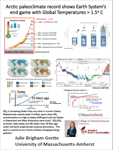
CO2 in our atmosphere is increasing faster than any time in human history. Paleoclimate records show we have to look beyond 800,000 years to find a time when CO2 concentrations were even briefly as high as today (410 parts per million, or ppm), and back 3 million years during the Pliocene Epoch to when CO2 was consistently that high. Scientists predict based on past changes in the Earth system that unless we can offset this rise, the high concentration of atmospheric CO2 will return our planet to Pliocene conditions, with rising seas, shifted weather patterns and altered conditions in both the natural world and human societies. If we are heading into Pliocene-like conditions, what was the world like at ~410 ppm? Unlike today, boreal forests reached the Arctic Ocean across much of Arctic Russia and North America. The Greenland Ice sheet did not exist, with only small glaciers along eastern Greenland; in Antarctica, the West Antarctic Ice sheet was absent, replaced only by an open seaway. Given the infrastructure of cities and businesses at the coast today, we must mitigate warming via non-polluting technologies, while developing resilient federal and state policies for managing resilient coastlines, water supplies, and agricultural practices.
Long Term Monitoring of Permafrost Degradation Highlights Two Key Forms of Landscape Response

Here we report on permafrost degradation observed in the High-Arctic and Interior of Alaska and show that the geomorphological impact of permafrost degradation varies primarily due to differences in the summer-vs-winter heat balance, ecosystem protection, and ground ice distribution. At three High-Arctic monitoring sites mean annual ground temperature at 1 m depth is ~ -13 C. Ground ice lies close to the surface and there is limited ecosystem protection. Between 2003 and 2016 we observed thawing degree days up to 240 % above historical normals. This caused active layer deepening, ground ice melt, and up to 90 cm of subsidence. In the sub-Arctic, we observed talik development at over 20 monitoring sites due in part to warmer winter conditions. These sites are characterized by warm permafrost where the mean annual ground temperature ranges from -1 C and -0.3 C. At these sites, active layer deepening combined with heavy winter snow fall has, in some years, led to incomplete freeze up and the intermittent formation of a talik. Unlike High-Arctic sites, recent warming has not yet led to wide-spread thermokarst development in the Interior. The two processes we observe have drastically different implications for the built and natural environment.
Making Good Infrastructure Decisions and Policies in Arctic Regions Under Global Warming

Due to global warming, the arctic regions are faced with natural and human-made, uncertain changes on their infrastructures ranging from villages and cities to roads and bridges to ports and depots. In response to this recent development, there have been numerous studies, projections, and scenarios for the possible arctic futures in 2050. In our study, we focus on how decision- and policy-makers can be supported from a quantitative (based on mathematics and economics) approach called stochastic optimal control in formulating their strategies and tactics in the meanwhile (from 2019 to 2050). For example, based on diffusion and jump processes to model uncertainties ranging from temperature and moisture, supply and demand, price and cost, and legislations, we show how decision- and policy-makers can value the strategical and tactical options to construct, expand, contract, mothball, decommission, and/or abandon the aforementioned infrastructures. From the analytical, numerical, and computational results, we will derive managerial insights and economic implications for the academics and practitioners. We also plan to crystalize the basic ideas of insights and implications so as to share them with various constituents and stakeholders ranging from impacted residents as well as relevant goods and service providers to the decision- and policy-makers.
Making the Case for Recognition of Traditional Indigenous Knowledge as Applied Science

Since ancient times indigenous peoples have lived in the harsh Arctic environment. Applied science – orally passed on from one generation to the next – enabled them to survive and balance their own needs with the region’s natural resources in a sustainable way. However, indigenous peoples’ profound expertise, acquired based on the same principles as western science through observation, practical experiments and evaluation, lacks full scientific recognition. Despite the fact that indigenous knowledge was vital for historical scientific achievements and continues to provide valuable input today, it still only occupies a niche of science. Due to the importance of indigenous expertise and supported by a growing awareness of the rights of ethnic minorities, traditional knowledge holders are now offered to be part of scientific activities. We argue that this limited participation does not provide a real opportunity to shape regional, national and supra-national Arctic policies as equal partners, thereby vulnerabilities to potentially detrimental consequences of powerful external stakeholders’ actions may not be sufficiently reduced.
We intend to address the following research questions in collaboration with traditional indigenous knowledge holders:
Should traditional indigenous knowledge be recognised as applied science?
What kind of robust evidence could facilitate full scientific recognition?
Managing Boreal Wildfires as a Climate Mitigation Strategy
The fate of arctic and boreal biomes will be tightly linked to the fate of our global climate due to their vast stores of carbon. As climate change increases the frequency and intensity of wildfires in these ecosystems, wildfires themselves exacerbate climate change through the release of greenhouse gases. Together with expanding populations, this reinforcing cycle leads to destruction of critical infrastructure, negative health outcomes from smoke exposure, and loss of life. Fire management, however, presents an opportunity to not only protect these vulnerable ecosystems, but stave off the devastating impacts of continued greenhouse gas release. To determine if fire management can be an economically and ecologically viable climate mitigation strategy in Alaska, our research combines historic fire data, remote sensing, economic analyses, and machine learning techniques. Our preliminary results indicate that fire management strategy is one of the primary predictors of final fire size, suggesting that enhancing management activity by increasing expenditures could reduce burned area and thus carbon loss. This research highlights the vulnerability of high-latitude ecosystems to global warming, while producing actionable results that can be used in the fight against climate change.
Modeling Ocean Acidification in the Bering Sea
The Bering Sea is highly vulnerable to ocean acidification (OA) due to naturally cold, low carbonate concentration waters. Expected negative impacts of OA to marine organisms therefore pose a significant threat to this highly productive marine ecosystem, which supports critical commercial and subsistence fisheries. Harsh weather conditions and substantial spatial variability within this rapidly changing environment hamper longterm observational monitoring. Well-validated biogeochemical models are a useful tool to help support observational efforts and provide skillful projections of OA on multiple timeframes. However, global-scale Earth System Models generally do not contain the spatial resolution and coastal processes (e.g. river biogeochemical inputs) required to capture dynamic coastal shelf systems. Therefore, we recently added carbonate chemistry to a regional ecosystem model of the Bering Sea at 10km horizontal resolution. Comparisons with observational data illustrate that this model skillfully reproduces carbon chemistry throughout the Bering Sea shelf. Our next steps are to utilize this validated model to produce regional predictions/projections of OA for the Bering Sea on timescales ranging from 9 months to the end of the 21st Century. These model results will provide information on OA risk and can be further developed to address emerging stakeholder needs.
Multiparty Collaborative Approach to Projects in the High Latitudes

“The road is long, supplies are costly, seasons are short, fortune is fickle.” These words written in 1895 are still true today. Development in the Arctic, driven in part by climate change is constrained by these factors; whether that development is new infrastructure such as ports or roads or repairing of existing infrastructure caused by degrading permafrost. This work will be costly and difficult to achieve. A new management approach based on the creation of teams and collaboration of multiple parties from different countries and cultures is necessary. Existing knowledge about the core issues for collaboration in such settings include: 1) understanding the role that culture and identity; 2) development of strong connectedness between parties; and 3) creation of shared vision. We report on an integrated mixed methods research study based on data gathered through interviews with business professional’s experience on transnational multiparty projects and quantitative data gathered through surveys representing eleven national/cultural sectors. Our findings shed insight into the mechanisms involved with collaboration in such settings: 1) as differences in culture can be a show-stopper, energy must be expended for active management and awareness of cultural differences; 2) collaborative environment is created through empathy and trust that acknowledges identity (both role and individual); and 3) the significance of an inclusive process of creating an iterative adaptive shared vision where constructive conflict takes place under the umbrella of a collective vision. Collaboration, as an emergent process, is created when all three elements are present and interact.
Narwhal: Revealing an Arctic Legend

Collaboration across the disciplines of evolutionary biology, anatomy, genetics, Inuit traditional knowledge, climate science, and art history have broadened our understanding of the narwhal, its extraordinary tusk, and the changing Arctic climate, ocean noise pollution and ecosystem. Twenty years of ongoing field research in the biologic sciences combined with the collection of oral knowledge from Inuit hunters across six communities in the Eastern Canadian high Arctic and five communities in the high Arctic of Western Greenland have resulted in a museum exhibit, and catalogue from the Smithsonian Institution. Combining the results of the scientific investigations, with Inuit knowledge presents the narwhal as an iconic symbol of a dynamic Arctic, unpredictable with its changing environmental, social, and climate indicators. By partnering with the Inuit, and including them as content reviewers, the exhibit messaging of this changing region is current with observations from the land and ocean and demonstrates the role museums can play in bringing the Inuit and our understanding of the narwhal to a broader audience. Following the Smithsonian venue, a traveling version will travel to other museums over the next several years. Ongoing genetic research from our studies about the narwhal will help answer complex questions of the narwhal’s unique evolutionary history.
NASA Mission Applications: Enabling an Effective Use of Ice, Cloud and Land Elevation Satellite-2 Data for a Changing Arctic Environment

The NASA Ice, Cloud, and land Elevation Satellite-2 (ICESat-2) is the new space-based altimeter mission launched on September 15, 2018. ICESat-2 continues the multi-year observations of the Earth’s surface elevation established by the first generation ICESat (2003-2009) and enables a suite of measurements that support terrestrial, atmospheric and oceanographic applications—scientific and practical—for the Arctic and beyond. In an effort to understand the innovative and practical uses of ICESat-2, scientists at Goddard Space Flight Center have implemented an Applications Program to expand the community of users beyond the research science community and to allow for insights, pre-launch through post-launch, on key decisions and actions the data may support. ICESat-2 Applications activities facilitate dialogue between the user community, mission project scientists, ICESat-2 science team, and NASA Headquarters to enable clear expectations on the functionality and utility of the data, as well as to allow for effective interpretation and translation of the data to inform decision makers’ priorities. In this poster, we summarize the initiatives of the Applications Program and highlight Early Adopter/Applied User research exploring the use of ICESat-2 to understand the changing Arctic environment and support applications ranging from Arctic marine navigation to oil spill mitigation to commercial fishing.
Navigating the Arctic: Understanding and Evaluating Uncertainties in Infrastructure Systems

The fast decline in sea ice in the past decade has drawn the attention of the maritime shipping industry. Due to an increase in the number of navigable days owing to warmer temperatures, maritime activity in the Arctic has significantly increased for freight, scientific expeditions, and tourism. The lack of infrastructure along Arctic routes coupled with variability of climate draws concerns on the safety of navigating the Arctic. This work characterizes uncertainties related to modelling the risk of navigating the Arctic. Specifically, a simulation model is developed that incorporates uncertainty analysis using Monte Carlo simulation tools to address a comprehensive set of future uncertainty scenarios under climate change and enhanced infrastructure management of maritime transportation. The variables in the model have projected probability distributions as opposed to point estimates of multiple scenarios and account for all possible future outcomes. The proposed approach will provide accurate predictions of the risks of navigating the Arctic shipping routes in the future, and as a result, will inform current infrastructure risk management of preparedness strategies for a thriving future in maritime transportation.
NOAA's Arctic Report Card – 15 Years of Arctic Change
For policy makers and environmental managers, the annually-produced NOAA Arctic Report Card (ARC) offers a succinct account of current Arctic environmental observations. Issued since 2006, the ARC is a timely and peer-reviewed source for clear, reliable and concise environmental information on the current state of the Arctic system. Written by a team of over 80 scientists across 12 countries, the ARC is comprised of seven essays on ‘Vital’ signs of Arctic change (i.e. surface air temperature, sea surface temperature, terrestrial snow cover, tundra greenness, sea ice conditions, Greenland ice sheet, and ocean primary productivity), three to four essays on rotating ‘Indicator’ topics (e.g. permafrost, fisheries, and ocean acidification), and two to three ‘Frostbite’ essays highlighting emerging topics of concern (e.g. microplastics, harmful algal blooms). The featured essays are observation-based, emphasizing that year’s changes with limited interpretation and editorializing while highlighting linkages between other topics featured in the Report Card. This document can provide policy makers at all levels of government the basic scientific knowledge that they need to make informed decisions to preserve life and property in the rapidly changing Arctic.
Not All Permafrost Microbiomes Are Created Equal: Divergent Microbial Diversity and Metabolic Pathways During Permafrost Thaw
Northern latitude regions are facing emerging issues due to rapid changes in permafrost integrity triggered by climatic disturbances. These lands are becoming increasingly vulnerable to ground subsidence due to thaw degradation with considerable uncertainty in where, when, and how thaw may occur. Microbes in permafrost activate when temperatures rise; however, the spatial and temporal heterogeneity of their activation during thaw is poorly understood. We examined a diverse selection of permafrost to test if permafrost with different starting microbiome compositions will produce different rates and types of metabolic processes when thawed. At the end of the study, respiration rates and microbial taxonomy were different among the various permafrost types tested, indicating that the starting population rather than temperature drove community shifts during thaw. Metabolite analysis revealed that temperature strongly influenced the permafrost metabolome during thaw. These results provide evidence that permafrost in different locations will have varied responses to thawing conditions. The microbial trajectories should be accounted for in current models because microbial processes have profound effects on nutrient cycling and vegetation in sub-Arctic and Arctic regions.
NSIDC: A Key Resource for Arctic Decision Makers
The National Snow and Ice Data Center (NSIDC), part of the Cooperative Institute for Research in Environmental Sciences (CIRES) at the University of Colorado-Boulder, conducts Arctic-focused research relevant to decision making. NSIDC scientists are engaged in cutting-edge science regarding sea ice, permafrost, snow, and land ice. For the sea, NSIDC provides improved predictions usable for planning in locations important for national security, environmental management and economic activities. For example, the Chukchi Sea is a key choke point for Arctic marine traffic supporting the transportation of goods, oil and gas exploration, and tourism. NSIDC works with NOAA, the U.S. National Ice Center and the U.S. Navy to develop specialized data products to support marine operations in the Chukchi Sea, and elsewhere in the Arctic. Over land, NSIDC is engaged in permafrost research with direct relevance to Alaska infrastructure, including roads, buildings, runways and the Alaska oil pipeline, much of which is built on permafrost. Studies focused on snow and land ice can inform local to national decisions on topics from regional ecosystem health to global sea level rise. NSIDC is available to serve the needs of policy and decision makers by providing relevant data products and supporting Arctic-wide understanding.
Numerical Reanalyses as a Gateway to Arctic Synthesis

Reanalyses are regularly gridded, retrospective depictions of the physical earth system, which are produced through the correction of a short-term forecast to available observations. In the Arctic, reanalyses are particularly well suited to marshal the sparse observing network to provide a plausible, multivariate representation of conditions. Atmospheric reanalyses such as MERRA-2 (NASA Modern-Era Retrospective analysis for Research and Applications, version 2) and ocean reanalyses such as SODA3 (University of Maryland Simple Ocean Data Assimilation, version 3) are widely used in Arctic research for diagnostic studies of circulation, model evaluation, and as boundary conditions for a variety of process models. Here, we provide examples that illustrate the utility of reanalyses for providing information on the spatial and temporal scales of recent, rapid changes in the Arctic. Recent trends in Arctic surface temperatures, surface melt over Greenland and Arctic glaciers, and evolving freshwater conditions in the Arctic Ocean are examples where reanalyses can provide information that cannot easily be obtained via other means. These examples provide information on the scale, magnitude, and the uncertainty of recent Arctic change and provide a context for future scenarios. We further quantify uncertainties in key reanalyses variables and approaches for addressing these issues.
Observing Arctic Land Ice Change Must Be a Scientific Priority

Loss of Arctic land ice, including glaciers and the Greenland Ice Sheet, influences local ecosystems, water resources for communities, and sea level rise around the globe. Understanding the timing, location, and magnitude of ice loss is critical for decision making at multiple levels. Land ice loss is a primary sea level rise contributor and the largest source of uncertainty regarding sea level rise timing and magnitude. The specific source location of ice loss also determines the local fingerprint of sea level rise. Quantifying current ice loss and accurately project future ice loss, and related sea level, requires continued improvements in understanding the ongoing evolution of land ice. Development of a coordinated, long-term observation program is necessary. While surface melt and snowfall is observed directly through the Programme for Monitoring of the Greenland Ice Sheet (PROMICE) and Greenland Climate Network (GC-Net), little is known about many dynamic marine-terminating glacier processes. To meet this need we recommend creating a Greenland Ice Sheet-Ocean Observing System (GrIOOS) and evaluation of necessary observing programs for capturing complementary data from other Arctic land ice areas. Data from a comprehensive observing program will enable scientific advances that fundamentally address the needs of policy and decision makers.
One Way to Success Is Cooperation with Local Communities

The Arctic Research Centre at Umeå University (Arcum) provides networking opportunities for over 325 affiliated researchers. Since our founding in 2012 we have found that one way to success is cooperation with local communities. 1. Arctic Governance: The New Governance project arranged stakeholder meetings in eight different places, asked for suggestions for further initiatives, allocated 15% of the budget for these endeavours, performed selected efforts and re-connected with stakeholders. 2. Aiming to identify the fingerprints of environmental change in Abisko and their relation to climate change, citizens and visitors are engaged in collecting information on plant distribution, flora and weather conditions. 3. Sami research: Indigenous research has established a concept of working together with reindeer herders that initiates a collaboration at an early stage, where questions, relevance and outreach are important components for the success of the projects.
Ongoing Expansion of the Cold Regions Research and Engineering Laboratory’s Permafrost Tunnel
The Cold Regions Research and Engineering Laboratory’s Permafrost Tunnel in Fox, Alaska includes 300 meters of excavation through ice rich high carbon permafrost. Ice wedges and smaller features can be readily surveyed and sampled. Construction started in the mid-1960s and early research focused on geotechnical engineering to support infrastructure development. The Tunnel provides an earth analog for Mars permafrost and the study of microbial life in extreme cold environments. Recent research has focused on permafrost biogeochemistry, the fate of frozen soils when they are thawed, and changes in surface conditions above the Tunnel. The Tunnel also provides access to permafrost for outreach and education to a variety of educational and governmental groups. Recent excavations (2011, 2013, and 2018) have expanded the Tunnel by an additional 100 meters. Future excavation in the winter of 2019-2020 will add another 100 meters and provide three dimensional access to large blocks of frozen soil and ice. The goal of the expansion project is to enlarge the three dimensional testbed for the application of geophysical stand-off measurements and geotechnical investigations.
Optical Characterization of Coastal Arctic Waters – An NRL Research Endeavor

Coastal waters in the Arctic have been affected by increased melting of ice and thawing of permafrost due to recent warming. Permafrost materials that had been frozen on land for a very long time are now draining into coastal waters through riverine transport and coastal erosion. The melting and thawing trigger a number of physical and biological changes in the coastal aquatic environment that are of concern from an environmental as well as a national security standpoint. The U.S. Naval Research Laboratory is conducting a project to study optical properties of coastal waters in the North Slope region of Alaska that are impacted by thawed permafrost materials, whose biophysical composition and optical properties are expected to be much different than those of typical constituents in lower-latitude waters. The goal of the project is to characterize the optical properties of coastal Arctic waters, study their geospatial variations, and use the information obtained to develop tools for monitoring the coastal aquatic Arctic environment using remote sensing.
Participatory Scenarios Methods and Outcomes: SEARCH Workshop April 2017
Rigorous, informed speculation about the future of the Arctic can help scientists and decision-makers prepare today to take action for future research, policies, and investments. These seven posters provide the outcome of the shared knowledge and work by over 30 participants at the Arctic Futures 2050 Scenarios Project workshop initiated by the Study of Environmental Arctic Change (SEARCH) in April 2018. This group participated in a scenarios process using the Robustness Analysis Method to answer the question "What information is needed to successfully respond to changes in Arctic environments by 2050?" Specifically, there is a poster that explains the method, a poster explaining the workshop, and five others that represent plausible future worlds created using the key drivers and future projections identified by the experts at the workshop.
Permafrost Coastal Erosion Controls and Remediations in the Arctic – Synthesis of the State of the Practice and Exploration of Potential Solutions
Erosion along the Arctic coasts has been accelerating in recent decades, resulting in loss of lands and damages to infrastructure, threatening the wellbeing of local communities, and forcing undesired community relocations. The current permafrost coastal erosion controls and remediations in many Arctic communities consist of expedient measures such as sandbags and ripraps to prevent growths of niches along permafrost bluffs and erosion along the Arctic shorelines. These measures are often ineffective in preventing or alleviating erosion during intensive storm events or in long term. This study intends to (1) evaluate the state of practice of the current coastal stabilization measures across some coastal communities in the Arctic, and (2) explore new and potential coastal stabilization measures to address erosion specific to the Arctic coasts. The engineering challenges in the current remediation and prevention measures for permafrost coastal erosion are presented through case studies. The erosion control measures that are proven effective in the non-Arctic coasts are presented and compared, and their applicability to the permafrost coastal erosion is studied. The benefits and limitations of each measure in remediating different types of permafrost coastlines and modes of failure are discussed to explore promising measures that can effectively battle permafrost coastal erosion.
Physical Changes in Air-Ice-Ocean Interaction in the Western Arctic
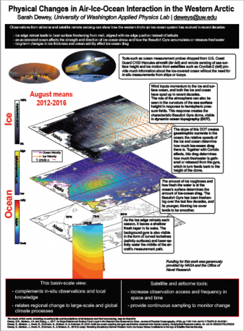
As sea ice cover has declined in the western Arctic Ocean, the way in which atmosphere, ocean, and ice interact has also changed. The Beaufort Sea north of Alaska is an optimal location to study these changes, because of the dramatic degree of its seasonal ice retreat and because of its high freshwater content relative to the rest of the Arctic Ocean. This freshwater, water less saline than a regional average, can affect local and global climate because of its influence on ocean circulation and sea ice formation.
We examine the Beaufort Sea mechanical air-ice-ocean system by looking at this freshwater, using buoy, airborne, and satellite measurements as well as computer models.
This work has three sections: The first looks at the vertical, or how sea ice melt and freeze-up affect the freshwater in the upper ocean. The second assesses how the relative drift speeds of ocean and ice can move freshwater horizontally. The final section looks at this ice-ocean interface again, using modern observations to evaluate decades-old assumptions about dynamical calculations.
Through this work we can provide a three-dimensional, updated description of how the Beaufort Sea surface physical system operates and transports freshwater, especially under recently diminished ice cover.
Piloting sUAS for Marine Mammal Monitoring: A Collaboration Between Tribal and Federal Governments

The Aleut Community of St. Paul Island Tribal Government has recently invested in training and equipment for the use of small unmanned aircraft systems (sUAS) in a variety of research and monitoring projects in the remote Pribilof Islands, Alaska. In collaboration with NOAA Alaska Fisheries Science Center and Duke Marine Robotics and Remote Sensing Laboratory, we investigated implementing sUAS surveys for the historically understudied Pribilofs stock of isuĝin (harbor seals; Phoca vitulina). Isuĝin have been an important subsistence resource for millennia and an unknown level of harvest has been sustained since the islands were permanently settled in the late 1700s. Areas of interest were chosen based on traditional knowledge from hunters and few historical waypoints. We used land- and boat-based sUAS surveys, advanced flight planning software that enabled customized transect capabilities and maximized data quality and output by experimenting with photographic settings. By combining local and traditional knowledge and western science to inform monitoring protocols, we produced high quality, reproducible products and a standardized but adaptable procedure. This pilot project provided a positive experience and resulted in increased local support for responsible monitoring and management of isuĝin in the Pribilof Islands.
Providing Science to Support Communities Across Arctic Alaska
Given the immense scale and rapid pace of Arctic change, effective approaches for the generation and exchange of information are critical for promoting community resilience and increasing adaptive capacity. Here we examine a suite of efforts drawn from across Arctic and near-Arctic Alaska and discuss how elements of these programs facilitate knowledge co-production, while also increasing the likelihood of high-quality science informing resource management and policy. Specific examples considered here fall into two broad categories: locally guided community engagement, and citizen- or stakeholder-led science. Case studies related to community engagement focus on processes for building trust and creating pathways for information exchange among various Alaska Native groups, including tribes, state and federal agencies, and community members. We will also highlight novel roles for agency staff embedded within these communities. Likewise, we consider a variety of programs where community members partner with state and federal scientists to fill crucial data gaps, and how these activities can be tailored to best meet the needs of both the citizen scientists and professional researchers involved.
Quantifying Changes in the Surface Mass Balance of the Greenland Ice Sheet via a Novel Data Assimilation and Modeling Approach
The Greenland ice sheet (GrIS) has been the focus of climate studies due to its considerable impact on sea level rise. Accurate estimates of surface mass fluxes would contribute to understanding the cause of its recent changes and would help to better estimate the future contribution of the GrIS to sea level rise. In situ measurement provides direct estimates of the SMB, but are inherently limited by their spatial extent and representativeness. Physically based regional climate models (RCMs) are critical for understanding GrIS physical processes. However, their results are highly uncertain. Remote sensing (RS) contain valuable information but the links between RS data and the SMB terms are most often indirect and implicit. Given the lack of in situ information, imperfect models, and under-utilized RS data it is critical to merge the available data in a systematic way to better characterize the spatial and temporal variation of the GrIS SMB.
This work proposes a data assimilation framework that yields SMB estimates that benefit from a state-of-the-art snow/ice model (Crocus) and an albedo product. Comparison of our results against in-situ SMB measurements from the Kangerlussuaq transect shows that assimilation of the albedo product reduces the root mean square error (RMSE) of the posterior estimates of SMB from 1240 millimeter water equivalent (mmWE/yr) to 230 mmWE/yr and reduces the bias from 1140 mmWE/yr to -20 mmWE/yr.
Rapid Cryospheric Change in the Arctic Intimately Linked to Complex Earth and Life Systems

Arctic land ice is melting, sea ice is declining, and permafrost is thawing. While often studied or spoken about as individual environmental components, these elements are actually interconnected. Many physical system interactions lead to accelerated rates of change. The result is more rapid Arctic change, and more far-reaching impacts. Impacts are spread across the human-environment system, from infrastructure to natural systems, cultures to security, and including people, economics, flora, and fauna both inside and outside of the Arctic. Arctic changes are increasing sea levels globally, worsening storm and hurricane impacts in polar and temperate latitudes, and causing further exacerbation of warming by darkening vast areas of the far north (shorter snow-cover and ice-cover seasons). Coastal communities are already experiencing these effects, including more frequent flooding, drinking water contamination, and coastal erosion. In this poster, we emphasize the interconnected relationships among changing Arctic environmental elements and among Arctic environmental changes and impacts experienced in coastal communities within the U.S. and across the globe. We also emphasize the importance of human decision making and action in mitigating future impacts, and adapting to current forecasts of change.
Refractory Black Carbon and Spectral Albedo Observations of a Range Sea Ice Surface Types of the Chuckchi Sea

Black carbon (BC) comes from the incomplete combustion of biomass and fossil fuels. When deposited on snow and sea ice, the dark BC aerosols absorb more solar radiation than the surrounding snow/ice surface. Therefore, BC deposition on sea ice causes a reduction in surface albedo, enhanced melt and potential for overall sea ice mass loss. Fluxes in deposition of BC to sea ice may increase in the future; waning sea ice is opening up new shipping routes resulting in increased shipping emissions. Additionally, Arctic wildfires may increase in frequency, intensity, and duration. In August 2018, snow on sea ice samples were collected for refractory black carbon (rBC) analysis by Single Particle Soot Photometer (SP2) in ~65 locations in the Chucki Sea. Preliminary results show increased BC concentrations closer to the ship as well as higher concentrations in aged snow versus fresh snow. Corresponding surface spectral albedo measurements were also collected with the rBC snow samples, as well as across a range of sea ice surfaces. Sea ice surface types include fresh snow, aged snow, bare ice, as well as frozen, open and refreezing melt ponds. Along with comparing surface spectral albedo and rBC concentrations, the albedo data are providing ground-based inputs for spectral un-mixing of sea ice surfaces via MODIS. Sea ice floe back trajectories and global aerosol model estimates of aerosol optical depth (AOD) are also being compared to ground-based rBC-snow concentrations to characterize BC sources as well as BC-fluxes to the sea ice surface.
Responding to Sea Level Rise Requires More Active Engagement Between Scientists and Stakeholders

Successful planning for and adaptation to sea level rise requires complex decisions by local to national stakeholders and decision makers. These investments and planning efforts should be informed by scientific research on the rate, magnitude, and location of sea level rise, including understanding the range and uncertainty in different types of sea level projections. Coordination between scientific and stakeholder communities, however, is inconsistent across the U.S., and best practices have not been established or applied outside of small regional contexts. The SEARCH Land Ice Action Team and key partners are working together to improve scientist-stakeholder engagement to produce actionable sea level rise science and use co-production to better link science and decision-making. Activities include scientists attending practitioner meetings (e.g., the National Adaptation Forum), working directly with communities to build capacity for the use of probabilistic sea level rise projections, and developing direct relationships between scientists and diverse stakeholders for on-the-ground sea level rise adaptation investments. Looking forward, our group is working with the National Academies to develop a workshop series and summit on sea level rise, focused on building scientist-stakeholder connections, and to use co-production strategies from the proposal planning stage to implementation across multiple organizations.
Revised Principles for Conducting Research in the Arctic: Respecting Local Culture and Knowledge

Researchers working in the Arctic have a responsibility to respect local culture and knowledge and advance stewardship of the Arctic environment. The original principles, released in 1990, have been revised to provide guidelines for the conduct of research, to better align with U.S. Arctic policy, to incorporate the latest advances in research methods, and to reflect expanded research efforts and disciplinary breadth in a rapidly changing Arctic. A U.S. Interagency Arctic Research Policy Committee (IARPC) Principles Revision Working Group prepared these Principles after seeking and receiving diverse input from Federal, State, and local agency representatives, Alaska Native people and organizations, academic organizations and individual researchers through outreach efforts, listening sessions, and two Federal Register open comment periods. The core Principles for Conducting Research in the Arctic are: Be Accountable, Establish Effective Communication, Respect Indigenous Knowledge and Cultures, Build and Sustain Relationships and Pursue Responsible Environmental Stewardship. This poster presentation will provide more details on the Principles with some examples of best practices.
Right to Self Determination: Coproduction of Knowledge

The rapid decrease in Arctic sea ice is leaving coastal communities vulnerable to powerful coastal storms resulting in erosion, flooding, permafrost thaw, and ground collapse (i.e., usteq). These impacts can be life threatening and cause Alaska Native communities to choose to relocate. To reduce the challenges of relocation, it is critical for communities to have access to relevant co-produced resources needed to develop a well-informed and integrated adaptation strategy. Through collaboration among Indigenous knowledge holders and scientists, we are advancing understanding of usteq and its effects on natural environments, built environments, and social systems, and developing a toolset to help determine whether and when relocation needs to occur. This work recognizes that: 1) adaptation decision making must be based on Indigenous frameworks of knowledge if they are to be relevant to Indigenous communities; 2) a multi-hazard analysis requiring interdisciplinary collaboration based on co-production of knowledge is critical to relay risk, because no single hazard operates on its own; 3) the social impacts and thresholds for environmental change are just as integral to adaptation decision making as physical indicators; and, therefore, 4) an adaptation decision-making framework requires the integration and consideration of both social and physical impacts and indicators.
Sand Resources Are Running out Worldwide, Except in Greenland

Greenland Ice sheet dynamics grind down bedrock and produce large amounts of sediment. Recent field observations and satellite data reconstructions show that glacial meltwater carries an estimated 8% of the world’s river sediment flux. Along the coast these sediments accumulate in sandy deltas. Comparison of an archive of WWII aerial photos with satellite imagery demonstrates that these deltas are rapidly expanding.
This abundance of sediment is in stark contrast to the rapid depletion of sand resources globally. The worldwide demand for sand has grown exponentially; largely due to urbanization, infrastructure and coastal protection improvements.
Here, we ask whether abundance of sand and gravel in Greenland could provide an opportunity for Greenland to become an exporter of aggregates and relieve an increasing global demand? Greenland seeks to diversify its economy, and has emphasized an economic development strategy focused on new mining industry. The magnitude of sand delivery to the coastal zones by Greenland Ice meltwater is significant and thus of potential value for the Greenlandic economy. However, a great deal of uncertainty exists around what impacts sand mining would have on the local environment and communities. Future research with Greenlandic government and industry partners will be essential to document the persistence and quality of sand delivered to the coast and how sand mining impacts local ecosystems and associated ecosystem services.
Scientific Community Engagement for the Arctic-Boreal Vulnerability Experiment (ABoVE) to Facilitate Interdisciplinary Collaboration
Scientific community engagement can facilitate interdisciplinary collaboration by creating virtual and real spaces for interaction, leveraging resources to reduce barriers to research implementation, and encouraging the development of synthetic research questions. NASA’s Arctic-Boreal Vulnerability Experiment (ABoVE) is a large, multi-disciplinary field campaign that has resulted in 100+ papers since 2015. The work of the Carbon Cycle and Ecosystems (CCE) Office, along with the Science Team leads Goetz and Miller, enables the success of the ABoVE Science Team. In addition to annual Science Team meetings, there are several active working groups focused on scientific themes and identification of common data, metadata, and data product standards, as well as ad hoc groups addressing more specialized and focused needs. The CCE Office has partnered with the NASA Center for Climate Simulation to create the ABoVE Science Cloud, a platform that provides a shared set of computational and data resources, including large, common data sets like satellite products. The logistics support provided to Science Team members allows for optimization of field activities and ensures the safety of project participants. By lowering the barriers to participation and collaboration, the CCE Office and the Science Team Leads create opportunities for collaboration and scientific advancement.
Sea Ice and the Alaska Transportable Array

The northern coastal seismic stations of the National Science Foundation EarthScope Alaska Transportable Array (www.usarray.org/Alaska) are well-positioned to record the seismic excitation arising from seasonal changes in formation and break-up of Arctic Ocean sea ice. Seismic noise levels around 1 Hz at these stations anticorrelate strongly with satellite estimates of sea ice concentration near seismic stations. The reduction in noise is especially apparent during the formation of local near-shore ice. For example, station A36M exhibits an earlier drop in noise than A19K (which is further to the southwest where sea ice forms later in the season). We hypothesize that short-period shore breaking waves create seismic waves in the 1 Hz frequency and that this signal is attenuated when ice growth is sufficient to attenuate ocean waves. We examine data from multiple stations recording multiple cycles of sea ice formation along with near-shore ice conditions from remote sensing and in-situ observations to better understand the effect of sea ice on seismic noise and evaluate usefulness of the seismic data for documenting the interactions of waves and the arctic coastal environment.
Serving Policymakers with Science via ‘Arctic Answers’
Policymakers consider scientific understanding and forecasts among other concerns in decision making. As the Arctic environment rapidly changes, policymakers increasingly need succinct, clear, and authoritative answers to specific questions about Arctic environments. The Study of Environmental Arctic Change (SEARCH) addresses the need with Arctic Answers, 1- to 2-page briefs written by scientific experts, reviewed by peers for scientific accuracy, and edited for clarity by non-scientists. Arctic Answers are contributions from the Arctic research community orchestrated by SEARCH. Each Arctic Answer states why the issue is important, the state of scientific knowledge on the topic, and a comment on where the science on that issue is headed. Each Arctic Answer also includes contact information for topic experts and access to reports and papers providing additional information. All Arctic Answers are hosted on the web, and SEARCH is responsive to policymaker requests for new Arctic Answers on specific topics. The goal of Arctic Answers is to ensure that the latest scientific knowledge is available to policymakers in an easy, usable format, enhancing their decision-making capability.
Sharing What We Know - Arctic Research Collaboration the Fram – High North Research Centre for Climate and the Environment - an Effective Novel Approach?

The FRAM Centre consists of 21 Norwegian institutions collaborating across diverse scientific fields. The Centre actively initiates interdisciplinary research and outreach across the fields of natural sciences, technology and social sciences.
The FRAM Centre’s mandate is the provision, to Norwegian Policy Makers, of resources necessary for the management of climate, environment and cultural/human resources in the High North.
The FRAM Centre building and support services provides a physically close environment for many institutions and is based in close proximity to the geographical areas in question whilst good transport links facilitate international cooperation.
The FRAM High North Research Centre collaboration is based around:
• Effects of climate change on sea and coastal ecology in the Arctic
• Effects of climate change on terrestrial ecosystems, landscapes, society and indigenous peoples in the High North
• Hazardous substances – effects on ecosystems and human health
• Environmental consequences of industrial development in the North (MIKON)
• Ocean acidification and ecosystem effects in northern waters
• Sea ice in the Arctic Ocean, Technology and Governance
Enabling cross-disciplinary collaboration, in order to facilitate greater understanding of the Arctic climate, is vital when attempting to fulfill the UN’s sustainable development goals.
Smart Educative Tools for Climate Change Action: A Case Study

Scandinavian Lapland which is the most densely populated area north of Arctic Circle, is vulnerable to climate change due to its latitudinal location and polar amplification caused by climate feedbacks. The understanding among local population about these changes and its associated impacts is important for adaptation and building resilience, particularly when the denial of climate change is spreading vigorously. The present work is a learning and knowledge co-creation assignment with focus on local and regional consequences of climate change. As climate change researchers we work with Swedish Secondary and High School teachers and students (13-16 years old) to get familiar with our research methods and techniques for quantifying the climate change. The experience planned as a real research project focuses on training the students and teachers to understand the climate change evidences based on long-term observed meteorological data from local weather station in association to the observed changes in local landscapes using GoogleEarth, gathered to palliate some local effect of the regional phenomenon. The program is implemented in Kråkbergsskolan, Luleå, Sweden with 17 students. A questionnaire-based survey was carried out to track the change in the knowledge, understanding and perception of the students about climate change and associated impacts.
Solar Energy to Take off in the Arctic

This poster will call attention to the gap in knowledge between solar energy and sustainable industrial development in the Arctic. Our research aims to unlock the full potential of solar energy above the Arctic Circle by identifying the unique obstacles and opportunities that new solar installations will face in the far north. We believe that expanding the development of these technologies will benefit not only the local communities, who are currently enduring some of the highest energy costs in the country, but also boost energy intensive sectors such as the oil and gas industry. Some of the novel challenges facing new solar installations in the north include panel degradation from inclement weather, and reduced solar collection due to partial shading by the surrounding terrain topology. We will share our findings on innovative operating solutions like maximum energy tracking of the sun’s seasonal arc in the higher latitudes to fully benefit from long summer days and high albedo. The energy economy is beginning to shift in favor of more solar integration, by defining a complementary role for renewable power in concert with the petroleum industry we can meet the unique energy demands of the Arctic today and well into the future.
Students on Ice: Building the Next Generation of Leaders in the Arctic

The Students on Ice (SOI) Foundation is an award-winning organization that takes youth aged 14-24 from around the world on educational expeditions to the Arctic. SOI strives to instill a thorough understanding of the Arctic, its history and complexities, in the next generation of leaders to set a high standard for sustainable development, healthy communities and environmental stewardship.
SOI uses an experiential education approach that is:
· Place-based & immersive
· Interdisciplinary
· Inquiry-based & student-centred
Place-based learning harnesses the power of place to teach us. Rooted in the history, environment, culture, and art of a particular place, it emphasizes engagement, authenticity and the use of all senses.
Interdisciplinarity is about studying a subject from multiple perspectives, and SOI expeditions include upwards of 80 staff with diverse experiences and expertise to help youth do exactly that. For example, while a scientist might teach about the pathology of a disease and its impact on a species, an Inuit elder might share more about the impact on local people’s ability to hunt.
SOI seeks to awaken and feed the natural curiosity of youth. The natural environment, and the diversity of participants, inspires change-oriented learning. The goal is to stimulate curiosity and arm participants with foundational understanding of complex issues, plus the tools to grow this understanding.
Successes and Challenges of Interdisciplinary Ocean Acidification Research and Monitoring in Alaska: An Integrated Approach for Supporting the Alaskan Blue Economy
Ocean acidification is rapidly advancing in the Arctic, producing newly corrosive conditions and shoaling saturation horizons. Given that acidification is occurring in important habitat for commercial and subsistence fisheries, this could eventually cause cascading economic echoes around the Nation. In response to this vulnerability, the NOAA Alaska Fisheries Science Center and the Pacific Marine Environmental laboratory formed a novel partnership that combined monitoring and observations with species response studies, OA forecasting models, and human impact assessments. This interdisciplinary scaled approach has resulted in an adaptive, efficient research portfolio that addresses emerging stakeholder needs as understanding of Alaskan acidification evolves. We have successfully connected acidification vulnerabilities with decision makers, enabling an extensive economic vulnerability assessment of Alaskan communities and economic consequences for important commercial species. We highlight these successes to show the potential of this interdisciplinary model for Arctic observing needs, especially as culturally and commercially important fish populations move northward into acidifying Arctic territory, and new programs such as the Distributed Biological Observatory (DBO), the Synoptic Arctic Survey (SAS), and Fish Stocks in the Central Arctic Ocean (FiSCAO) emerge.
The Arctic 21 Network

Arctic 21 is an informal network that seeks to communicate to policymakers and the public the unraveling of the arctic due to climate change. Initially founded on the advent of the U.S. Chairmanship of the Arctic Council from 2015-2017, the network emerged to support the Obama Administration’s decision to make climate change a focus of its chairmanship. Since that time, the network has grown to more than 200 organizations and individuals.
The network urges the political consideration of an essential question: ‘What is the Arctic we have to have to protect the global climate system?” In encouraging consideration of the required end state of the Arctic, the network focuses on crumbling pillars of the global climate system: loss of sea ice, permafrost thaw, spring snow cover decline, and ice mass loss from Greenland and high latitude glaciers.
By communicating across the Arctic 21 network research on the decline of these pillars and the international policy that governs the Arctic, Arctic 21 and its individual participants seek to raise the profile of important climate developments among the public and governments. Arctic 21 also conducts regular briefings on key scientific and diplomatic issues to educate its participants and outside policymakers.
The Arctic Observing Viewer: A Tool for Data Discovery, Visualization, Strategic Planning, and Decision Support for Arctic Observing
To better assess development in Arctic Observing and research efforts made by NSF AON, US AON, SAON, and related initiatives, enhancements to the Arctic Observing Viewer (AOV) web mapping application has been published. This resource and information system communicates the who, what, where, and when of data collection sites across the Arctic. Over 31,000 sites are documented, including a range of boreholes, ship tracks, buoys, towers, sampling stations, sensor networks, plots, stream gauges, ice cores, observatories, and more. Contributing partners include the US NSF and related Arctic Data Center, NOAA, ADIwg, AOOS, a2dc, CAFF, GINA, IASOA, INTERACT, NASA ABoVE, and USGS. Users have basic GIS capabilities such as visualize, navigate, select, search, draw, print, view details, and follow links to obtain a comprehensive perspective of environmental monitoring efforts. Recent updates include improved search tool with free text queries, auto-complete, and filters. AOV complements other distributed cyber resources and helps science planners, funding agencies, investigators, data specialists, and citizens to: assess status, identify overlap, fill gaps, optimize sampling design, refine network performance, clarify directions, access data, coordinate logistics, educate communities and spark collaborations to meet Arctic Observing goals. AOV compliments the Arctic Research Mapping Application (armap.org).
The Arctic Research Mapping Application (ARMAP): a Geoportal for Visualizing Project-level Information about U.S. Funded Research in the Arctic
The Arctic Research Mapping Application (ARMAP; http://armap.org) is a suite of online applications and data services that support Arctic science by providing project tracking information (who is doing what, when and where in the region) for United States Government funded projects. In collaboration with 17 research agencies, project locations are displayed in a web mapping application. Key information about each project is presented along with links that provide additional information, including data where possible. The latest ARMAP iteration has improvements to the front-end user interface including revamped search tools; a new heat map visualization that provides a clear image of where field projects are concentrated; a companion application with 3D visualization plus new reference layers and updated ship track information. On the back-end, the application incorporates improved search algorithms and filtering capabilities to support a higher volume of data without affecting performance. An upgrade to SOLR version 7.4.0 has also optimized performance and user experience. Refinements to the ISO 19115-1 metadata web service have allowed for greater collaboration with international logistics providers. These improvements have been made to improve discoverability, enhance logistics coordination, identify geographic gaps in research/observation effort, and foster enhanced collaboration among the research community.
The Cultural and Climate Importance of Abrupt Permafrost Thaw
Thawing permafrost affects northern communities through changes in infrastructure, on-the-land activities, food security, and cultural resources. Carbon release from thawing permafrost also is a key uncertainty in projecting future climate. Large scale models representing permafrost carbon release assume that the soil will thaw from the surface gradually over decades to centuries. Yet abrupt state changes are occurring in ice-rich permafrost triggering surface collapse, erosion, landslides, and expanding thaw lakes. We are combining field measurements, spatial analysis, and modeling to improve predictions of when and where abrupt permafrost thaw will occur. Less than 20% of the entire permafrost region is affected by abrupt thaw. However, these areas are disproportionately carbon-rich, meaning that abrupt thaw could affect more than half of all permafrost carbon. As a result, despite affecting a limited amount of land, abrupt thaw could provide a similar climate feedback as gradual thaw emissions across the entire permafrost region. Spatial datasets and models used for carbon-release estimates can be modified for assessing community hazards and risks associated with abrupt thaw. Using community-engaged scholarship, we demonstrate how scientific and local knowledge can work together to determine the risks associated with changing permafrost.
The Exchange for Local Observations and Knowledge of the Arctic (ELOKA): Supporting Arctic Communities in Stewarding Indigenous Knowledge and Data
The Exchange for Local Observations and Knowledge of the Arctic (ELOKA) fosters collaboration between Indigenous Arctic communities and visiting researchers to facilitate the collection, preservation, exchange, and use of local observations and Indigenous knowledge of the Arctic. ELOKA provides data management and user support to Indigenous communities to ensure their knowledge and data are managed, visualized, and shared in an ethical manner in order to work toward information and data sovereignty for Arctic residents. The co-development of online tools and other dissemination products ensures that Indigenous knowledge and data are shared in ways and with audiences defined by community partners. Current ELOKA collaborations focus on traditional place name documentation, Indigenous food systems, and environmental monitoring. By working together and recognizing multiple ways of knowing, Arctic residents and researchers can make significant contributions to a deeper understanding of the Arctic and the social and environmental changes ongoing in the region. ELOKA is a program at the National Snow and Ice Data Center funded by the National Science Program.
The Interagency Arctic Research Policy Committee: Facilitating Communication and Collaboration Across Boundaries.

Over the past decade or so, social media technology has emerged as a powerful tool for connecting people from different locations, backgrounds, and interests. The Interagency Arctic Research Policy Committee (IARPC) has harnessed this tool to accelerate the pace of Arctic research. The IARPC Collaborations website (www.iarpccollaborations.org) was originally developed to support collaborative implementation of the Interagency Arctic Research Policy Committee’s (IARPC) 5-Year Plan for Arctic Research. With a growing emphasis on enabling transparent and inclusive communication and collaboration, the website connects nearly 2000 Arctic researchers and stakeholders from State, academic, NGO, industry, indigenous and international organizations to share their work and form new collaborations. The IARPC Collaborations community supports teams focused on various disciplines in Arctic research but also teams focused on expanding the impact of Arctic research, such as the Science Communication Forum, Arctic STEM Education Group, and Diversity & Inclusion Group. This poster will demonstrate the power of an interactive website to bring together the research community to tackle tough issues.
The Nansen Legacy

An ice-free Arctic is gradually emerging, and it is imperative for the Norwegian research community to rise the scientific and exploratory legacy of Fridtjof Nansen. New activities require a knowledge based sustainable management in the northern Barents Sea. To understand complex couplings between atmosphere, sea ice, ocean currents and ecosystems, Arctic expertise from ten research institutions has initiated a historic collaboration. Over six years, scientists will work across disciplines and institutions to provide knowledge on how the marine ecosystem respond to climate and human activities. A climatic gradient through the Barents Sea, from ice-free waters in the south to an ice-covered Arctic basin in the north is investigated on a seasonal, annual and geological time scales. The goal is to understand how the physical environment function and impact the ecosystem in the past, present and in future scenarios.
The Nansen Legacy will educate 50 new Polar researchers, and engage users like laymen, youth, stakeholders and policy makers to discuss status and changes in the Arctic.
The Nansen Legacy is a partnership between the Universities in Oslo, Bergen, Trondheim and Tromsø, UNIS, Institute of Marine Research, Norwegian Polar Institute, Meteorological Institute, Nansen Environmental Remote Sensing Center and Akvaplan-Niva.
The Shrinking Arctic Mirror Affects Us All

Over the past four decades, we have witnessed the disappearance of half of the Arctic's summer sea-ice cover and over 10% of the northern hemisphere's spring snow cover owing to extra heat trapped by rising greenhouse gas concentrations and deposition of soot particles on the snow/ice surface. Although the Arctic seems distant and removed from life in mid-latitudes, this loss of the Earth's "mirror" affects us all. More of the sun's energy now is absorbed by the climate system rather than being reflected back to space, which is increasing global warming by 25-40%. The Arctic itself is warming at two-to-three times the rate of areas farther south, which is accelerating permafrost thaw and serving up a buffet of once-frozen organic matter for microbes to devour, releasing yet more carbon into the atmosphere. Glaciers and ice sheets are also melting faster, leading to accelerating sea-level rise, and Arctic warming is affecting weather patterns all around the northern hemisphere, contributing to an uptick in extreme weather events. What happens in the Arctic doesn't stay in the Arctic!
The Study on the Priority on the Arctic Challenges in Policy Perspectives of Korea

After gaining the Arctic Council Observer status in 2013, the Korean Government established the 1st Masterplan for the Arctic policy (2013-2017) as a follow-up action in the same year. The 2nd Masterplan for the second term (2018-2022) was adopted in July, 2018.
Then, the Ministry of Ocean and Fishery (MOF) declared a statement during the Arctic Partnership Week in December, 2018 on the “2050 Polar Vision” to provide a long-term Arctic policy vision.
This study reviews Korea’s Arctic Policies in terms of historical perspectives, and analyzed the 1st Masterplan (2013) and the 2nd Masterplan (2018) from the vision to action-plans. Korea’s Arctic Policy Model is developed considering common features between two masterplans.
As the next step, through domestic expert-questionnaire analysis, the study tried to set the priority on the arctic challenges including Climate Change, Ecosystem Change, and Arctic Shipping, and suggests Korea’s future Arctic policy directions. And based on the expert-questionnaire result, the study suggests what kinds of project have the priorities and can provide the implications and ideas to the Arctic policy-makers in Korea for setting the the next Arctic masterplans.
The Swedish Polar Research Process: Linking Science, Society and Technology Through Research Design
The Polar Regions are undergoing rapid transformations with consequences to ecosystems, societies, possibilities for economic activities and the global climate system. Multiple scientific and political compilation reports have underlined how the responses to the societal and environmental concerns associated with these changes require increased international coordination of polar research. Yet, the management of research infrastructure in the Arctic remains largely a national effort. In order to overcome these boundaries and to fulfill the scientific and political needs of polar research the Swedish Polar Research Secretariat is developing a new model for its research coordination. Because of the strengths of the Swedish polar research infrastructure the core of this process is formed by maritime expeditions. The details of these expeditions are negotiated through open planning workshops and stakeholder engagement, which are used to couple the expedition to a wider overarching theme such as sea level change. This theme is then used to connect the expedition-based research to disciplinary questions outside of its scope in e.g. humanities, social, terrestrial, atmospheric and technical sciences. The end products of this coordination are both disciplinary publications and a synthesis report within the theme aimed at the more general audience. In sum, the Polar Research Process aims to better both, the understanding of how polar research is embedded in society and to further facilitate knowledge-based decision-making.
The Terminology of Local and Collaborative Arctic Research: Primers from the Exchange for Local Observations and Knowledge of the Arctic (ELOKA) Program
Arctic research has no shortage of terminology. Some terms are specific to a particular discipline, while others are used to characterize emerging priorities across research communities and, as a result, develop varied meanings. A common understanding of terminology is critical for effective communication, while mismatches in understanding may inadvertently misalign priorities or erode trust. Such challenges exist within communication surrounding local and collaborative arctic research, particularly projects with Indigenous communities. For example, “knowledge co-production” is widely used to describe collaboration across different disciplines or knowledge systems. However, some members of the Arctic research community remain unaware of this term, while for others, it envelopes an array of related concepts—relationship building, co-defining of objectives, reciprocity, and knowledge and data sovereignty.
This poster by the Exchange for Local Observations and Knowledge of the Arctic (ELOKA) will distribute short 1-2 page primers with useful definitions and examples for: (1) knowledge co-production; (2) Arctic community-based monitoring; (3) Indigenous knowledge and data sovereignty; and (4) data interoperability. ELOKA, a program at the National Snow and Ice Data Center, fosters collaboration between Indigenous Arctic communities and visiting researchers to facilitate the collection, preservation, exchange, and use of local observations and Indigenous knowledge of the Arctic.
The Vulnerability of Permafrost Carbon to Climate Change: Key Findings from a Decade of Synthesis
Substantial carbon release from the Arctic is a wildcard that could alter the future trajectory of climate change. A key societal question is whether there are global carbon cycle surprises that will make climate change effects such as sea-level rise, extreme weather, droughts, and impacts on agriculture occur faster than currently projected by models. Permafrost carbon, the remnants of plants, microbes, and animals accumulated in perennially frozen Arctic soil over thousands of years, currently holds twice as much carbon as the atmosphere. Release of just a fraction of this frozen carbon as the greenhouse gases carbon dioxide and methane into the atmosphere could speed future warming. The Permafrost Carbon Network is an effort designed to bring ideas and people together to create new knowledge on this topic through science synthesis. Following the current trajectory of warming, 5% to 15% of the soil carbon stored in the northern circumpolar permafrost zone (mean 10% value equal to 146 to 160 billion tons carbon) is considered vulnerable to release by the year 2100. These future carbon emission levels would be a significant fraction of those projected from fossil fuels with implications for allowable carbon budgets that are consistent with limiting global warming.
To Excel at Interdisciplinary Research, Dedicate Resources for Collaboration and Communication
The North Pacific Research Board (NPRB) was created by Congress in 1997 to fund cooperative marine research that addresses pressing fishery management needs and marine ecosystem information needs in the Gulf of Alaska, Bering Sea, and Arctic Ocean. The NPRB funds research, and the infrastructure required for research, including tools for collaboration across disciplines. Since 2002, the NPRB has worked with the Secretary of Commerce to grant over $120 million for research to universities, federal and state agencies, Alaska Native organizations and others.
The big idea the NPRB will present at Arctic Futures 2050 is that dedicated resources for collaboration and communication are essential for excellent interdisciplinary research. NPRB will draw on our current Arctic Integrated Ecosystem Research Program (the “Arctic Program”), which involves over two-dozen principal investigators and dozens of additional researchers, to present lessons on how to:
• provide essential support and cultivate strong teams through annual planning and logistics meetings and regular communications;
• include all researchers, including Alaska Native team members, in creating and refining research questions;
• develop cruise communications protocols for affected and interested communities;
• communicate preliminary research results through social and other multimedia, and tailored presentations to scientists, communities, and policymakers;
• leverage resources by connecting researchers within and external to the NPRB Arctic Program to assets such as ship time, data, and colleagues who can complement their disciplinary expertise; and
• prepare researchers to use the integrated ecosystem research approach to pursue interdisciplinary work in other settings.
Towards Reducing the Gap Between Stakeholder Needs and Seasonal Sea Ice Outlooks

The Sea Ice Prediction Network-Phase 2 (SIPN2; https://www.arcus.org/sipn) Project Team coordinates the contributions to the Sea Ice Outlook with key partners, advances the science of seasonal sea ice predictability, develops new remote sensing products, deepens understanding of Arctic science by the public, and works with the operational marine industry in Alaska and in Europe to identify their sea ice forecasting needs.
Though seasonal forecasting capabilities have advanced in the past two decades, there exists a gap between what stakeholders need and what scientists can provide. There is also a gap between what scientists can provide and the products and formats stakeholders may find useful (1). SIPN2 is applying collaborative approaches to reduce this gap by advancing and communicating the science of seasonal predictability together with a better understanding stakeholder needs.
(1) Wagner, Penelope, Nick Hughes, Pascale Bourbonnais, Julienne Stroeve, Lasse Rabenstein, Uma Bhatt, Joe Little, and Helen Wiggins, 2019: Sea-ice Information and Forecast Needs for Industry Maritime Stakeholders, (in revision) Polar Geography.
Tracing Freshwater in the Arctic Ocean
Since the Arctic freshwater system has been hypothesized to have a significant impact on the global climate in the early 50s, it became an object of great scientific interest. These studies were based on the water, salt and heat balance of the Arctic Ocean system, until Östlund and Hut (1984) proposed combining salinity and oxygen isotopes of water to distinguish between river runoff, sea ice meltwater, and Atlantic Water fractions. The governing principle of the method is the specific oxygen isotope fractionation during evaporation and sea ice formation, that results in the isotopic depletion of high latitude rain and enrichment of the heavier oxygen isotope in sea ice. In my research I use river organics to assess the performance of the widely-used water fractionation technique. We bring together the advances in organic geochemistry, optical properties, and water fraction calculation based on oxygen isotope analysis. We propose a modified approach to freshwater fractions analysis based on Chromophoric Dissolved Organic Matter (CDOM), oxygen isotopes, and salinity, to explore the role of freezing/thawing cycles for the circulation and water mass modifications in the Arctic Ocean.
U.S. Arctic Research Policy: Myths and Realities

The Arctic Research and Policy Act of 1984 (ARPA), P.L. 98-373, established the Arctic Research Commission (the Commission) and the Interagency Arctic Research Policy Committee (IARPC) to work together to develop and recommend an integrated national Arctic research policy and establish a national Arctic research plan to implement the policy. While the law lays out specific actions and activities for the Commission and IARPC, in practice the science-for-policy-making process and its counterpart—how policies affect science—are messy and complicated. It involves bringing together over 16 different federal entities to absorb input from the Commission, the State of Alaska, local and indigenous organization, the academic community, and the public to produce and implement a five-year Arctic Research Plan. It requires strong leadership from the National Science and Technology Council of the Office of Science and Technology Policy to articulate Administration goals, as well as trust and strong relationships between federal entities supporting the research. Agency missions and budgets strongly influence the priority-setting process, but these are continually changing and evolving as new scientific results inform decision making. This poster will describe the challenges and opportunities of interagency research coordination, examples of science informing decision making, and the benefits of agencies working together to accomplish more as a group than any one agency can do on its own.
Understanding and Responding to Changing Sea Ice Conditions in Northern Communities
Indigenous people in the Arctic depend for their subsistence on food from the land. This means traveling on the land and ice. Changes in weather and sea ice are making travel dangerous as sea ice is freezing up later and breaking up earlier. The ice is thinner now and is more mobile, easier to pile into ridges, and more susceptible to drifting away due to high winds. Indigenous people find that indigenous ways of knowing are not always helpful to predict sea ice conditions in the face of these changing environmental parameters. Residents have an interest in obtaining better ice information, training on how to use what information is currently available on the internet, and working with federal weather and ice forecasting services on developing new products.
The Canadian Ice Service is partnering with the University of Victoria to work with residents from Ulukhaktok, Tuktoyaktuk and Sachs Harbour in the Inuvialuit region and in Gjoa Haven, Kugluktuk and Cambridge Bay in Nunavut, to collaborate on a pilot project to document and respond to these ice information needs with a view to inform policy and to evaluate what is currently available from government agencies. The intent is to identify relevant delivery methods and develop prototype products and delivery methods and to include Indigenous knowledge in the Canadian Ice Service 1991-2020 climate normals that will be released at the end of this project.
Understanding Peat Expansion in Arctic Tundra in a Warming Climate (TundraPEAT)
This presentation will provide an overview of a new 5-year project, funded by US NSF’s Macrosystem Biology program and Big Idea Navigating the New Arctic, to understand peat expansion in Arctic tundra. Amplified climate warming in the Arctic in recent decades has caused a multitude of changes in terrestrial ecosystems. In this project, we as a multidisciplinary team of researchers will combine (1) new data collection from multiple tundra sites along the northernmost peat-forming frontiers of the North American Arctic, together with (2) laboratory incubation experiments, (3) a synthesis of existing data from the tundra and boreal biomes, along with a group of international collaborators in Europe and Canada, and (4) ecosystem-scale process model simulations. Our overarching question is: Will the warming Arctic evolve into a peatland-rich landscape, as the boreal zone is now, or are there some essential conditions missing in a warming Arctic that will prevent this? We will use our observational, experimental, and modeling results, along with synthesis products from a coordinated international research network, to test several specific hypotheses. The results will help us understand environmental conditions and processes that control the formation and northward migrations of green peat frontier in a warming Arctic.
Understanding the Arctic Through a Co-Production of Knowledge

The Arctic has been home to Indigenous Peoples from time immemorial. Distinct world views with complex knowledge systems passed on from generation to generation have evolved over time and are still developing in a living process today. Indigenous Peoples knowledge systems encompass both cultural and ecological systems that interlink and support each other. They hold their own methodologies and evaluation processes.
The Arctic environment is changing at an unprecedented rate due to climate change. Concomitant changes in anthropogenic activity (e.g., industrial, economic, philanthropic and conservation interests) are increasing. These interests largely originate from distant locations. These changes present many challenges that don’t equitably include Indigenous Knowledge systems.
Given the complex interactions associated with Arctic change, it is imperative to bring different knowledge systems together in a holistic view to address interests from research, policy and resource management. A holistic view should be informed by knowledge held by Arctic Indigenous Peoples. Indigenous Peoples knowledge systems hold methodologies and assessment processes that provide a pathway for better understanding the Arctic than using a scientific lens alone. There is a strong need to understand multiple drivers and their cumulative impacts using methodologies from both science and Indigenous Peoples knowledge systems. Bringing together multiple knowledge systems and scientific disciplines should be advanced through a co-production of knowledge approach.
A co-production of knowledge approach is increasingly recognized; however, in many instances it is incorrectly applied. We will differentiate co-production of knowledge from a multi-disciplinary approach or multi-evidence based decision-making. Co-production of knowledge will provide the holistic view needed to inform: policy; resource management; and conservation. We underscore the role and value of different knowledge systems with different methodologies and the need for equitable collaborative approaches. Equity is a central concept in a co-production of knowledge framework. In this presentation we will share a conceptual model for a framework for co-production of knowledge. We will discuss the key components related to the process of a co-production of knowledge along with examples. We anticipate an open and respectful dialogue that builds on our collective experience from our Indigenous communities.
Using Real-Time Vessel Tracking Information and Subsistence Harvest Area Data for Decision Support

The Automatic Identification System (AIS) is a real-time network of shipboard transmitters and land- and satellite-based receivers that allow vessel movements to be broadcast from ship to shore or ship to satellite, tracked and recorded. The Alaska Arctic coasts now have an extensive network of these stations, providing real-time information about vessels transiting through Alaska waters. The original purpose of the AIS was to help ships avoid collisions, but many other real-time information applications have since developed. These include maritime security and monitoring, search and rescue, oil spill risk assessments and response, and using historical information for incident investigations. Management agencies and coastal communities in the Arctic are now interested in using historical AIS data records for other applications focused on resource management and oil spill response planning and identifying changing patterns and trends in vessel traffic in an emerging ice-free Arctic.
Historical AIS records, though archived, have not been readily accessible or easy to use for other applications. AIS datasets are also large, making traditional data storage and processing techniques insufficient to deal with the data, even on a local scale. AOOS has now developed a methodology to handle the “big data” issue, which now allows successful repurposing of historical Arctic AIS data records. One project with the Arctic Domain Awareness Center synthesized a 5-year record of AIS vessel tracking data collected by the Marine Exchange of Alaska throughout the U.S. Arctic region. The primary goal was to format data into usable inputs for the model used by NOAA to prioritize ocean mapping and charting efforts. Stakeholder inputs on this project also guided the development of a specialized data portal hosting over 30 data layers for comparison and analysis against this 5-year AIS data record. Another project supported by the National Academy of Sciences synthesized vessel traffic patterns and identified vessel traffic hotspots, and aggregated maps of subsistence harvest areas and species along the Beaufort Sea coast. Using ocean circulation and atmospheric wind models to power oil spill trajectory scenarios, vessel traffic areas with the highest potential impacts to subsistence use can now be identified in advance. Both projects integrate data into an interactive mapping tool hosted by the AOOS data system to increase public knowledge and inform government agency and community decision-making.
Using the Power of Daily Observations to Understand the Timing, Patterns, and Triggers of Plant Life History Events over the Short Arctic Growing Season
The arctic growing season is notably brief, and as a result plant life cycle events, e.g., leafing, flowering, fruiting must occur at a rapid pace. Traditional seasonal measurements of phenology, pollination biology, and physiology have generally focused on weekly or at best twice weekly manual measurements. Given the short growing season, the ability to detect small differences in timing of key seasonal events would be greatly improved with daily measurements. As part of the Arctic Observing Network, the International Tundra Experiment team initiated semi-automated long-term daily to near daily growing-season measurements of spectral reflectance, 3D video, albedo, and surface temperatures across fixed 50 m transects spanning the local hydrological gradient at four sites in Northern Alaska starting in 2011. These daily measurements have enabled precise tracking of peak greenness, daily increases and decreases in greenness in response to specific temperature events and temperature sensitivity differences among sites. Our cross-site transect studies have shown that Normalized Difference Vegetation Index (NDVI), an index of green biomass, is sensitive to daily temperature variation. For example, individual warm days at the end of the growing season as plants senesce temporarily reduce loss of greenness, and at high enough temperatures greenness may even temporarily increase.
We Depend on the Sea: The Importance of Walrus to Little Diomede
The Iŋalit, or people of Little Diomede, maintain a long-standing and complex relationship with walrus. Traditionally, every part of the walrus had its own specific use so that no part was wasted. Walrus meat provides nourishment, the stomach can be made into drums, the hide can be used to make boats, and the tusks can be made into harpoon tips and jewelry, just to name a few of the many uses Diomede people have for walrus. Great cultural value and meaning are attached to walrus, as the community has relied heavily on the harvest of walrus to sustain them for millennia. Although this relationship between Diomede people and walrus has changed over time, walrus remain a critical resource for people on Little Diomede today.
What Does It Take to Move a Community?

As the melting permafrost impacts the Arctic and sea level rise affects communities everywhere, how can communities survive and thrive when they relocate? The Arctic is at the forefront of the need to move communities and others can learn from their experience.
When movement is necessary, what is the process for choosing the new site location? Which stakeholders are involved in decision making? Does the community have cultural or other reasons for the choice? Or is it an administrative/bureaucratic decision independent of community input? What are the issues and impacts to timeframe and cost associated with each approach?
What are the logistics of moving? How will needed Infrastructure—roadways, power grid, pipelines, airstrips, and services—be provided? Who will deliver food and services, and when will they commence at the new location? How long will redundant services be offered in both sites? How will the community create employment opportunities at the new location?
The research focuses on how the issues facing communities displaced by climate change may be mitigated depending on the circumstances of their relocation—whether self-selected and managed or mandated by external factors and decision makers. Other communities can learn from Individual experiences in the Arctic.
What Is 'Arctic' About Arctic Security?

This work will focus on the governance of the Arctic ocean, through the prism of security, by analyzing security policies and treaties from coastal countries around the Arctic in order to understand how they apprehend the changing Arctic. A series of interviews conducted in Winter and Spring of 2019 will complete this discourse analysis. We argue that when tackling the issue of the governance of an ocean system, two key-processes have to be taken into account: environmental on the one hand, social on the other. Both are currently undergoing important changes in the Arctic, implying new variables in the security equation. We aim at (1) broadly delineating the state of the security system in the Arctic today, through a cross-analysis of the actor network at play and the referent objects for security put forward in Arctic strategies. Doing so, we will focus on the coastal states around the Arctic Ocean. This will allow us, then (2) to conduct a multiscalar analysis of this security system. Still focusing on the ocean as a core territory of study, we want to question the scale of ‘Arctic Security’ and how it faces external powers getting more and more interested in the region.
What Is the Arctic Value?

The Arctic with its extremely rich yet difficult-to-attain natural resources, have in the last ten years attracted a lot of attention from states, global businesses, and international policy-makers. Google Scholar shows that from 2010 to 2018 the total number of scientific publications related to the Arctic has reached 472,000. A similar trend is observed in the appearance of many comprehensive reports on issues of socio-economic development in the Arctic and the High North, supported by international institutions such as the Arctic Council, the Arctic Economic Council, the Nordic Council of Ministers, OECD, as well as the Arctic states. The most recent reports include topics of human development northern sparsely populated areas, recommendations for an interconnected Arctic, examination of socio-economic, drivers of change in the Arctic, the economy of the North sustainable business development in the Nordic Arctic, Business Index North and European High North business and investments. In our research, we address the question what is Arctic value? What are the indicators used? Who creates the measures and why? Building on traditions of western and eastern philosophy we are looking for an Arctic based approach that brings an alternative view to highly standardized statistical measurements of the Arctic value.
What We Know, How We Know It, and How we Document It: Case Studies from the Indigenous Sentinels Network

The rapid pace of climate change in arctic ecosystems has increased scientific uncertainty regarding future resilience of these regions. The BeringWatch Indigenous Sentinels Network (ISN) is an expanding tribal-driven, collaborative effort comprised of a wide diversity of partners in Alaska and Canada that enables reliable environmental and biological data collection in order to support and inform decision-making. The ISN has successfully implemented a variety of ecological surveys for over 15 years in remote communities in the Bering Sea and Aleutian Islands, Alaska, in order to collect baseline data, track changes occurring in marine and terrestrial ecosystems, and secure funding to implement adaptation and resilience planning efforts. These activities have resulted in long-term datasets that have been able to detect changes in wildlife populations, quantify coastal erosion, and identify environmental threats. Several case studies are presented here to showcase how sound management and policy processes require use of multiple knowledge systems and the engagement and cooperation of a range of stakeholders, especially local and Indigenous communities. Co-production of knowledge, tools for self-assessment and decision-making, facilitating integration of scientific knowledge at the community level, and supporting the education and training of local leaders all contribute to adaptive capacity and resilience to changes.
Why We Need to Document and Understand Terrestrial Ecosystem Change in the New Arctic
Documenting terrestrial ecosystem changes is critical to understanding and predicting changes in carbon exchange and energy balance across the rapidly changing and consequently New Arctic. As the region warms, the balance of photosynthesis and respiration is likely to shift to respiration and may release old stored carbon from the soils (accumulated over thousands of years) back to the atmosphere. As plants become larger with warming, less energy is expected to be reflected back to the atmosphere and the region may warm further. As these changes to the physical environment happen, the competitive balance between plant species is expected to change, resulting in earlier development for some species and changes in abundance. These changes in the timing of plant development and abundance of plant species are likely to impact herbivore populations and are of importance to the peoples of the region. Therefore, the U.S. funded sites that were originally established as part of the International Tundra Experiment (ITEX) in the mid 1990’s came together to establish an Arctic Observatory Network (ITEX-AON) in order to document and understand terrestrial ecosystem change across the U.S. Arctic.
Working Together to Save Arctic Ice

Increased heating in the Arctic from rapid loss of highly-reflective ice – caused by global warming – is now comparable to CO2 in accelerating global warming worldwide.
We have learned that there are dire effects on Arctic communities from sea ice loss, and that sea ice is of great cultural and practical significance for communities that depend on it for food and other resources.
Ice911 is a small nonprofit whose aim is to restore Arctic sea ice and slow climate change. Climate modeling and small field studies on lake ice have shown that we can slow ice melt and restore ice, using a thin layer of reflective glass beads on some areas of Arctic sea ice.
We recognize the importance of building relationships with local communities wherever we conduct our research. When doing our field work, we always obtain permissions first, and we work transparently with the communities where we do any testing.
We are attending this conference to build critical relationships as we continue our mission to restore Arctic ice. We know we have much to learn from seeking out and listening to the voices and opinions of the local, first people that have lived in these Arctic areas for millennia.
“Bog There, Marshland Here”: Risk and Ethics as Challenges in Co-Producing Scientific Knowledge on Climate Geoengineering in the Arctic

Climate intervention has been suggested as a strategy to buy time for decarbonizing energy systems. Scientists have modeled how solar geoengineering, or albedo modification, could cool the planet globally, or regionally in the Arctic. This would bring the possibility of slowing ice melt, but also various risks. Because different ways of enacting climate intervention can produce different climate impacts, the co-production of knowledge about them is crucial: not just from a normative standpoint, but a substantive one. In this paper, we are interested in not just upstream public engagement with geoengineering policy, but we focus on citizen involvement into the geoengineering research process itself. Having local people evaluate potential impacts to their communities, in terms of their own priorities and concerns, generates knowledge about how geoengineering can affect vulnerability and resilience to climate change on community and regional scales. Moreover, public discussion also can suggest research priorities and ideas for scientists, and help to guide the research agenda. To test this, we held public lectures and focus groups in Finnish Lapland, by and above the Arctic Circle, about climate intervention. Based on this qualitative work, climate modeling was done to examine scenarios of winter duration and conditions under climate change and climate engineering. We revisited the two communities of study in the following year to share outcomes and further deliberate with the communities. This article contributes to the active discussion on the role of Arctic communities as sufferers from (or facing) climate change from their viewpoint, as a part of the global community. We also discuss the tension between different boundings of the problem under investigation in projects of knowledge co-production, and how to use that tension productively.