By: Lieutenant Commander John Woods, U.S. Naval Academy (USNA) Polar Science Program (PSP)
Gina Henderson, U.S. Naval Academy (USNA) Polar Science Program (PSP)
Cathy Geiger, University of Delaware (UD) Geography Department
Ignatius Rigor, University of Washington APL (Applied Physics Lab) Polar Science Center (PSC)
Tracy DeLiberty, University of Delaware (UD) Geography Department
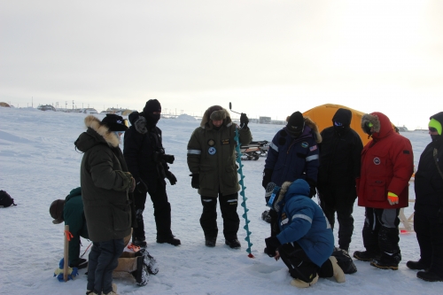
For the majority of undergraduate students, the term "spring break" is synonymous with sun, surf and, sand. However, this was not the case for five students from the United States Naval Academy (USNA) this past March. The newly developed and fast-growing Polar Science Program (PSP) of the USNA's Oceanography Department conducted its first Naval Academy Ice Experiment (NAICEX), based out of Barrow, Alaska, from 8-16 March 2013. NAICEX's goals were to: deploy a pair of Arctic Observing Platforms (dubbed "IceKids") to obtain visual, atmospheric, and underwater acoustics data for future analysis; introduce future Navy and Marine Corps Officers to the polar regions through field activities tied closely to course work; and to assist collaborators with sea ice and snow measurements.
Preparation for NAICEX
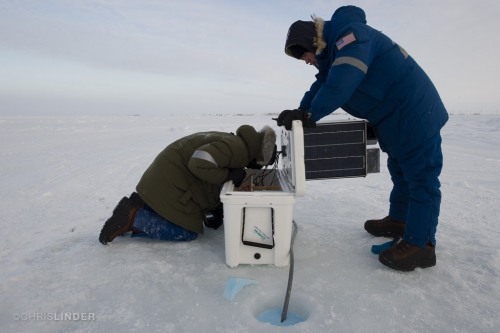
NAICEX was used as part of a senior capstone research project for engineering and oceanography students. In fall 2012, the midshipmen began working together to outline scientific parameters, such as underwater sound and atmospheric conditions, that are useful for understanding the rapidly changing Arctic environment. Two solar-powered autonomous Arctic observing platforms, the IceKid2-Acoustic and IceKid3-Temperature, were designed, built, and tested over the fall and early spring semesters in preparation for deployment during the field exercises (see Figure 1). Data collected by these platforms will be analyzed by midshipmen in future research projects.
Field and Outreach Experience
Five midshipmen from USNA collaborated with researchers from the University of Delaware (UD), the Polar Science Center (PSC) at the University of Washington, and a Naval Research Laboratory (NRL) team onboard a Twin Otter aircraft. USNA students directly participated in one over-flight on the NRL aircraft as well as ground measurements of snow and sea ice thickness to help better understand the relationship between aircraft data and in situ measurements (see Figures 2 and 3).
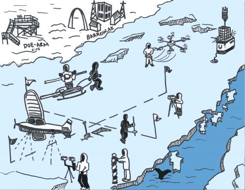
The UD team was asked by USNA to organize the ice thickness survey, building from the successes of the USNA trip to Barrow the previous year. The primary educational goal was to establish a safe experience for undergraduate and graduate students. As first-year participants, UD's main contributions, included drill holes (see Figure 3), electromagnetic induction thickness retrievals, surveying and topography analysis, and stereo imagery. Thesis topics of UD students will focus on horizontal and vertical measurement accuracy by modifying traditional ice thickness methodologies. The UD activities were chosen to directly support airborne flights by NRL and NASA IceBridge programs as part of their MERLIN project. Comparisons are underway between in-situ measurements and aerial instruments to improve our understanding of measurement uncertainties and changes in uncertainties from one scale to another.
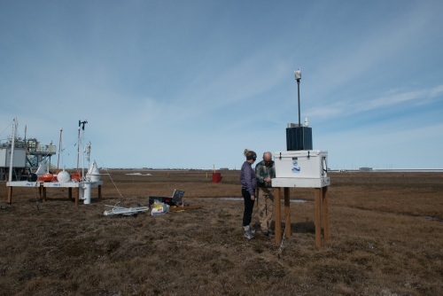
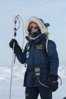
The Polar Science Center team deployed the "Arctic Observing Experiment (AOX)" test site for the International Arctic Buoy Programme (IABP). Site data will be used to reassess the accuracy of temperature, air pressure, GPS, and wind sensors typically used by the IABP. At the same time, a prototype "IceKid" was also deployed at the AOX site (see Figure 4), measuring temperature, air pressure, and winds using a new ultrasonic sensor. Observations from the AOX site will be collected for at least one year. Analysis of this data has already begun as a capstone project for a USNA senior oceanography major who is currently on a summer internship with PSC.
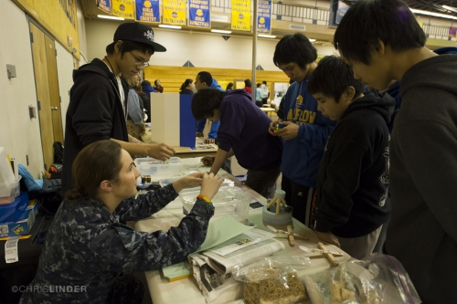
In addition to the physical field exercises, there was an education and outreach component to NAICEX. Students worked side by side with local Inupiat on the ice, gaining knowledge and appreciation of those who call the North Slope home. They also participated as judges in the Barrow High School Science fair, and lead hands-on science, technology, engineering, and mathematics (STEM) activities such as building catapults and air gliders (Figure 5).
Successes and the Future of NAICEX
The NAICEX field exercises proved to be a great success for both students and collaborators alike. The participating midshipmen completed their research projects and presented initial results at the NSF-sponsored 9th Polar Technology Conference, and the USNA/ONR Research Poster Day. On graduation day, they were commissioned into the U.S. Navy and Marine Corps and may one day operate in similar harsh conditions. The field exercises provided valuable insight into the difficulties of performing tasks in arctic conditions, such as engineering failures due to cold and how mundane tasks become incredibly difficult when trying to perform them at 40˚F below zero. The students also gained an appreciation for the culture of communities that thrive on the North Slope. Data collected from the campaign can be accessed here.
Future NAICEX programs are being planned in upcoming years with the purpose of exposing future Naval Officers to the rigors of fieldwork on the ice. The data sets collected will lead to more research projects, with a host of collaborators that will assist the scientific community in understanding the rapidly changing conditions. These future officers may one day find themselves operating on the Arctic Ocean, and this experience will benefit them through a better understanding of the challenges of this demanding environment.
NAICEX 2013 was supported by the Office of Naval Research (ONR) Polar and Global Prediction Program, the NSF Division of Polar Programs, the USNA Research Office, and the USNA STEM Office. UMIAQ (a subsidiary of UIC) provided the field services support to the research team while on the ice.
For more information, see the NAICES website or contact LCDR John Woods, Polar Science Program, US Naval Academy (woods [at] usna.edu).
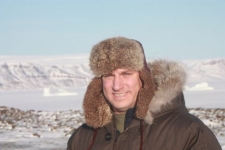 Lieutenant Commander John Woods is the coordinator for the United States Naval Academy (USNA) Polar Science Program (PSP). He is a Meteorology and Oceanography Officer (METOC) for the U.S. Navy and is currently assigned as a military instructor in the Oceanography Department. He completed tours as a Surface Warfare Officer on the USS Clevenland (LPD-7), Graduate studies at the Naval Postgraduate School, and was the Science Officer at the National Ice Center where he began to study changes in the Arctic and Antarctic sea ice. LCDR Woods participated in ICEX09 (Beaufort Sea), NASA ICEBRIDGE11 (Thule, Greenland) and NASA BROMEX12 (Barrow, AK) before leading NAICEX13.
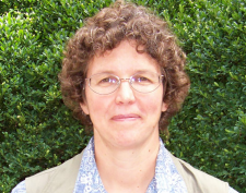 Cathy Geiger has been with the University of Delaware (UD) since 1998 where she currently works as a Research Associate Professor in the Geography Department at the College of Earth, Ocean, and Environment (CEOE). She coordinates an active research group through which several Master's and PhD students have developed expertise in sea ice, geography, and climatology. She is currently involved in editorship duties for the International Glaciological Society (IGS). Career highlights include participation in 12 high-latitude experiments in the Arctic and Antarctic and over 60 published works in sea ice and polar oceanography.
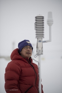 Ignatius Rigor, a climatologist from the University of Washington, studies Arctic and Antarctic sea ice, which is one of the primary indicators of global climate change. The ice waxes and wanes driven by variations in sunlight and temperature. Changes in wind also play an important role by redistributing the ice across the polar oceans creating areas of open water, and by compressing this ice into ridges. Making sense of the complex interplay between the air, ocean and sea ice is a challenging puzzle that motivates his research.
 Tracy DeLiberty's interests are in the areas of physical and hydroclimatology, GIS, and remote sensing focusing on land surface interactions with climate (and vice versa) by investigating regional to global observations and remotely sensed datasets. She relies heavily on using GIS and image processing systems for visualization of the geographic data and for mapping and spatial analysis. Geographic areas investigated include the Southern Great Plains with her dissertation soil moisture work, the Amazon Basin, and more recently the polar areas examining sea ice thickness.

